Area Overview for RH12 5FP
Photos of RH12 5FP

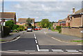
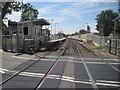
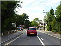
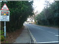
52 photos from this area
Area Information
Key information about the RH12 5FP including its size, population, and administrative classification.
- Area Type
- Postcode
- Area Size
- 1.1 hectares
- Population
- 1900
- Population Density
- 4582 people/km²
House Prices in RH12 5FP
27
Properties
£248,837
Average Sold Price
£91,950
Lowest Price
£440,000
Highest Price
Showing 27 properties
| Address | Type | Beds | Baths | Last Sale Price | Last Sale Date | |
|---|---|---|---|---|---|---|
| 1 Yarrow Close, Horsham, RH12 5FP | Semi-detached | 2 | 1 | £375,000 | Mar 2025 | |
| 10 Yarrow Close, Horsham, RH12 5FP | Semi-detached | 3 | 1 | £440,000 | Jul 2022 | |
| 19 Yarrow Close, Horsham, RH12 5FP | Detached | 3 | - | £375,000 | Nov 2016 | |
| 6 Yarrow Close, Horsham, RH12 5FP | Semi-detached | 3 | 1 | £354,000 | Nov 2016 | |
| 2 Yarrow Close, Horsham, RH12 5FP | house | 2 | 1 | £273,000 | Aug 2016 | |
| 8 Yarrow Close, Horsham, RH12 5FP | Semi-detached | 2 | - | £208,000 | Jul 2013 | |
| 23 Yarrow Close, Horsham, RH12 5FP | house | 4 | - | £345,000 | Dec 2010 | |
| 24 Yarrow Close, Horsham, RH12 5FP | house | 3 | - | £249,000 | Oct 2010 | |
| 11 Yarrow Close, Horsham, RH12 5FP | Semi-detached | - | - | £249,995 | Feb 2010 | |
| 16 Yarrow Close, Horsham, RH12 5FP | Semi-detached | - | - | £249,999 | May 2008 |
Page 1 of 3
Energy Efficiency in RH12 5FP
Amenities
Schools
| Rank | School | Type | Entry gender | Ages |
|---|
Explore more schools in this area
Go to Schools tabDemographics
Household Size
Family (3-5 people)
most common
Accommodation Type
Houses
most common
Tenure
80
majority
Ethnic Group
White
most common
Religion
N/A
most common
Household Composition
N/A
most common
Age
47
median
Adults (30-64 years)
most common
Household Deprivation
N/A
with no deprivation
NS-SEC
49
in Lower managerial occupations
Explore more demographic insights in this area
Go to Demographics tabPlanning
Planning Constraints
- Flood RiskPremium
- Ramsar Wetland SitesPremium
- Area of Outstanding Natural BeautyPremium
- Protected Nature ReservePremium
- Protected WoodlandPremium