Area Overview for RH1 5HF
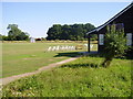
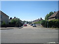
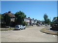
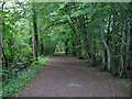
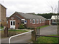
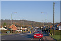
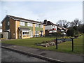
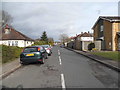
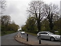
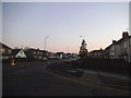
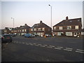
Photos of RH1 5HF
Area Information
Living in RH1 5HF means calling a specific residential cluster home. This postcode covers an area of 5,289 square metres and serves a population of 1,722 people. You will find a community defined by its quiet residential nature, where the space averages roughly 739 people per square kilometre. The location offers a distinct character compared to broader urban centres. Residents enjoy the benefits of a contained neighbourhood with minimal sprawl. Daily life revolves around this compact footprint, which separates the area from the wider hustle of the surrounding region. The small scale creates a defined living environment. You live within a clear boundary where the community feels intimate. This postcode sits in England and represents a stable, established cluster. The area does not offer the vast openness of rural land but provides a concentrated residential experience. Homebuyers seeking a specific, bounded location will find RH1 5HF offers exactly that. The density ensures you are close to neighbours while maintaining a residential feel. It is a place where the population is settled and the character is consistent.
- Area Type
- Postcode
- Area Size
- 5289 m²
- Population
- 1722
- Population Density
- 739 people/km²
The property market in RH1 5HF is characterised by a strong owner-occupier presence. With 71 per cent of households owning their homes, this area functions as a classic residential district rather than a rental hotspot. Houses dominate the stock, meaning the terrace houses and flats common in city centres are largely absent. You are looking at a market where stability reigns supreme. Most residents have built equity over time, and the housing stock reflects long-term residency patterns. For buyers, this suggests a lower level of churn and a quieter neighbourhood dynamic. The small area size of 5,289 square metres limits the volume of available properties. Demand here likely depends on buyers seeking specific house types rather than investors hunting for rental yields. The predominance of houses means you will not encounter the density or maintenance concerns associated with flats. This ecosystem supports families and retired professionals who value quiet ownership. The market moves differently than high-rise zones because the asset base is rooted in solid ground.
House Prices in RH1 5HF
Showing 18 properties
| Address | Type | Beds | Baths | Last Sale Price | Last Sale Date | |
|---|---|---|---|---|---|---|
| Flat 12, Tollgate Court, 15 Woodhatch Road, Redhill, RH1 5HF | Flat | 2 | 1 | - | - | |
| Flat 16, Tollgate Court, 15 Woodhatch Road, Redhill, RH1 5HF | Maisonette | 2 | 1 | - | - | |
| Flat 1, Tollgate Court, 15 Woodhatch Road, Redhill, RH1 5HF | Maisonette | 2 | 1 | - | - | |
| Flat 6, Tollgate Court, 15 Woodhatch Road, Redhill, RH1 5HF | Maisonette | 2 | 1 | - | - | |
| Flat 4, Tollgate Court, 15 Woodhatch Road, Redhill, RH1 5HF | Maisonette | 2 | 1 | - | - | |
| Flat 3, Tollgate Court, 15 Woodhatch Road, Redhill, RH1 5HF | Maisonette | 2 | - | - | - | |
| Flat 14, Tollgate Court, 15 Woodhatch Road, Redhill, RH1 5HF | Maisonette | 2 | - | - | - | |
| Flat 9, Tollgate Court, 15 Woodhatch Road, Redhill, RH1 5HF | Flat | - | - | - | - | |
| Flat 10, Tollgate Court, 15 Woodhatch Road, Redhill, RH1 5HF | Flat | - | - | - | - | |
| Flat 11, Tollgate Court, 15 Woodhatch Road, Redhill, RH1 5HF | Maisonette | - | - | - | - |
Energy Efficiency in RH1 5HF
Living in RH1 5HF puts you close to essential amenities without urban distraction. Five retail outlets serve the local commercial needs, with notable venues including M&S East, Co-op Reigate, and Spar. These shops provide daily necessities and groceries directly within your reach. Transport links are equally accessible, with five nearby rail stations like Earlswood and Redhill facilitating easy travel. Five metro-style shuttle stations connect you to Gatwick North and South Terminals. Two major airport facilities are also close by. A bus service operates near the South Terminal Coach Station, adding another layer of public transport. This network means you have multiple ways to leave the postcode whenever required. Shopping for food or essentials requires minimal effort. The proximity to these five retail locations, combined with the rail and airport connectivity, creates a practical lifestyle. You can combine a quiet residential day with easy access to larger towns or international travel. The amenities listed ensure you do not feel isolated despite the small area size.
Amenities
Schools
Families considering RH1 5HF have access to specific educational facilities nearby. Cornfield School is the primary institution listed for this postcode. It operates as a special school, which serves students with additional needs. The presence of this single facility defines the local educational landscape. You will not find mainstream primary or secondary schools directly listed for this immediate cluster. Cornfield School provides a specialist environment for those requiring targeted support. This means family choices are specific and focused on special educational requirements rather than a broad mix of academic options. The school type indicates a dedicated focus on inclusion and tailored learning. Parents moving here would need to verify if their specific educational needs align with the school's provisions. Nearby amenities or housing in broader areas might be better suited for those seeking standard comprehensive or primary options. For now, RH1 5HF is defined by this one specialised institution.
| Rank | School | Type | Entry gender | Ages |
|---|
Explore more schools in this area
Go to Schools tabDemographics
The community in RH1 5HF reflects a mature and established demographic profile. The median age stands at 47 years, indicating a population skewed towards older residents. Most inhabitants fall into the 30 to 64 age range, suggesting a workforce and families with older children. You are far more likely to find long-term residents than transient populations. Home ownership rates sit at 71 per cent, which indicates high stability within the neighbourhood. Most households own their property outright or with a mortgage. The predominant ethnic group is White, which aligns with the broader demographic makeup of older English suburbs. Houses form the primary accommodation type, meaning you will not find many high-rise blocks or terraced terraces. This profile paints a picture of a settled community where people have put down roots. The high ownership rate suggests that finding rentals may be difficult while selling a home could be straightforward for those who fit the local profile. There is little evidence of rapid change or demographic shifts at this time.
Household Size
Accommodation Type
Tenure
Ethnic Group
Religion
Household Composition
Age
Household Deprivation
NS-SEC
Explore more demographic insights in this area
Go to Demographics tabPlanning
Planning Constraints
- Flood RiskPremium
- Ramsar Wetland SitesPremium
- Area of Outstanding Natural BeautyPremium
- Protected Nature ReservePremium
- Protected WoodlandPremium