Area Overview for RH1 2JD
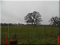
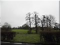
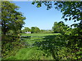
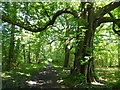
Photos of RH1 2JD


Area Information
Living in RH1 2JD means residing within a tightly defined residential cluster that spans approximately 2.5 hectares. This small postcode area supports a population of 1,492 people, creating a neighbourhood where community interaction is naturally facilitated by the limited scale of the environment. The density reaches 59,908 people per square kilometre, which ensures residents are never far from their neighbours while maintaining a distinct separation from the broader sprawl of the surrounding region. Daily life here is characterised by a sense of closeness, driven by the concentration of households in a finite space. You will find that the layout supports a similar rhythm to other clusters in the Redhill and Merstham vicinity, offering a compact living environment without the isolation of rural living. The area functions as a cohesive unit, ideal for those who prefer a structured neighbourhood where the boundaries of local life are clear. For anyone considering homes in RH1 2JD, the small footprint guarantees that local events and amenities remain within immediate reach, fostering a predictable and manageable way of life. The postcode serves as a gateway to larger transport hubs and retail points just beyond its borders, linking this intimate residential zone to the wider South Godalming and Guildford network efficiently.
- Area Type
- Postcode
- Area Size
- 2.5 hectares
- Population
- 1492
- Population Density
- 3581 people/km²
The property market in RH1 2JD is heavily skewed towards owner-occupied residences, with 60% of households owning their homes outright or with a mortgage. The accommodation type is exclusively houses, which points to a stock dominated by detached or semi-detached properties rather than flats or maisonettes. This concentration suggests a market where buyers are often looking for family homes or retirement properties rather than first-time buyer starter flats. The small size of the area, covering only 2.5 hectares, limits the total number of available properties, which can lead to a competitive environment for those seeking specific housing types within the RH1 2JD postcode. As a result, the market operates with a lower volume of transactions compared to larger urban centres. Existing homeowners constitute the vast majority of the population, which often influences the nature of listings, with properties frequently changing hands to retiring couples or downsizers rather than young sharers. The prevalence of houses also means that there is less likelihood of high-rise developments or communal living arrangements. Potential buyers should focus on the immediate surroundings and the immediate vicinity if they require more options, as the specific square footage of RH1 2JD restricts the inventory strictly within its own boundaries.
House Prices in RH1 2JD
Showing 45 properties
| Address | Type | Beds | Baths | Last Sale Price | Last Sale Date | |
|---|---|---|---|---|---|---|
| 35 Elmwood Road, Redhill, RH1 2JD | Semi-detached | 3 | 2 | £620,000 | Jul 2024 | |
| 33 Elmwood Road, Redhill, RH1 2JD | Semi-detached | 3 | 1 | £445,000 | May 2021 | |
| 8 Elmwood Road, Redhill, RH1 2JD | house | - | - | £500,000 | Mar 2021 | |
| 10 Elmwood Road, Redhill, RH1 2JD | house | - | - | £425,000 | Mar 2021 | |
| 17 Elmwood Road, Redhill, RH1 2JD | house | - | - | £440,000 | Nov 2020 | |
| 13 Elmwood Road, Redhill, RH1 2JD | house | - | - | £465,650 | Sep 2020 | |
| 32 Elmwood Road, Redhill, RH1 2JD | house | 4 | 1 | £481,500 | Feb 2019 | |
| 21 Elmwood Road, Redhill, RH1 2JD | Semi-detached | 3 | - | £485,000 | Aug 2018 | |
| 26 Elmwood Road, Redhill, RH1 2JD | Terraced | 3 | 1 | £347,000 | Feb 2018 | |
| 12 Elmwood Road, Redhill, RH1 2JD | Terraced | 3 | - | £420,000 | Jan 2018 |
Energy Efficiency in RH1 2JD
Lifestyle convenience in RH1 2JD is bolstered by a selection of nearby amenities that serve the daily needs of residents. For shopping requirements, Tesco Redhill, Co-op Merstham, and Sainsburys Redhill are the most notable retail options within easy reach. These supermarkets provide comprehensive groceries and household necessities, ensuring you do not need to travel far for essential shopping runs. Public transport is well-supported with access to Merstham Railway Station, Redhill Railway Station, and Earlswood Railway Station. These rail links connect residents to major employment hubs, facilitating a smooth commute into London or surrounding business districts. The presence of five distinct retail venues and five major railway stations within the broader vicinity means that your daily errands and commuting journeys are efficient and reliable. The combination of major high-street retailers and critical transport infrastructure creates a practical lifestyle where work and home life are easily balanced. Residents can walk to their daily provisions or hop on a train without significant delay. This accessibility is a defining feature of the RH1 2JD area, allowing you to enjoy a quiet postcode while maintaining full access to the vibrancy of larger neighbouring towns like Redhill and Merstham.
Amenities
Schools
Families considering RH1 2JD have access to a variety of educational institutions within practical reach. For younger children, Lime Tree Primary School offers education with an outstanding Ofsted rating, providing a secure and high-quality start to schooling. This primary option, combined with the independent Battlebridge Education Centre, adds depth to the local educational portfolio. Older students can attend East Surrey College, a sixth-form institution that provides further education and vocational training options. Additionally, the Phoenix Centre serves as another educational resource in the vicinity. The mix of state primary, independent, and sixth-form colleges indicates a diverse pathway for local youth, though note that the specific names and types provided cover a range from primary to higher education. While there are no secondary schools explicitly listed in the immediate nearby data, the presence of an outstanding-rated primary school is a significant positive for families with younger children living in the area. The availability of these specific institutions means that residents have multiple avenues for education without needing to travel far daily. Parents can choose between the rigorous standards of the independent centre or the strong academic track record of the state-funded outstanding school.
| Rank | School | Type | Entry gender | Ages |
|---|
Explore more schools in this area
Go to Schools tabDemographics
The community in RH1 2JD is defined by a mature demographic profile, with a median age of 47 years. The most common age range consists of adults between 30 and 64 years old, indicating a population dominated by established households rather than students or young professionals. Home ownership stands at 60%, suggesting that the majority of residents have secured tenure in their current properties. This high level of ownership aligns with the accommodation type, which consists primarily of houses rather than apartments or flats. The predominant ethnic group in the area is White, reflecting the traditional character of many older residential clusters in this part of Surrey. There are no significant indicators of rapid demographic shifts or transient populations within this postcode. The stability of the workforce and the prevalence of homeowners likely contribute to a quiet, settled atmosphere. Residents are likely to have been living in the homes for extended periods, fostering long-term relationships within the street and the wider neighbourhood. This demographic composition supports local businesses that appeal to families and individuals with steady employment in nearby towns. The lack of young families or students as the primary demographic means noise levels and traffic patterns may differ from neighbouring student zones.
Household Size
Accommodation Type
Tenure
Ethnic Group
Religion
Household Composition
Age
Household Deprivation
NS-SEC
Explore more demographic insights in this area
Go to Demographics tabPlanning
Planning Constraints
- Flood RiskPremium
- Ramsar Wetland SitesPremium
- Area of Outstanding Natural BeautyPremium
- Protected Nature ReservePremium
- Protected WoodlandPremium