Area Overview for RG9 5DU
Photos of RG9 5DU


Area Information
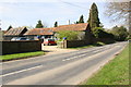
Living in RG9 5DU offers a distinct residential experience characterised by low density and a strong sense of established community. This specific postcode covers a small residential cluster measuring 2550 m², resulting in a population density of just 54 people per square kilometre. You will find approximately 1279 residents calling this area home, creating a quiet environment that stands apart from more densely populated urban zones. The location is defined by its exclusivity of space and a deliberate avoidance of high-intensity living. Daily life here revolves around proximity to nature and a slower pace, supported by a demographic that has settled permanently rather than transiently passing through. The area functions as an intimate bubble where residents share immediate surroundings with neighbours. For those seeking homes in RG9 5DU, the reality is a trade-off between limited local infrastructure and exceptional privacy. The physical footprint of this postcode means you are rarely overwhelmed by crowds or traffic congestion within the immediate boundaries. Instead, the area serves as a foundation for exploring slightly wider neighbourhoods for broader amenities. You enter a space designed for those who value air and open skies over urban convenience. The small size of the cluster ensures that development is unlikely to radically change your immediate horizon. This makes RG9 5DU a specific choice for buyers who prioritise space and lower noise levels above all other factors.
- Area Type
- Postcode
- Area Size
- 2550 m²
- Population
- 1279
- Population Density
- 54 people/km²
Homes in RG9 5DU represent a purely owner-occupied market with no rental sector present within the defined boundaries. The overwhelming majority of the stock consists of houses, which aligns with the 76% home ownership rate found in the area. Because there are no flats or purpose-built rental developments, you will not find a mix of housing types that usually characterises modern mixed-use estates. The property environment is designed for those who intend to settle and stay. This means the buyer pool in RG9 5DU is typically cash buyers, mortgage holders with significant equity, or those purchasing from existing owners rather than corporate landlords. The absence of rental properties simplifies the transaction process, removing the uncertainty often associated with void periods or short-let regulations. As a specific postcode covering only 2550 m², the total number of available properties is naturally low, creating a niche market. This scarcity means competition for houses can be high if you wish to move out of the area, while buyers seeking specific property types may find limited choice beyond the standard stock available in this small cluster. The fact that 76% of residents own their homes suggests that property prices here have historically been sensitive to interest rates and local employment trends. Potential buyers should expect a market where negotiation relies heavily on individual property condition rather than tenant demand. The exclusive focus on houses also means any investment you make is tied directly to the physical maintenance and structural quality of the building rather than the demand for student accommodation or corporate lets. This stability makes RG9 5DU a predictable choice for those prioritising long-term asset value over speculative growth.
House Prices in RG9 5DU
Showing 3 properties
| Address | Type | Beds | Baths | Last Sale Price | Last Sale Date | |
|---|---|---|---|---|---|---|
| 1, Stonehouse Cottages, Section Of B 481 Through Highmoor Cross, Highmoor Cross, Henley On Thames, RG9 5DU | house | - | - | £516,000 | Aug 2025 | |
| 2, Stonehouse Cottages, Section Of B 481 Through Highmoor Cross, Highmoor Cross, Henley On Thames, RG9 5DU | Semi-detached | 4 | 2 | £480,000 | Jan 2021 | |
| 3, Stonehouse Cottages, Section Of B 481 Through Highmoor Cross, Highmoor Cross, Henley On Thames, RG9 5DU | house | - | - | - | - |
Energy Efficiency in RG9 5DU
Your daily life in RG9 5DU is defined by a reliance on nearby amenities rather than immediate local shopping or leisure facilities. Within practical reach, you have access to five notable retail outlets, including Budgens Nettlebed, Co-op Sonning, and Waitrose Henley-on. These locations provide all the essentials for grocery shopping and household needs without requiring a lengthy drive. There are four railway stations serving the vicinity, specifically Henley, Shiplake Railway Station, and Tilehurst Railway Station. These rail links offer critical transport connections for commuting or travel, linking this small residential cluster to wider regional networks. While RG9 5DU itself measures only 2550 m², the presence of these major towns ensures you do not live in isolation. The proximity to Henley-on-Thames and Tilehurst means you can combine a rural feel with rapid access to larger retail parks, cinemas, and hospitals. Shopping trips to Budgens or the Co-op can be a quick stopover before heading to the main stations for broader exploration. The lifestyle here avoids the noise of city centres but retains the convenience of well-established high streets and railway hubs. You can enjoy the quiet of your house while keeping town centres within a short journey. This balance allows you to maintain a private domestic life without giving up the ability to visit major leisure destinations on short notice. The combination of specific supermarket brands and multiple rail stations creates a transport-oriented lifestyle where connectivity is prioritised.
Amenities
Schools
| Rank | School | Type | Entry gender | Ages |
|---|
Explore more schools in this area
Go to Schools tabDemographics
The community in RG9 5DU skews significantly towards maturity, with a median age of 47 years. The most common age range is adults between 30 and 64 years, meaning schools near RG9 5DU cater more often to young families or parents of younger children rather than teenagers or elderly residents. This age profile suggests a stable, settled population likely focused on career consolidation and family management rather than student housing or retirement living. Home ownership stands at a robust 76% within the area, indicating that the vast majority of residents have bought into the property market and are not renters. This high level of ownership fosters long-term investment and community stability, as homeowners are typically more engaged in local upkeep and civic responsibility. The accommodation type is exclusively houses, confirming that there are no flats or purpose-built rental blocks within this specific cluster. There is no data provided regarding ethnic diversity, but the predominant group is identified as White, reflecting a generally traditional demographic mix common in established rural or suburban pockets. The area does not exhibit signs of being a commuter village for young professionals or a retirement hotspot. Instead, the 76% ownership rate combined with the house-only stock points to a market dominated by second homes or families who have moved out of central cities to secure more space. This demographic consistency means you are entering a neighbourhood of permanent residents rather than a shifting marketplace. The age group of 30 to 64 years aligns perfectly with the typical homeowner demographic, reinforcing the idea that this is a place people stay in for decades rather than a short-term stopover.
Household Size
Accommodation Type
Tenure
Ethnic Group
Religion
Household Composition
Age
Household Deprivation
NS-SEC
Explore more demographic insights in this area
Go to Demographics tabPlanning
Planning Constraints
- Flood RiskPremium
- Ramsar Wetland SitesPremium
- Area of Outstanding Natural BeautyPremium
- Protected Nature ReservePremium
- Protected WoodlandPremium