Area Overview for RG9 5DY
Photos of RG9 5DY


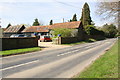


56 photos from this area
Area Information
Key information about the RG9 5DY including its size, population, and administrative classification.
- Area Type
- Postcode
- Area Size
- 47.5 hectares
- Population
- 1279
- Population Density
- 54 people/km²
House Prices in RG9 5DY
18
Properties
£315,661
Average Sold Price
£90,000
Lowest Price
£570,000
Highest Price
Showing 18 properties
| Address | Type | Beds | Baths | Last Sale Price | Last Sale Date | |
|---|---|---|---|---|---|---|
| Highmoor, 4 Holly Close, Highmoor Cross, Henley On Thames, RG9 5DY | Semi-detached | 3 | 2 | £565,000 | Aug 2023 | |
| 5 Holly Close, Highmoor Cross, Henley On Thames, RG9 5DY | Semi-detached | 3 | - | £570,000 | Nov 2018 | |
| 16 Holly Close, Highmoor Cross, Henley On Thames, RG9 5DY | Semi-detached | 3 | 2 | £340,000 | Jul 2017 | |
| 6 Holly Close, Highmoor Cross, Henley On Thames, RG9 5DY | Detached | 3 | 1 | £355,000 | Apr 2015 | |
| 3 Holly Close, Highmoor Cross, Henley On Thames, RG9 5DY | house | 3 | - | £249,950 | Aug 2012 | |
| 15 Holly Close, Highmoor Cross, Henley On Thames, RG9 5DY | house | - | - | £248,000 | Oct 2010 | |
| 1 Holly Close, Highmoor Cross, Henley On Thames, RG9 5DY | Semi-detached | 2 | - | £240,000 | Dec 2008 | |
| 17 Holly Close, Highmoor Cross, Henley On Thames, RG9 5DY | Bungalow | - | - | £183,000 | Mar 2005 | |
| 10 Holly Close, Highmoor Cross, Henley On Thames, RG9 5DY | Semi-detached | - | - | £90,000 | Nov 1996 | |
| 12 Holly Close, Highmoor Cross, Henley On Thames, RG9 5DY | house | - | - | - | - |
Page 1 of 2
Energy Efficiency in RG9 5DY
Amenities
Schools
| Rank | School | Type | Entry gender | Ages |
|---|
Explore more schools in this area
Go to Schools tabDemographics
Household Size
Two person
most common
Accommodation Type
Houses
most common
Tenure
76
majority
Ethnic Group
White
most common
Religion
N/A
most common
Household Composition
N/A
most common
Age
47
median
Adults (30-64 years)
most common
Household Deprivation
N/A
with no deprivation
NS-SEC
49
in Lower managerial occupations
Explore more demographic insights in this area
Go to Demographics tabPlanning
Planning Constraints
- Flood RiskPremium
- Ramsar Wetland SitesPremium
- Area of Outstanding Natural BeautyPremium
- Protected Nature ReservePremium
- Protected WoodlandPremium