Area Overview for RG8 0DJ
Photos of RG8 0DJ
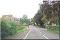
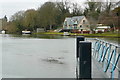
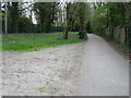
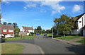

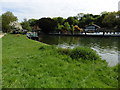
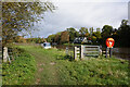
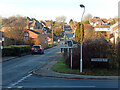
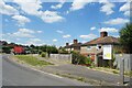

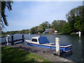
41 photos from this area
Area Information
Key information about the RG8 0DJ including its size, population, and administrative classification.
- Area Type
- Postcode
- Area Size
- 5937 m²
- Population
- 1473
- Population Density
- 126 people/km²
House Prices in RG8 0DJ
13
Properties
£424,563
Average Sold Price
£169,000
Lowest Price
£625,500
Highest Price
Showing 13 properties
| Address | Type | Beds | Baths | Last Sale Price | Last Sale Date | |
|---|---|---|---|---|---|---|
| 6, Cleeve Park Cottages, Icknield Road, Goring, Reading, RG8 0DJ | house | - | - | £590,000 | Jul 2021 | |
| 11, Cleeve Park Cottages, Icknield Road, Goring, Reading, RG8 0DJ | Terraced | 3 | 1 | £525,000 | Apr 2021 | |
| 9, Cleeve Park Cottages, Icknield Road, Goring, Reading, RG8 0DJ | house | - | - | £585,000 | Mar 2021 | |
| 7, Cleeve Park Cottages, Icknield Road, Goring, Reading, RG8 0DJ | Semi-detached | 4 | 1 | £625,500 | Jul 2017 | |
| 10, Cleeve Park Cottages, Icknield Road, Goring, Reading, RG8 0DJ | house | - | - | £228,000 | Oct 2009 | |
| 2, Cleeve Park Cottages, Icknield Road, Goring, Reading, RG8 0DJ | Cottage | 4 | 2 | £379,000 | Nov 2006 | |
| 1, Cleeve Park Cottages, Icknield Road, Goring, Reading, RG8 0DJ | Semi-detached | 3 | 1 | £295,000 | Jan 2003 | |
| 8, Cleeve Park Cottages, Icknield Road, Goring, Reading, RG8 0DJ | Semi-detached | - | - | £169,000 | Aug 1998 | |
| 3, Cleeve Park Cottages, Icknield Road, Goring, Reading, RG8 0DJ | Terraced | 2 | - | - | - | |
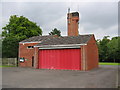
| Social Club, Fire Station, Icknield Road, Goring, Reading, RG8 0DJ | pub | - | - | - | - |
Page 1 of 2
Energy Efficiency in RG8 0DJ
Amenities
Schools
| Rank | School | Type | Entry gender | Ages |
|---|
Explore more schools in this area
Go to Schools tabDemographics
Household Size
Family (3-5 people)
most common
Accommodation Type
Houses
most common
Tenure
80
majority
Ethnic Group
White
most common
Religion
N/A
most common
Household Composition
N/A
most common
Age
47
median
Adults (30-64 years)
most common
Household Deprivation
N/A
with no deprivation
NS-SEC
53
in Lower managerial occupations
Explore more demographic insights in this area
Go to Demographics tabPlanning
Planning Constraints
- Flood RiskPremium
- Ramsar Wetland SitesPremium
- Area of Outstanding Natural BeautyPremium
- Protected Nature ReservePremium
- Protected WoodlandPremium