Area Overview for RG6 4JA
Photos of RG6 4JA

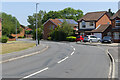


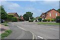
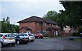
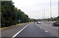
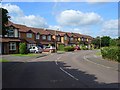
21 photos from this area
Area Information
Key information about the RG6 4JA including its size, population, and administrative classification.
- Area Type
- Postcode
- Area Size
- 3.4 hectares
- Population
- 1610
- Population Density
- 2633 people/km²
House Prices in RG6 4JA
55
Properties
£314,220
Average Sold Price
£95,000
Lowest Price
£570,000
Highest Price
Showing 55 properties
| Address | Type | Beds | Baths | Last Sale Price | Last Sale Date | |
|---|---|---|---|---|---|---|
| 27 Chatteris Way, Earley, RG6 4JA | house | 3 | 1 | £472,500 | Mar 2024 | |
| 9 Chatteris Way, Earley, RG6 4JA | Detached | 3 | 1 | £510,000 | Nov 2023 | |
| 29 Chatteris Way, Earley, RG6 4JA | house | - | - | £566,500 | Dec 2021 | |
| 32 Chatteris Way, Earley, RG6 4JA | Detached | 4 | - | £525,000 | Jun 2021 | |
| 57 Chatteris Way, Earley, RG6 4JA | Detached | 3 | 1 | £530,000 | Sep 2018 | |
| 7 Chatteris Way, Earley, RG6 4JA | Detached | 3 | - | £390,000 | Jul 2018 | |
| 26 Chatteris Way, Earley, RG6 4JA | Detached | 5 | 1 | £570,000 | Mar 2018 | |
| 6 Chatteris Way, Earley, RG6 4JA | Detached | 3 | - | £385,000 | Mar 2017 | |
| 1 Chatteris Way, Earley, RG6 4JA | Semi-detached | 4 | 2 | £505,000 | Mar 2016 | |
| 20 Chatteris Way, Earley, RG6 4JA | house | - | - | £459,950 | Dec 2015 |
Page 1 of 6
Energy Efficiency in RG6 4JA
Amenities
Schools
| Rank | School | Type | Entry gender | Ages |
|---|
Explore more schools in this area
Go to Schools tabDemographics
Household Size
Family (3-5 people)
most common
Accommodation Type
Houses
most common
Tenure
82
majority
Ethnic Group
White
most common
Religion
N/A
most common
Household Composition
N/A
most common
Age
47
median
Adults (30-64 years)
most common
Household Deprivation
N/A
with no deprivation
NS-SEC
51
in Lower managerial occupations
Explore more demographic insights in this area
Go to Demographics tabPlanning
Planning Constraints
- Flood RiskPremium
- Ramsar Wetland SitesPremium
- Area of Outstanding Natural BeautyPremium
- Protected Nature ReservePremium
- Protected WoodlandPremium