Area Overview for RG41 4TN
Photos of RG41 4TN
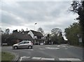

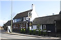
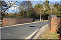
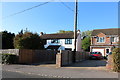


28 photos from this area
Area Information
Key information about the RG41 4TN including its size, population, and administrative classification.
- Area Type
- Postcode
- Area Size
- 13.0 hectares
- Population
- 1934
- Population Density
- 951 people/km²
House Prices in RG41 4TN
22
Properties
£462,000
Average Sold Price
£150,000
Lowest Price
£870,000
Highest Price
Showing 22 properties
| Address | Type | Beds | Baths | Last Sale Price | Last Sale Date | |
|---|---|---|---|---|---|---|
| Hill View House, School Road, Barkham, RG41 4TN | Detached | 5 | 4 | £870,000 | Oct 2015 | |
| Harvest Cottage, School Road, Barkham, RG41 4TN | house | - | - | £355,000 | Jul 2015 | |
| Sherwood, School Road, Barkham, RG41 4TN | Detached | 6 | - | £780,000 | Oct 2014 | |
| Inglewood, School Road, Barkham, RG41 4TN | house | 4 | - | £550,000 | Jul 2011 | |
| Pickwick, School Road, Barkham, RG41 4TN | house | 4 | - | £500,000 | Jun 2010 | |
| Fieldfare, School Road, Barkham, RG41 4TN | Semi-detached | 3 | - | £283,000 | Jan 2008 | |
| Windrush, School Road, Barkham, RG41 4TN | Detached | - | - | £460,000 | Jul 2006 | |
| The Nook, School Road, Barkham, RG41 4TN | Detached | - | - | £210,000 | Feb 1998 | |
| Coringa, School Road, Barkham, RG41 4TN | house | - | - | £150,000 | May 1997 | |
| Willow Farm, School Road, Barkham, RG41 4TN | Detached | 3 | 2 | - | - |
Page 1 of 3
Energy Efficiency in RG41 4TN
Amenities
Schools
| Rank | School | Type | Entry gender | Ages |
|---|
Explore more schools in this area
Go to Schools tabDemographics
Household Size
Family (3-5 people)
most common
Accommodation Type
Houses
most common
Tenure
50
majority
Ethnic Group
White
most common
Religion
N/A
most common
Household Composition
N/A
most common
Age
47
median
Adults (30-64 years)
most common
Household Deprivation
N/A
with no deprivation
NS-SEC
48
in Lower managerial occupations
Explore more demographic insights in this area
Go to Demographics tabPlanning
Planning Constraints
- Flood RiskPremium
- Ramsar Wetland SitesPremium
- Area of Outstanding Natural BeautyPremium
- Protected Nature ReservePremium
- Protected WoodlandPremium