Area Overview for RG40 4TS
Photos of RG40 4TS
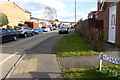
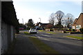
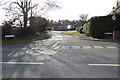

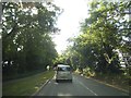
43 photos from this area
Area Information
Key information about the RG40 4TS including its size, population, and administrative classification.
- Area Type
- Postcode
- Area Size
- 26.7 hectares
- Population
- 1934
- Population Density
- 951 people/km²
House Prices in RG40 4TS
67
Properties
£469,032
Average Sold Price
£68,500
Lowest Price
£777,000
Highest Price
Showing 67 properties
| Address | Type | Beds | Baths | Last Sale Price | Last Sale Date | |
|---|---|---|---|---|---|---|
| 24 Langley Common Road, Barkham, RG40 4TS | Semi-detached | 3 | 1 | £460,000 | Aug 2023 | |
| 14A Langley Common Road, Barkham, RG40 4TS | Bungalow | 3 | - | £650,000 | Feb 2021 | |
| 26 Langley Common Road, Barkham, RG40 4TS | Detached | 4 | - | £570,000 | Jan 2020 | |
| 28 Langley Common Road, Barkham, RG40 4TS | Detached | 4 | 3 | £672,500 | Jun 2019 | |
| 8 Langley Common Road, Barkham, RG40 4TS | Detached | 4 | 4 | £777,000 | Apr 2019 | |
| 22 Langley Common Road, Barkham, RG40 4TS | Semi-detached | 3 | - | £389,950 | May 2016 | |
| 30 Langley Common Road, Barkham, RG40 4TS | Detached | 4 | 4 | £600,000 | Mar 2016 | |
| 54 Langley Common Road, Barkham, RG40 4TS | Semi-detached | 3 | 2 | £406,000 | Jan 2016 | |
| 10 Langley Common Road, Barkham, RG40 4TS | Detached | 4 | - | £500,000 | Dec 2014 | |
| 18 Langley Common Road, Barkham, RG40 4TS | Bungalow | - | - | £298,000 | Dec 2013 |
Page 1 of 7
Energy Efficiency in RG40 4TS
Amenities
Schools
| Rank | School | Type | Entry gender | Ages |
|---|
Explore more schools in this area
Go to Schools tabDemographics
Household Size
Family (3-5 people)
most common
Accommodation Type
Houses
most common
Tenure
50
majority
Ethnic Group
White
most common
Religion
N/A
most common
Household Composition
N/A
most common
Age
47
median
Adults (30-64 years)
most common
Household Deprivation
N/A
with no deprivation
NS-SEC
48
in Lower managerial occupations
Explore more demographic insights in this area
Go to Demographics tabPlanning
Planning Constraints
- Flood RiskPremium
- Ramsar Wetland SitesPremium
- Area of Outstanding Natural BeautyPremium
- Protected Nature ReservePremium
- Protected WoodlandPremium