Area Overview for RG4 9NH
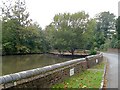
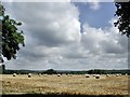
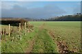
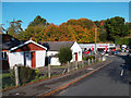
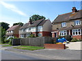
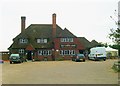
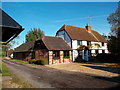
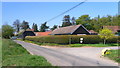
Photos of RG4 9NH


Area Information
RG4 9NH represents a compact residential cluster within England, covering an area of just 3896 square metres. This small footprint supports a community of 1386 people, creating a neighbourhood with a population density of 183 people per square kilometre. You will find that living in this postcode means being part of a tightly knit group where residents know their neighbours. The area functions as a self-contained unit, ideal for those who prefer a quiet setting over the sprawl of larger towns. Daily life here is characterised by a manageable scale, allowing for easy access to local services without the hustle of high-density urban zones. As one of the few residential records with such specific boundaries, RG4 9NH offers a distinct lifestyle defined by its limited size and concentrated population. Prospective buyers should view this as an opportunity to secure a home in a stable environment where the scale of the community is entirely in check. The modest size ensures that services are within close proximity, fostering a sense of convenience that larger areas often lack.
- Area Type
- Postcode
- Area Size
- 3896 m²
- Population
- 1386
- Population Density
- 183 people/km²
The property market in RG4 9NH is overwhelmingly characterised by owner-occupation rather than private rental. With 88 per cent of households owning their homes, this area functions as a settled residential zone where residents purchase rather than rent. Houses dominate the accommodation type, meaning you will find a collection of detached and semi-detached properties rather than apartments or maisonettes. This high ownership rate of 88 per cent makes RG4 9NH attractive to buyers looking to put down roots and contribute to the local tax base. The housing stock consists primarily of houses, which typically offer more space and privacy compared to flats. Because most residents own their homes, this small cluster serves as a beacon for those seeking stability and a fixed address. The lack of significant rental inventory suggests that securing a home here requires a purchase approach, not a lease agreement. This market structure indicates a stable investment environment where property values may be sustained by a community of owners who wish to remain in the area for the long term.
House Prices in RG4 9NH
Showing 1 properties
| Address | Type | Beds | Baths | Last Sale Price | Last Sale Date | |
|---|---|---|---|---|---|---|
| Johnson Matthey Technology Centre, Blounts Court Road, Sonning Common, Reading, RG4 9NH | office_workshop | - | - | - | - |
Energy Efficiency in RG4 9NH
The lifestyle of RG4 9NH relies on a network of amenities located within practical reach, ensuring daily convenience. Retail options are straightforward, with five key outlets available to you. You can shop at Co-op Sonning, Budgens Caversham, and Morrisons Daily to cover your regular grocery and household needs. Beyond shopping, rail connectivity is strong with five stations nearby. These include Henley, Shiplake Railway Station, and Tilehurst Railway Station, providing you with direct train links to wider travel networks. These stations allow you to commute or travel for leisure without needing a private car for every journey. The proximity of these specific venues means you have your essentials and transport hubs close by. Life here involves starting your day with a morning coffee or produce at one of these named supermarkets before catching a train at Henley or Tilehurst for business. The mix of local retail and national rail options creates a balanced lifestyle where local errands and wider travel coexist comfortably.
Amenities
Schools
Families living in RG4 9NH have access to a mix of educational institutions serving different needs. The nearest state school is Peppard Church of England Primary School, which holds a good Ofsted rating for primary education. This school provides a solid foundation for younger children within the local cluster. For those seeking an alternative educational path, Highlands School operates as an independent school nearby. This combination gives parents in the area choices between a state-funded religious primary institution and a private education option. The presence of Highlands School suggests that the neighbourhood attracts families with the means to consider independent education. You will not find comprehensive secondary schools listed directly within the immediate data for this specific postcode, but the primary provision is robust. The proximity of Peppard Church of England Primary School means you can drop your children off locally while they receive their foundation years of education. The independent option at Highlands School offers an alternative for families preferring a different curriculum or fee-based model.
| Rank | School | Type | Entry gender | Ages |
|---|
Explore more schools in this area
Go to Schools tabDemographics
The community in RG4 9NH is defined by a stable and mature population. The median age for residents is 47 years, with adults aged between 30 and 64 years representing the most common age range. This demographic skew indicates a neighbourhood that has attracted families and established professionals rather than young students or retirees. You will note that home ownership stands at 88 per cent, reflecting a community where people stay and build long-term roots. Houses make up the primary accommodation type, meaning you are unlikely to find high-rise flats or purpose-built rental blocks in this specific cluster. The predominant ethnic group is White, which aligns with the broader demographic trends of the region. With 88 per cent of adults owning their homes, the area likely operates with lower turnover rates compared to rental-heavy zones. This stability creates an environment where local businesses can rely on a consistent customer base. The age profile suggests a settlement that has matured into a permanent residence for its inhabitants, prioritising ownership and comfort over transient living arrangements.
Household Size
Accommodation Type
Tenure
Ethnic Group
Religion
Household Composition
Age
Household Deprivation
NS-SEC
Explore more demographic insights in this area
Go to Demographics tabPlanning
Planning Constraints
- Flood RiskPremium
- Ramsar Wetland SitesPremium
- Area of Outstanding Natural BeautyPremium
- Protected Nature ReservePremium
- Protected WoodlandPremium