Area Overview for RG4 9RS
Photos of RG4 9RS
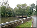
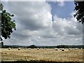

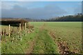
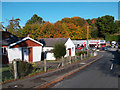

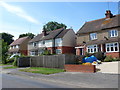
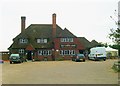

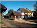

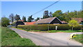
13 photos from this area
Area Information
Key information about the RG4 9RS including its size, population, and administrative classification.
- Area Type
- Postcode
- Area Size
- 1.7 hectares
- Population
- 1611
- Population Density
- 931 people/km²
House Prices in RG4 9RS
17
Properties
£415,300
Average Sold Price
£116,000
Lowest Price
£875,000
Highest Price
Showing 17 properties
| Address | Type | Beds | Baths | Last Sale Price | Last Sale Date | |
|---|---|---|---|---|---|---|
| Meadow View, Blounts Court Road, Sonning Common, Reading, RG4 9RS | house | - | - | £415,000 | Jan 2023 | |
| The Elms, Blounts Court Road, Sonning Common, Reading, RG4 9RS | Detached | 4 | 3 | £595,250 | Sep 2021 | |
| Granary House, Blounts Court Road, Sonning Common, Reading, RG4 9RS | Detached | 4 | 2 | £875,000 | Nov 2020 | |
| Somerton, Blounts Court Road, Sonning Common, Reading, RG4 9RS | Bungalow | 3 | 3 | £705,000 | Sep 2020 | |
| The Linney, Blounts Court Road, Sonning Common, Reading, RG4 9RS | house | - | - | £302,500 | Aug 2010 | |
| Fairview, Blounts Court Road, Sonning Common, Reading, RG4 9RS | house | - | - | £205,000 | Apr 2009 | |
| 48 Blounts Court Road, Sonning Common, Reading, RG4 9RS | Semi-detached | 3 | 1 | £248,950 | Sep 2005 | |
| The Mulberry, Blounts Court Road, Sonning Common, Reading, RG4 9RS | Semi-detached | 3 | 1 | £275,000 | Aug 2005 | |
| Dijon, Blounts Court Road, Sonning Common, Reading, RG4 9RS | Detached | - | - | £116,000 | Feb 1998 | |
| Daybell, Blounts Court Road, Sonning Common, Reading, RG4 9RS | Detached | 2 | 2 | - | - |
Page 1 of 2
Energy Efficiency in RG4 9RS
Amenities
Schools
| Rank | School | Type | Entry gender | Ages |
|---|
Explore more schools in this area
Go to Schools tabDemographics
Household Size
Family (3-5 people)
most common
Accommodation Type
Houses
most common
Tenure
65
majority
Ethnic Group
White
most common
Religion
N/A
most common
Household Composition
N/A
most common
Age
47
median
Adults (30-64 years)
most common
Household Deprivation
N/A
with no deprivation
NS-SEC
40
in Lower managerial occupations
Explore more demographic insights in this area
Go to Demographics tabPlanning
Planning Constraints
- Flood RiskPremium
- Ramsar Wetland SitesPremium
- Area of Outstanding Natural BeautyPremium
- Protected Nature ReservePremium
- Protected WoodlandPremium