Area Overview for RG4 9BX
Photos of RG4 9BX
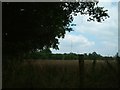
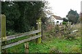

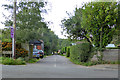
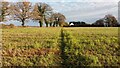
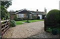


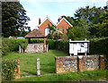
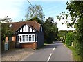
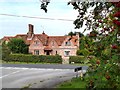
28 photos from this area
Area Information
Key information about the RG4 9BX including its size, population, and administrative classification.
- Area Type
- Postcode
- Area Size
- 23.9 hectares
- Population
- 1611
- Population Density
- 931 people/km²
House Prices in RG4 9BX
17
Properties
£871,321
Average Sold Price
£360,000
Lowest Price
£1,275,000
Highest Price
Showing 17 properties
| Address | Type | Beds | Baths | Last Sale Price | Last Sale Date | |
|---|---|---|---|---|---|---|
| Greenways, Horsepond Road, Gallowstree Common, Reading, RG4 9BX | Bungalow | 4 | 2 | £930,000 | Jul 2024 | |
| Fernbank, Horsepond Road, Gallowstree Common, Reading, RG4 9BX | Detached | 4 | 2 | £1,030,000 | May 2024 | |
| Sundown, Horsepond Road, Gallowstree Common, Reading, RG4 9BX | Retail | 5 | 3 | £1,275,000 | Sep 2022 | |
| Lazyhill, Horsepond Road, Gallowstree Common, Reading, RG4 9BX | Detached | 3 | - | £750,000 | Jun 2021 | |
| Fairview, Horsepond Road, Gallowstree Common, Reading, RG4 9BX | house | - | - | £1,200,000 | Nov 2020 | |
| Hillfield House, Horsepond Road, Gallowstree Common, Reading, RG4 9BX | Detached | 4 | 3 | £1,275,000 | Aug 2019 | |
| Dormers, Horsepond Road, Gallowstree Common, Reading, RG4 9BX | Detached | 5 | 3 | £1,150,000 | May 2018 | |
| New Copse House, Horsepond Road, Gallowstree Common, Reading, RG4 9BX | Detached | 4 | 3 | £1,165,000 | Jan 2018 | |
| Hazel Cottage, Horsepond Road, Gallowstree Common, Reading, RG4 9BX | Detached | 4 | 3 | £885,000 | May 2017 | |
| Dilly, Horsepond Road, Gallowstree Common, Reading, RG4 9BX | Bungalow | - | - | £421,500 | Dec 2011 |
Page 1 of 2
Energy Efficiency in RG4 9BX
Amenities
Schools
| Rank | School | Type | Entry gender | Ages |
|---|
Explore more schools in this area
Go to Schools tabDemographics
Household Size
Family (3-5 people)
most common
Accommodation Type
Houses
most common
Tenure
65
majority
Ethnic Group
White
most common
Religion
N/A
most common
Household Composition
N/A
most common
Age
47
median
Adults (30-64 years)
most common
Household Deprivation
N/A
with no deprivation
NS-SEC
40
in Lower managerial occupations
Explore more demographic insights in this area
Go to Demographics tabPlanning
Planning Constraints
- Flood RiskPremium
- Ramsar Wetland SitesPremium
- Area of Outstanding Natural BeautyPremium
- Protected Nature ReservePremium
- Protected WoodlandPremium