Area Overview for RG4 9TD
Photos of RG4 9TD

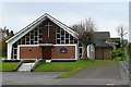

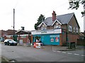


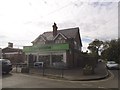


27 photos from this area
Area Information
Key information about the RG4 9TD including its size, population, and administrative classification.
- Area Type
- Postcode
- Area Size
- 12.8 hectares
- Population
- 1370
- Population Density
- 2017 people/km²
House Prices in RG4 9TD
44
Properties
£521,545
Average Sold Price
£191,000
Lowest Price
£985,000
Highest Price
Showing 44 properties
| Address | Type | Beds | Baths | Last Sale Price | Last Sale Date | |
|---|---|---|---|---|---|---|
| 35 Woodlands Road, Sonning Common, Reading, RG4 9TD | Semi-detached | 3 | 3 | £570,000 | May 2024 | |
| 17 Woodlands Road, Sonning Common, Reading, RG4 9TD | Semi-detached | 3 | 2 | £675,000 | May 2024 | |
| 59 Woodlands Road, Sonning Common, Reading, RG4 9TD | Bungalow | 2 | 1 | £800,000 | Jun 2021 | |
| 67 Woodlands Road, Sonning Common, Reading, RG4 9TD | house | - | - | £985,000 | Jun 2021 | |
| 51 Woodlands Road, Sonning Common, Reading, RG4 9TD | house | - | - | £950,000 | Mar 2021 | |
| 53 Woodlands Road, Sonning Common, Reading, RG4 9TD | Bungalow | 3 | 2 | £895,000 | Nov 2019 | |
| 25A Woodlands Road, Sonning Common, Reading, RG4 9TD | Detached | 4 | 3 | £710,000 | Apr 2019 | |
| 21 Woodlands Road, Sonning Common, Reading, RG4 9TD | Detached | 4 | 2 | £775,000 | Sep 2017 | |
| 73 Woodlands Road, Sonning Common, Reading, RG4 9TD | Chalet | 3 | - | £545,000 | Sep 2016 | |
| 31 Woodlands Road, Sonning Common, Reading, RG4 9TD | Semi-detached | 3 | 1 | £373,000 | Sep 2015 |
Page 1 of 5
Energy Efficiency in RG4 9TD
Amenities
Schools
| Rank | School | Type | Entry gender | Ages |
|---|
Explore more schools in this area
Go to Schools tabDemographics
Household Size
Two person
most common
Accommodation Type
Houses
most common
Tenure
88
majority
Ethnic Group
White
most common
Religion
N/A
most common
Household Composition
N/A
most common
Age
47
median
Adults (30-64 years)
most common
Household Deprivation
N/A
with no deprivation
NS-SEC
50
in Lower managerial occupations
Explore more demographic insights in this area
Go to Demographics tabPlanning
Planning Constraints
- Flood RiskPremium
- Ramsar Wetland SitesPremium
- Area of Outstanding Natural BeautyPremium
- Protected Nature ReservePremium
- Protected WoodlandPremium