Area Overview for RG4 8DY
Photos of RG4 8DY
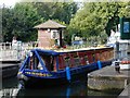

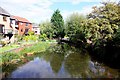
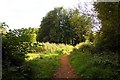
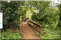


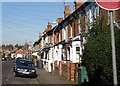
100 photos from this area
Area Information
Key information about the RG4 8DY including its size, population, and administrative classification.
- Area Type
- Postcode
- Area Size
- 5252 m²
- Population
- 1699
- Population Density
- 4275 people/km²
House Prices in RG4 8DY
29
Properties
£240,024
Average Sold Price
£82,000
Lowest Price
£395,000
Highest Price
Showing 29 properties
| Address | Type | Beds | Baths | Last Sale Price | Last Sale Date | |
|---|---|---|---|---|---|---|
| 301 Gosbrook Road, Caversham, Reading, RG4 8DY | Terraced | 2 | 3 | £315,000 | Sep 2024 | |
| 327 Gosbrook Road, Caversham, Reading, RG4 8DY | Terraced | 3 | 1 | £395,000 | Dec 2023 | |
| 337 Gosbrook Road, Caversham, Reading, RG4 8DY | Terraced | 3 | 1 | £307,000 | Nov 2023 | |
| 319 Gosbrook Road, Caversham, Reading, RG4 8DY | Terraced | 2 | 1 | £346,000 | Oct 2023 | |
| 335 Gosbrook Road, Caversham, Reading, RG4 8DY | Terraced | 2 | 2 | £387,000 | Nov 2022 | |
| 295 Gosbrook Road, Caversham, Reading, RG4 8DY | house | 2 | 2 | £315,000 | Feb 2022 | |
| 343 Gosbrook Road, Caversham, Reading, RG4 8DY | Terraced | 3 | 1 | £272,000 | Nov 2019 | |
| 303 Gosbrook Road, Caversham, Reading, RG4 8DY | Semi-detached | 3 | 1 | £290,000 | Apr 2018 | |
| 325 Gosbrook Road, Caversham, Reading, RG4 8DY | Terraced | 3 | 1 | £320,000 | Apr 2017 | |
| 297 Gosbrook Road, Caversham, Reading, RG4 8DY | house | 1 | 1 | £272,000 | Jun 2015 |
Page 1 of 3
Energy Efficiency in RG4 8DY
Amenities
Schools
| Rank | School | Type | Entry gender | Ages |
|---|
Explore more schools in this area
Go to Schools tabDemographics
Household Size
Two person
most common
Accommodation Type
Houses
most common
Tenure
59
majority
Ethnic Group
White
most common
Religion
N/A
most common
Household Composition
N/A
most common
Age
47
median
Adults (30-64 years)
most common
Household Deprivation
N/A
with no deprivation
NS-SEC
55
in Lower managerial occupations
Explore more demographic insights in this area
Go to Demographics tabPlanning
Planning Constraints
- Flood RiskPremium
- Ramsar Wetland SitesPremium
- Area of Outstanding Natural BeautyPremium
- Protected Nature ReservePremium
- Protected WoodlandPremium