Area Overview for RG4 5AN
Photos of RG4 5AN
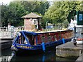
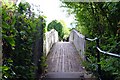
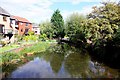
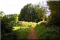


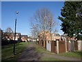
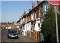
100 photos from this area
Area Information
Key information about the RG4 5AN including its size, population, and administrative classification.
- Area Type
- Postcode
- Area Size
- 7720 m²
- Population
- 1655
- Population Density
- 7163 people/km²
House Prices in RG4 5AN
25
Properties
£372,383
Average Sold Price
£107,500
Lowest Price
£525,000
Highest Price
Showing 25 properties
| Address | Type | Beds | Baths | Last Sale Price | Last Sale Date | |
|---|---|---|---|---|---|---|
| 29 St Johns Road, Caversham, Reading, RG4 5AN | Terraced | 3 | 1 | £362,000 | Mar 2025 | |
| 10 St Johns Road, Caversham, Reading, RG4 5AN | Semi-detached | 3 | 2 | £525,000 | Jan 2025 | |
| 23 St Johns Road, Caversham, Reading, RG4 5AN | Terraced | 3 | 1 | £367,000 | Oct 2023 | |
| 12 St Johns Road, Caversham, Reading, RG4 5AN | Semi-detached | 3 | 1 | £425,000 | Aug 2023 | |
| 39 St Johns Road, Caversham, Reading, RG4 5AN | Terraced | 2 | 1 | £360,000 | Aug 2023 | |
| 27 St Johns Road, Caversham, Reading, RG4 5AN | Terraced | 2 | 1 | £405,000 | Jun 2023 | |
| 33 St Johns Road, Caversham, Reading, RG4 5AN | Terraced | 2 | 2 | £425,330 | Dec 2022 | |
| 21 St Johns Road, Caversham, Reading, RG4 5AN | Terraced | 2 | 1 | £357,240 | Mar 2022 | |
| 15 St Johns Road, Caversham, Reading, RG4 5AN | Terraced | 2 | 1 | £335,000 | Nov 2021 | |
| 14 St Johns Road, Caversham, Reading, RG4 5AN | house | 1 | 1 | £408,000 | May 2021 |
Page 1 of 3
Energy Efficiency in RG4 5AN
Amenities
Schools
| Rank | School | Type | Entry gender | Ages |
|---|
Explore more schools in this area
Go to Schools tabDemographics
Household Size
Two person
most common
Accommodation Type
Houses
most common
Tenure
62
majority
Ethnic Group
White
most common
Religion
N/A
most common
Household Composition
N/A
most common
Age
47
median
Adults (30-64 years)
most common
Household Deprivation
N/A
with no deprivation
NS-SEC
43
in Lower managerial occupations
Explore more demographic insights in this area
Go to Demographics tabPlanning
Planning Constraints
- Flood RiskPremium
- Ramsar Wetland SitesPremium
- Area of Outstanding Natural BeautyPremium
- Protected Nature ReservePremium
- Protected WoodlandPremium