Area Overview for RG31 5TY
Photos of RG31 5TY
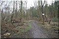

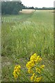


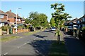
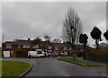
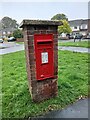
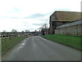

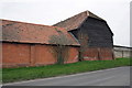
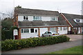
34 photos from this area
Area Information
Key information about the RG31 5TY including its size, population, and administrative classification.
- Area Type
- Postcode
- Area Size
- 5.7 hectares
- Population
- 1366
- Population Density
- 5397 people/km²
House Prices in RG31 5TY
43
Properties
£371,593
Average Sold Price
£125,000
Lowest Price
£775,000
Highest Price
Showing 43 properties
| Address | Type | Beds | Baths | Last Sale Price | Last Sale Date | |
|---|---|---|---|---|---|---|
| 69 Little Heath Road, Tilehurst, Reading, RG31 5TY | Semi-detached | 4 | 2 | £585,000 | Mar 2025 | |
| The Willows, 29A Little Heath Road, Tilehurst, Reading, RG31 5TY | Detached | 4 | 3 | £775,000 | May 2024 | |
| 71 Little Heath Road, Tilehurst, Reading, RG31 5TY | Semi-detached | 3 | 2 | £492,500 | Jan 2023 | |
| 67 Little Heath Road, Tilehurst, Reading, RG31 5TY | Retail | 4 | 1 | £620,000 | Jul 2022 | |
| 5 Little Heath Road, Tilehurst, Reading, RG31 5TY | Retail | 3 | 1 | £577,000 | Apr 2022 | |
| 11 Little Heath Road, Tilehurst, Reading, RG31 5TY | house | - | - | £540,000 | Oct 2020 | |
| 59 Little Heath Road, Tilehurst, Reading, RG31 5TY | Semi-detached | 3 | - | £335,000 | Apr 2015 | |
| 7 Little Heath Road, Tilehurst, Reading, RG31 5TY | Detached | 4 | 2 | £550,000 | Nov 2014 | |
| 49 Little Heath Road, Tilehurst, Reading, RG31 5TY | Maisonette | - | - | £167,500 | Oct 2011 | |
| 51 Little Heath Road, Tilehurst, Reading, RG31 5TY | Maisonette | - | - | £220,000 | Sep 2011 |
Page 1 of 5
Energy Efficiency in RG31 5TY
Amenities
Schools
| Rank | School | Type | Entry gender | Ages |
|---|
Explore more schools in this area
Go to Schools tabDemographics
Household Size
Family (3-5 people)
most common
Accommodation Type
Houses
most common
Tenure
89
majority
Ethnic Group
White
most common
Religion
N/A
most common
Household Composition
N/A
most common
Age
47
median
Adults (30-64 years)
most common
Household Deprivation
N/A
with no deprivation
NS-SEC
40
in Lower managerial occupations
Explore more demographic insights in this area
Go to Demographics tabPlanning
Planning Constraints
- Flood RiskPremium
- Ramsar Wetland SitesPremium
- Area of Outstanding Natural BeautyPremium
- Protected Nature ReservePremium
- Protected WoodlandPremium