Area Overview for RG31 5LA
Photos of RG31 5LA
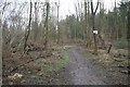

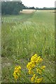
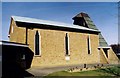

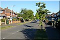
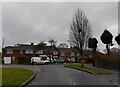

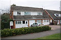
34 photos from this area
Area Information
Key information about the RG31 5LA including its size, population, and administrative classification.
- Area Type
- Postcode
- Area Size
- 1.5 hectares
- Population
- 1552
- Population Density
- 1436 people/km²
House Prices in RG31 5LA
25
Properties
£303,682
Average Sold Price
£148,000
Lowest Price
£440,000
Highest Price
Showing 25 properties
| Address | Type | Beds | Baths | Last Sale Price | Last Sale Date | |
|---|---|---|---|---|---|---|
| 34 Warborough Avenue, Tilehurst, Reading, RG31 5LA | house | - | - | £370,000 | Mar 2025 | |
| 20 Warborough Avenue, Tilehurst, Reading, RG31 5LA | Semi-detached | 3 | 1 | £377,000 | May 2024 | |
| 44 Warborough Avenue, Tilehurst, Reading, RG31 5LA | Bungalow | 3 | 2 | £440,000 | Jan 2023 | |
| 46 Warborough Avenue, Tilehurst, Reading, RG31 5LA | Retail | 2 | 1 | £375,000 | May 2022 | |
| 28 Warborough Avenue, Tilehurst, Reading, RG31 5LA | house | - | - | £355,000 | Apr 2021 | |
| 10 Warborough Avenue, Tilehurst, Reading, RG31 5LA | house | - | - | £305,000 | Oct 2020 | |
| 24 Warborough Avenue, Tilehurst, Reading, RG31 5LA | house | - | - | £327,500 | May 2020 | |
| 26 Warborough Avenue, Tilehurst, Reading, RG31 5LA | Semi-detached | 3 | 1 | £337,000 | Aug 2017 | |
| 12 Warborough Avenue, Tilehurst, Reading, RG31 5LA | Semi-detached | 3 | 1 | £332,950 | Mar 2016 | |
| 32 Warborough Avenue, Tilehurst, Reading, RG31 5LA | Semi-detached | 3 | - | £326,500 | Jan 2016 |
Page 1 of 3
Energy Efficiency in RG31 5LA
Amenities
Schools
| Rank | School | Type | Entry gender | Ages |
|---|
Explore more schools in this area
Go to Schools tabDemographics
Household Size
Family (3-5 people)
most common
Accommodation Type
Houses
most common
Tenure
91
majority
Ethnic Group
White
most common
Religion
N/A
most common
Household Composition
N/A
most common
Age
47
median
Adults (30-64 years)
most common
Household Deprivation
N/A
with no deprivation
NS-SEC
34
in Lower managerial occupations
Explore more demographic insights in this area
Go to Demographics tabPlanning
Planning Constraints
- Flood RiskPremium
- Ramsar Wetland SitesPremium
- Area of Outstanding Natural BeautyPremium
- Protected Nature ReservePremium
- Protected WoodlandPremium