Area Overview for RG31 4ER
Photos of RG31 4ER
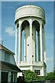
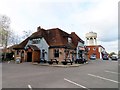
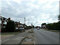
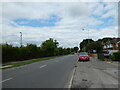

31 photos from this area
Area Information
Key information about the RG31 4ER including its size, population, and administrative classification.
- Area Type
- Postcode
- Area Size
- 1.5 hectares
- Population
- 1597
- Population Density
- 4753 people/km²
House Prices in RG31 4ER
21
Properties
£261,220
Average Sold Price
£68,500
Lowest Price
£565,000
Highest Price
Showing 21 properties
| Address | Type | Beds | Baths | Last Sale Price | Last Sale Date | |
|---|---|---|---|---|---|---|
| Hollies, Boundary Close, Tilehurst, Reading, RG31 4ER | Detached | 4 | 2 | £565,000 | Aug 2020 | |
| 16 Boundary Close, Tilehurst, Reading, RG31 4ER | Semi-detached | 4 | 3 | £463,911 | Nov 2019 | |
| 5 Boundary Close, Tilehurst, Reading, RG31 4ER | Semi-detached | 3 | - | £299,950 | Sep 2014 | |
| 11 Boundary Close, Tilehurst, Reading, RG31 4ER | Semi-detached | 3 | - | £277,500 | Apr 2013 | |
| 1 Boundary Close, Tilehurst, Reading, RG31 4ER | Semi-detached | - | - | £234,000 | Aug 2006 | |
| At Last, Boundary Close, Tilehurst, Reading, RG31 4ER | Detached | - | - | £330,000 | May 2006 | |
| 7 Boundary Close, Tilehurst, Reading, RG31 4ER | Semi-detached | - | - | £226,500 | May 2005 | |
| 15 Boundary Close, Tilehurst, Reading, RG31 4ER | Semi-detached | 3 | - | £241,000 | Aug 2004 | |
| 2 Boundary Close, Tilehurst, Reading, RG31 4ER | Semi-detached | - | - | £207,000 | Feb 2003 | |
| 6 Boundary Close, Tilehurst, Reading, RG31 4ER | house | - | - | £177,500 | Jul 2002 |
Page 1 of 3
Energy Efficiency in RG31 4ER
Amenities
Schools
| Rank | School | Type | Entry gender | Ages |
|---|
Explore more schools in this area
Go to Schools tabDemographics
Household Size
Family (3-5 people)
most common
Accommodation Type
Houses
most common
Tenure
69
majority
Ethnic Group
White
most common
Religion
N/A
most common
Household Composition
N/A
most common
Age
47
median
Adults (30-64 years)
most common
Household Deprivation
N/A
with no deprivation
NS-SEC
33
in Lower managerial occupations
Explore more demographic insights in this area
Go to Demographics tabPlanning
Planning Constraints
- Flood RiskPremium
- Ramsar Wetland SitesPremium
- Area of Outstanding Natural BeautyPremium
- Protected Nature ReservePremium
- Protected WoodlandPremium