Area Overview for RG30 4JP
Photos of RG30 4JP

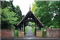


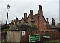
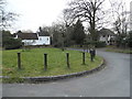
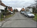

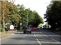


46 photos from this area
Area Information
Key information about the RG30 4JP including its size, population, and administrative classification.
- Area Type
- Postcode
- Area Size
- 1.9 hectares
- Population
- 1406
- Population Density
- 4376 people/km²
House Prices in RG30 4JP
18
Properties
£439,722
Average Sold Price
£175,000
Lowest Price
£637,500
Highest Price
Showing 18 properties
| Address | Type | Beds | Baths | Last Sale Price | Last Sale Date | |
|---|---|---|---|---|---|---|
| 30 New Lane Hill, Tilehurst, Reading, RG30 4JP | Retail | 4 | 2 | £637,500 | Apr 2022 | |
| 40 New Lane Hill, Tilehurst, Reading, RG30 4JP | house | - | - | £550,000 | Mar 2021 | |
| 56 New Lane Hill, Tilehurst, Reading, RG30 4JP | Detached | 4 | 2 | £625,000 | Nov 2018 | |
| 34 New Lane Hill, Tilehurst, Reading, RG30 4JP | Detached | 4 | 2 | £500,000 | May 2015 | |
| 28 New Lane Hill, Tilehurst, Reading, RG30 4JP | Detached | 4 | - | £420,000 | Apr 2014 | |
| 24 New Lane Hill, Tilehurst, Reading, RG30 4JP | house | - | - | £295,000 | Oct 2011 | |
| 46 New Lane Hill, Tilehurst, Reading, RG30 4JP | Detached | 4 | 1 | £450,000 | Sep 2007 | |
| 48 New Lane Hill, Tilehurst, Reading, RG30 4JP | Detached | - | - | £305,000 | Mar 2005 | |
| 22 New Lane Hill, Tilehurst, Reading, RG30 4JP | Detached | - | - | £175,000 | Jan 2000 | |
| 54 New Lane Hill, Tilehurst, Reading, RG30 4JP | Detached | 5 | 3 | - | - |
Page 1 of 2
Energy Efficiency in RG30 4JP
Amenities
Schools
| Rank | School | Type | Entry gender | Ages |
|---|
Explore more schools in this area
Go to Schools tabDemographics
Household Size
One person
most common
Accommodation Type
Houses
most common
Tenure
52
majority
Ethnic Group
White
most common
Religion
N/A
most common
Household Composition
N/A
most common
Age
47
median
Adults (30-64 years)
most common
Household Deprivation
N/A
with no deprivation
NS-SEC
29
in Lower managerial occupations
Explore more demographic insights in this area
Go to Demographics tabPlanning
Planning Constraints
- Flood RiskPremium
- Ramsar Wetland SitesPremium
- Area of Outstanding Natural BeautyPremium
- Protected Nature ReservePremium
- Protected WoodlandPremium