Area Overview for RG30 3TG
Photos of RG30 3TG
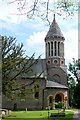
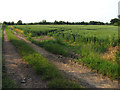
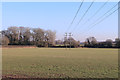
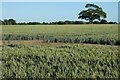
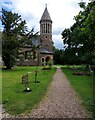
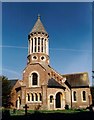
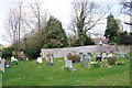
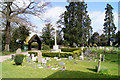
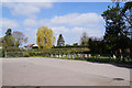
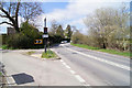
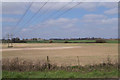
24 photos from this area
Area Information
Key information about the RG30 3TG including its size, population, and administrative classification.
- Area Type
- Postcode
- Area Size
- 25.6 hectares
- Population
- 1429
- Population Density
- 95 people/km²
House Prices in RG30 3TG
17
Properties
£770,000
Average Sold Price
£310,000
Lowest Price
£1,260,000
Highest Price
Showing 17 properties
| Address | Type | Beds | Baths | Last Sale Price | Last Sale Date | |
|---|---|---|---|---|---|---|
| Amber Lea, Reading Road, Burghfield, Reading, RG30 3TG | Detached | 4 | 3 | £1,180,000 | Dec 2024 | |
| Manor Cottage, Church Lane, Burghfield, Reading, RG30 3TG | Detached | 6 | 4 | £1,260,000 | Sep 2021 | |
| Clappers, Church Lane, Burghfield, Reading, RG30 3TG | Detached | 3 | 1 | £800,000 | Apr 2014 | |
| Church Willows, Reading Road, Burghfield, Reading, RG30 3TG | house | - | - | £750,000 | Jan 2007 | |
| Fairhaven, Church Lane, Burghfield, Reading, RG30 3TG | Detached | - | - | £320,000 | Nov 2003 | |
| Manor Lodge, Church Lane, Burghfield, Reading, RG30 3TG | Semi-detached | - | - | £310,000 | Jul 2003 | |
| Badgers, Church Lane, Burghfield, Reading, RG30 3TG | Detached | 4 | 2 | - | - | |
| DIVOTO, CHURCH LANE, Burghfield, Reading, RG30 3TG | Detached | - | - | - | - | |
| The Annexe At, Clappers, Church Lane, Burghfield, Reading, RG30 3TG | Bungalow | - | - | - | - | |
| Tennis 34M From Little Manor 15M From Church Lane, Church Lane, Burghfield, Reading, RG30 3TG | Leisure | - | - | - | - |
Page 1 of 2
Energy Efficiency in RG30 3TG
Amenities
Schools
| Rank | School | Type | Entry gender | Ages |
|---|
Explore more schools in this area
Go to Schools tabDemographics
Household Size
Two person
most common
Accommodation Type
Houses
most common
Tenure
81
majority
Ethnic Group
White
most common
Religion
N/A
most common
Household Composition
N/A
most common
Age
47
median
Adults (30-64 years)
most common
Household Deprivation
N/A
with no deprivation
NS-SEC
50
in Lower managerial occupations
Explore more demographic insights in this area
Go to Demographics tabPlanning
Planning Constraints
- Flood RiskPremium
- Ramsar Wetland SitesPremium
- Area of Outstanding Natural BeautyPremium
- Protected Nature ReservePremium
- Protected WoodlandPremium