Area Overview for RG7 1NB
Photos of RG7 1NB
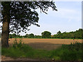
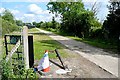
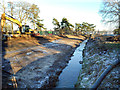
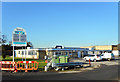
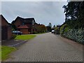
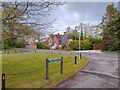
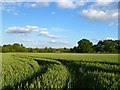
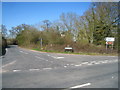
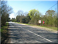
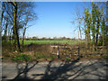
24 photos from this area
Area Information
Key information about the RG7 1NB including its size, population, and administrative classification.
- Area Type
- Postcode
- Area Size
- 37.6 hectares
- Population
- 1429
- Population Density
- 95 people/km²
House Prices in RG7 1NB
16
Properties
£985,000
Average Sold Price
£985,000
Lowest Price
£985,000
Highest Price
Showing 16 properties
| Address | Type | Beds | Baths | Last Sale Price | Last Sale Date | |
|---|---|---|---|---|---|---|
| James Farm House, James Lane, Grazeley Green, Reading, RG7 1NB | Detached | 5 | 4 | £985,000 | Oct 2023 | |
| Ruperts Barn, 1 James Farm, James Lane, Grazeley Green, Reading, RG7 1NB | Detached | 4 | 2 | - | - | |
| 2, The Granary, James Farm, James Lane, Grazeley Green, Reading, RG7 1NB | Semi-detached | 4 | 3 | - | - | |
| 6, The Hay Barn, James Farm, James Lane, Grazeley Green, Reading, RG7 1NB | Semi-detached | 5 | 5 | - | - | |
| 3, The Pump House, James Farm, James Lane, Grazeley Green, Reading, RG7 1NB | Semi-detached | 2 | 1 | - | - | |
| 5, The Old Dairy, James Farm, James Lane, Grazeley Green, Reading, RG7 1NB | Semi-detached | 4 | 3 | - | - | |
| 4, The Old Forge, James Farm, James Lane, Grazeley Green, Reading, RG7 1NB | Semi-detached | 2 | 1 | - | - | |
| Mobile Home, T M N E, James Lane, Grazeley Green, Reading, RG7 1NB | Mobile Home | - | - | - | - | |
| Smithy Top, James Farm, James Lane, Grazeley Green, Reading, RG7 1NB | Detached | - | - | - | - | |
| Polishcar, Workshop And Premises, James Farm, James Lane, Grazeley Green, Reading, RG7 1NB | Industrial | - | - | - | - |
Page 1 of 2
Energy Efficiency in RG7 1NB
Amenities
Schools
| Rank | School | Type | Entry gender | Ages |
|---|
Explore more schools in this area
Go to Schools tabDemographics
Household Size
Two person
most common
Accommodation Type
Houses
most common
Tenure
81
majority
Ethnic Group
White
most common
Religion
N/A
most common
Household Composition
N/A
most common
Age
47
median
Adults (30-64 years)
most common
Household Deprivation
N/A
with no deprivation
NS-SEC
50
in Lower managerial occupations
Explore more demographic insights in this area
Go to Demographics tabPlanning
Planning Constraints
- Flood RiskPremium
- Ramsar Wetland SitesPremium
- Area of Outstanding Natural BeautyPremium
- Protected Nature ReservePremium
- Protected WoodlandPremium