Area Overview for RG29 1PG
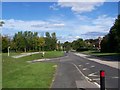
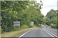
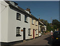
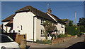
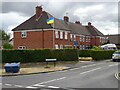
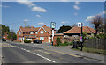
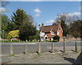
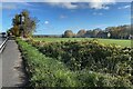
Photos of RG29 1PG


Area Information
RG29 1PG is a specific postcode area covering a small residential cluster of 6,092 square metres. With a total population of 2,147, this neighbourhood offers a compact living environment where residents interact closely. The area is situated within England and functions as a distinct pocket within the wider housing network. Daily life here revolves around proximity, with a population density of 426 people per square kilometre. This tight-knit setting creates a community where neighbours are often familiar faces. The area is defined by its residential focus, lacking large-scale commercial or industrial zones within its immediate boundaries. You will find that the space is utilised primarily for housing, providing a quiet atmosphere away from the heaviest traffic flows of larger towns. The small footprint means that amenities are clustered within easy reach, reducing the need for extensive travel for daily tasks. This concentration supports a lifestyle where convenience is built into the daily routine. The character of RG29 1PG is grounded in its manageable size, offering a retreat from the scale of bigger urban centres.
- Area Type
- Postcode
- Area Size
- 6092 m²
- Population
- 2147
- Population Density
- 426 people/km²
RG29 1PG operates as a primarily owner-occupied market, with 77 per cent of homes owned outright or through mortgages. The accommodation type is almost exclusively houses, meaning flat buyers will not find many options within this specific postcode. This stock composition appeals to families and those seeking traditional detached or semi-detached living arrangements. The high ownership percentage indicates that investors and buy-to-let landlords are not the dominant force in this small cluster. When viewing homes in RG29 1PG, you can expect a focus on single-family dwellings designed for long-term residence. The limited area size of just 6,092 square metres constrains new large-scale developments, keeping the housing stock relatively static. Buyers looking for this area should be prepared for a market where properties change hands less frequently due to long-term ownership. The market reflects a desire for roots, with residents choosing to stay and modify their homes rather than move for rental opportunities. This dynamic can lead to competitive bidding on suitable properties when they come to market.
House Prices in RG29 1PG
Showing 20 properties
| Address | Type | Beds | Baths | Last Sale Price | Last Sale Date | |
|---|---|---|---|---|---|---|
| 11 Burgess Close, Odiham, Hook, RG29 1PG | Detached | 1 | 1 | £285,000 | Jun 2025 | |
| 16 Burgess Close, Odiham, Hook, RG29 1PG | Semi-detached | 2 | 2 | £410,000 | Mar 2024 | |
| 1 Burgess Close, Odiham, Hook, RG29 1PG | Semi-detached | 4 | 1 | £636,000 | Aug 2022 | |
| 4 Burgess Close, Odiham, Hook, RG29 1PG | house | - | - | £425,000 | Sep 2021 | |
| 7 Burgess Close, Odiham, Hook, RG29 1PG | house | - | - | £350,000 | Feb 2020 | |
| 8 Burgess Close, Odiham, Hook, RG29 1PG | Terraced | 2 | 1 | £253,500 | Sep 2019 | |
| 6 Burgess Close, Odiham, Hook, RG29 1PG | Detached | 2 | - | £357,500 | Apr 2018 | |
| 15 Burgess Close, Odiham, Hook, RG29 1PG | Semi-detached | 3 | 1 | £347,500 | Jan 2018 | |
| 5 Burgess Close, Odiham, Hook, RG29 1PG | Semi-detached | 2 | - | £338,000 | Dec 2017 | |
| 2 Burgess Close, Odiham, Hook, RG29 1PG | Detached | 4 | 1 | £436,000 | Jan 2017 |
Energy Efficiency in RG29 1PG
Residents of RG29 1PG enjoy access to several retail parks and shops, including The Southern Co-operative Co, Tesco Hook, and Budgens Hook. These venues provide a practical choice for weekly grocery shopping and essential retail needs. Beyond food, the area offers proximity to two airports: RAF Odiham and Lasham Airport. While these are aviation facilities, they serve as key transportation links for air travel. For rail commuters, there are five stations nearby, including Hook Railway Station, Winchfield Railway Station, and Fleet Railway Station. Access to three specific railway stations allows for efficient travel to Southampton, London, and other major hubs. The combination of local shops and multiple transport links means you can conduct daily errands and commute without needing extensive planning. Leisure options are centred around these transport nodes and retail outlets rather than dedicated leisure parks within the immediate 6,000 square metres.
Amenities
Schools
Families in RG29 1PG have access to two named schools within the area: Buryfields Infant School and Mayhill Junior School. Both institutions hold a good Ofsted rating. Buryfields Infant School caters to the earliest years of a child's education, while Mayhill Junior School covers the later primary phases. The presence of two separate schools suggests a system designed to manage different age groups within the immediate vicinity. The Good ratings from Ofsted confirm that these establishments meet the national standards for educational quality and child welfare. For parents considering schools near RG29 1PG, this pair offers a consolidated educational option without needing to travel far for basic primary education. The mix of infant and junior provision in this small area highlights a focus on serving the local community's children. You do not need to look beyond these named institutions for primary-level schooling options in this postcode cluster.
| Rank | School | Type | Entry gender | Ages |
|---|
Explore more schools in this area
Go to Schools tabDemographics
The community in RG29 1PG is defined by a mature demographic, with a median age of 47 years old. Adults between 30 and 64 years represent the most common age range within this population. This age profile suggests a settlement where many families have settled and stayed long-term. Home ownership stands at 77 per cent, indicating a stable estate where residents own their property rather than renting. The accommodation type is predominantly houses, which aligns with the older demographic seeking space and stability. While the predominant ethnic group is White, the tight community feels established and cohesive. The high rate of home ownership means you are likely to purchase a property with a legacy of occupants rather than a transient tenant. This stability often translates to well-maintained gardens and properties that reflect the needs of a family-led household. The demographic makeup supports a quiet, settled environment where locals know each other and maintain a shared interest in the upkeep of the neighbourhood.
Household Size
Accommodation Type
Tenure
Ethnic Group
Religion
Household Composition
Age
Household Deprivation
NS-SEC
Explore more demographic insights in this area
Go to Demographics tabPlanning
Planning Constraints
- Flood RiskPremium
- Ramsar Wetland SitesPremium
- Area of Outstanding Natural BeautyPremium
- Protected Nature ReservePremium
- Protected WoodlandPremium