Area Overview for RG29 1PD
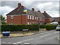
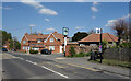
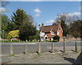
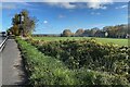
Photos of RG29 1PD


Area Information
RG29 1PD is a compact residential cluster covering just 1.1 hectares, home to a population of 2,147. This dense settlement offers a quiet, contained environment where daily life revolves around local streets and immediate surroundings. Situated in England, this postcode represents a specific micro-community rather than a sprawling suburb, fostering a sense of intimacy among residents. With a population density of 426 people per square kilometre, the area feels settled and established, avoiding the transient nature often found in new developments. Living in RG29 1PD means experiencing a neighbourhood defined by its concentration of homes and the stability brought by a high rate of permanent occupancy. The landscape is dominated by houses, creating a uniform residential fabric without large commercial or industrial intrusions. For those considering homes in this area, the scale is manageable, making it easy to know your neighbours and feel secure. It is a place where the pace of life is dictated by the immediate community rather than distant city traffic, providing a deliberate retreat from the wider region while remaining close to essential services.
- Area Type
- Postcode
- Area Size
- 1.1 hectares
- Population
- 2147
- Population Density
- 426 people/km²
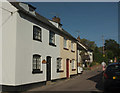
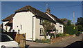
The property market in RG29 1PD is characterised by a dominant owner-occupied sector, with 77% of residents owning their homes outright or with a mortgage. This statistic creates a stable market environment where buyers compete for a limited selection of properties rather than fighting over student rentals or transient housing. The accommodation type is exclusively houses, meaning you will not find flats, terraced rows, or student accommodation within this specific postcode. For prospective buyers looking at homes in RG29 1PD, the focus is on detached or semi-detached family homes that have likely appreciated in value due to the high ownership rate. The small size of the area, covering only 1.1 hectares, restricts the total number of available properties, making each listing rare. You are buying into a consistent stock of residential properties without the mix of commercial units found in larger postcodes. This uniformity simplifies the search process, as expectations regarding property style and size remain consistent across the cluster.
House Prices in RG29 1PD
Showing 22 properties
| Address | Type | Beds | Baths | Last Sale Price | Last Sale Date | |
|---|---|---|---|---|---|---|
| 15 St Davids Close, Odiham, Hook, RG29 1PD | house | - | - | £535,000 | Jul 2024 | |
| 9 St Davids Close, Odiham, Hook, RG29 1PD | house | 3 | - | £515,000 | Dec 2023 | |
| 3 St Davids Close, Odiham, Hook, RG29 1PD | house | - | - | £530,000 | Apr 2021 | |
| 6 St Davids Close, Odiham, Hook, RG29 1PD | Detached | 4 | 2 | £425,000 | Nov 2014 | |
| 16 St Davids Close, Odiham, Hook, RG29 1PD | house | 3 | - | £310,000 | Dec 2009 | |
| 10 St Davids Close, Odiham, Hook, RG29 1PD | Detached | - | - | £310,000 | May 2009 | |
| 14 St Davids Close, Odiham, Hook, RG29 1PD | house | - | - | £310,000 | Nov 2007 | |
| 13 St Davids Close, Odiham, Hook, RG29 1PD | Detached | - | - | £337,500 | Mar 2007 | |
| 20 St Davids Close, Odiham, Hook, RG29 1PD | Terraced | - | - | £284,000 | Sep 2004 | |
| 2 St Davids Close, Odiham, Hook, RG29 1PD | Semi-detached | - | - | £238,500 | Jul 2003 |
Energy Efficiency in RG29 1PD
Residents of RG29 1PD enjoy convenient access to local retail outlets and transport hubs within practical reach. Five retail options are available nearby, including The Southern Co-operative Co, Tesco Hook, and Budgens Hook. These shops provide essential groceries and daily necessities without requiring long travel times. Transport links are robust, with two airports, RAF Odiham and Lasham Airport, offering aviation services within range. For rail travel, five stations serve the vicinity, including Hook Railway Station, Winchfield Railway Station, and Basingstoke Railway Station. This network allows you to access major cities or regional centres with ease. The proximity of these amenities means your daily routine involves short trips to Tesco Hook for shopping or trains for commuting to Basingstoke. The Southern Co-operative Co adds a characteristically local touch to the retail landscape, complementing the national chains. Your lifestyle benefits from having these five retail outlets and multiple transport nodes just away from your doorstep, ensuring that convenience does not compromise the quiet nature of RG29 1PD.
Amenities
Schools
Families living in RG29 1PD have access to two specific schools within nearby catchment areas. Buryfields Infant School serves the early education needs of young children and holds an Ofsted rating of good. Mayhill Junior School continues this education for older children and also carries a good Ofsted rating. The presence of these two institutions suggests a logical separation between infant and junior stages, catering to the families with children aged 30 to 64 years old who reside here. Having both schools nearby allows parents to keep their children within the local community, potentially avoiding the stress of commuting long distances for education. The fact that both schools hold a good rating provides a solid educational foundation for families considering moving into this area. While these schools do not cover secondary education, they form the primary and early secondary stages for local pupils. The consistency in ratings reflects a reliable educational environment that supports the predominantly adult and family demographic of the neighbourhood.
| Rank | School | Type | Entry gender | Ages |
|---|
Explore more schools in this area
Go to Schools tabDemographics
The community within RG29 1PD is defined by a stable, mature population with a median age of 47. Most residents fall into the adult bracket between 30 and 64 years old, suggesting a neighbourhood populated by established professionals, families, and retirees rather than students or young adults seeking a first home. Seven hundred and seven per cent of households own their homes, which significantly impacts the local character and stability. This high level of homeownership indicates long-term residents who are invested in the area's success and less likely to move frequently. The housing stock consists almost exclusively of houses, reflecting the traditional suburban or semi-rural nature of the settlement. Demographically, the area is predominantly White, offering a homogenous community feel typical of many established English towns. The age profile and accommodation type mean you are likely to encounter families with older children or empty-nesters rather than young sharers. The absence of rental properties suggests a strong sense of belonging, as households here have rooted themselves deeply over time.
Household Size
Accommodation Type
Tenure
Ethnic Group
Religion
Household Composition
Age
Household Deprivation
NS-SEC
Explore more demographic insights in this area
Go to Demographics tabPlanning
Planning Constraints
- Flood RiskPremium
- Ramsar Wetland SitesPremium
- Area of Outstanding Natural BeautyPremium
- Protected Nature ReservePremium
- Protected WoodlandPremium