Area Overview for RG29 1NL
Photos of RG29 1NL
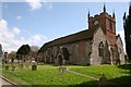
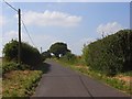
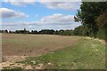
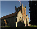
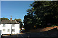
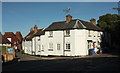
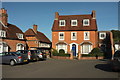
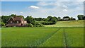
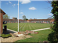
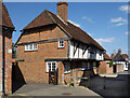
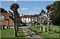
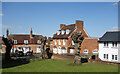
100 photos from this area
Area Information
Key information about the RG29 1NL including its size, population, and administrative classification.
- Area Type
- Postcode
- Area Size
- 2182 m²
- Population
- 2147
- Population Density
- 426 people/km²
House Prices in RG29 1NL
7
Properties
£304,071
Average Sold Price
£97,500
Lowest Price
£576,500
Highest Price
Showing 7 properties
| Address | Type | Beds | Baths | Last Sale Price | Last Sale Date | |
|---|---|---|---|---|---|---|
| 4, Blakes Cottages, King Street, Odiham, Hook, RG29 1NL | Terraced | 2 | 1 | £297,000 | Jun 2025 | |
| 5, Blakes Cottages, King Street, Odiham, Hook, RG29 1NL | house | 2 | - | £295,000 | Oct 2024 | |
| Forge House, King Street, Odiham, Hook, RG29 1NL | Terraced | - | - | £442,500 | Mar 2016 | |
| 1, Blakes Cottages, King Street, Odiham, Hook, RG29 1NL | Terraced | 1 | 1 | £205,000 | Mar 2016 | |
| 3, Blakes Cottages, King Street, Odiham, Hook, RG29 1NL | house | 2 | 1 | £215,000 | Mar 2010 | |
| Farthings, King Street, Odiham, Hook, RG29 1NL | Detached | 3 | 2 | £576,500 | Nov 2004 | |
| 2, Blakes Cottages, King Street, Odiham, Hook, RG29 1NL | Terraced | 2 | 1 | £97,500 | Jan 2000 |
Energy Efficiency in RG29 1NL
Amenities
Schools
| Rank | School | Type | Entry gender | Ages |
|---|
Explore more schools in this area
Go to Schools tabDemographics
Household Size
Two person
most common
Accommodation Type
Houses
most common
Tenure
77
majority
Ethnic Group
White
most common
Religion
N/A
most common
Household Composition
N/A
most common
Age
47
median
Adults (30-64 years)
most common
Household Deprivation
N/A
with no deprivation
NS-SEC
50
in Lower managerial occupations
Explore more demographic insights in this area
Go to Demographics tabPlanning
Planning Constraints
- Flood RiskPremium
- Ramsar Wetland SitesPremium
- Area of Outstanding Natural BeautyPremium
- Protected Nature ReservePremium
- Protected WoodlandPremium