Area Overview for RG29 1NJ
Photos of RG29 1NJ
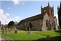
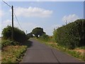
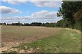
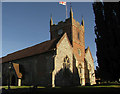
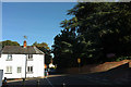
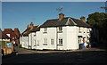
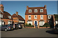

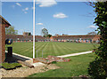
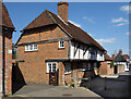
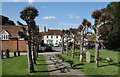
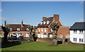
100 photos from this area
Area Information
Key information about the RG29 1NJ including its size, population, and administrative classification.
- Area Type
- Postcode
- Area Size
- 1.3 hectares
- Population
- 2147
- Population Density
- 426 people/km²
House Prices in RG29 1NJ
17
Properties
£433,333
Average Sold Price
£200,000
Lowest Price
£540,000
Highest Price
Showing 17 properties
| Address | Type | Beds | Baths | Last Sale Price | Last Sale Date | |
|---|---|---|---|---|---|---|
| Meadow View, King Street, Odiham, Hook, RG29 1NJ | house | 3 | - | £540,000 | Mar 2020 | |
| Hollybank, King Street, Odiham, Hook, RG29 1NJ | Detached | 3 | - | £530,000 | Dec 2014 | |
| Chapel House, King Street, Odiham, Hook, RG29 1NJ | house | - | - | £495,000 | Oct 2011 | |
| Myrtle Cottage, King Street, Odiham, Hook, RG29 1NJ | house | - | - | £440,000 | Apr 2011 | |
| Norfolk Villa, King Street, Odiham, Hook, RG29 1NJ | house | - | - | £395,000 | Dec 2007 | |
| Brewery Cottage, King Street, Odiham, Hook, RG29 1NJ | Terraced | 2 | 1 | £200,000 | Apr 2000 | |
| 1, Charlotte Terrace, King Street, Odiham, Hook, RG29 1NJ | Terraced | 2 | 2 | - | - | |
| 3, Charlotte Terrace, King Street, Odiham, Hook, RG29 1NJ | Terraced | 3 | - | - | - | |
| 2, Charlotte Terrace, King Street, Odiham, Hook, RG29 1NJ | Terraced | 3 | 2 | - | - | |
| 2, Horton Villa, King Street, Odiham, Hook, RG29 1NJ | Semi-detached | 2 | 1 | - | - |
Page 1 of 2
Energy Efficiency in RG29 1NJ
Amenities
Schools
| Rank | School | Type | Entry gender | Ages |
|---|
Explore more schools in this area
Go to Schools tabDemographics
Household Size
Two person
most common
Accommodation Type
Houses
most common
Tenure
77
majority
Ethnic Group
White
most common
Religion
N/A
most common
Household Composition
N/A
most common
Age
47
median
Adults (30-64 years)
most common
Household Deprivation
N/A
with no deprivation
NS-SEC
50
in Lower managerial occupations
Explore more demographic insights in this area
Go to Demographics tabPlanning
Planning Constraints
- Flood RiskPremium
- Ramsar Wetland SitesPremium
- Area of Outstanding Natural BeautyPremium
- Protected Nature ReservePremium
- Protected WoodlandPremium