Area Overview for RG27 8BF
Photos of RG27 8BF
Area Information
RG27 8BF represents a specific residential cluster within the RG27 postcode region, covering an area of 10.4 hectares. This compact footprint supports a population of 1536 residents, creating a relatively tight-knit community. With a population density of just 53 people per square kilometre, the area offers spacious surroundings compared to more crowded urban zones. You will find living in RG27 8BF involves a settled pace where each household has significant privacy. The neighbourhood functions as a distinct pocket of housing rather than a large town centre. Daily life here is defined by proximity to other homes while maintaining enough space to avoid congestion. The small size of the area means that local streets are easily navigable and neighbours are familiar with one another. You can expect a simple, functional environment focused on residential peace rather than commercial activity. The layout combines to create a specific living experience for those seeking a defined postcode area with clear boundaries. This setting suits individuals who value a contained domestic sphere over expansive, mixed-use developments.
- Area Type
- Postcode
- Area Size
- 10.4 hectares
- Population
- 1536
- Population Density
- 53 people/km²
RG27 8BF presents a distinct property market profile driven by its specific housing stock and ownership dynamics. The accommodation type is almost entirely composed of houses, meaning you will rarely encounter flats or shared apartments in this postcode cluster. With an 85% homeownership rate, the area is firmly established as an owner-occupied zone rather than a rental market. This statistic implies that most properties have been purchased by buyers who intend to stay for the long term. For prospective homebuyers considering cores within this area, competition may arise from existing owners who are reluctant to move. The local housing stock consists of traditional houses suited to families and individuals seeking privacy. Given the small geographical size of 10.4 hectares, the total number of available homes is limited. This scarcity often keeps prices stable or raises them depending on demand from surrounding areas. You are looking at a market where transactions involve substantial dwellings rather than starter homes or investment flats. The high ownership percentage suggests that many residents have equity in their current homes, potentially making them more selective about selling.
House Prices in RG27 8BF
Showing 48 properties
| Address | Type | Beds | Baths | Last Sale Price | Last Sale Date | |
|---|---|---|---|---|---|---|
| 26 Beauclerk Green, Winchfield, Hook, RG27 8BF | Semi-detached | 3 | 2 | £617,210 | Dec 2025 | |
| 18 Beauclerk Green, Winchfield, Hook, RG27 8BF | house | - | - | £520,000 | Nov 2025 | |
| 22 Beauclerk Green, Winchfield, Hook, RG27 8BF | house | 3 | 1 | £435,000 | Jun 2025 | |
| 38 Beauclerk Green, Winchfield, Hook, RG27 8BF | Semi-detached | 3 | 2 | £482,000 | Feb 2025 | |
| 34 Beauclerk Green, Winchfield, Hook, RG27 8BF | Semi-detached | 3 | 2 | £525,000 | Feb 2025 | |
| 35 Beauclerk Green, Winchfield, Hook, RG27 8BF | Terraced | 2 | 1 | £365,000 | Apr 2024 | |
| 49 Beauclerk Green, Winchfield, Hook, RG27 8BF | Detached | 4 | 2 | £770,000 | Dec 2023 | |
| 8 Beauclerk Green, Winchfield, Hook, RG27 8BF | Semi-detached | 2 | 1 | £319,000 | May 2021 | |
| 4 Beauclerk Green, Winchfield, Hook, RG27 8BF | Semi-detached | 2 | 1 | £350,000 | Nov 2020 | |
| 24 Beauclerk Green, Winchfield, Hook, RG27 8BF | Semi-detached | 3 | 2 | £450,000 | Sep 2020 |
Energy Efficiency in RG27 8BF
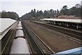
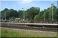
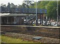
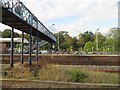
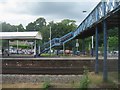
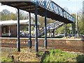
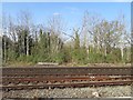
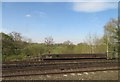
Residents of RG27 8BF benefit from a range of amenities within practical reach despite the residential focus of the postcode. Retail options include Tesco Hartley, Sainsburys Hook, and Morrisons Elvetham, giving you five notable nearby supermarkets to choose from for groceries and daily essentials. Transport links are facilitated by four key railway stations, including Winchfield Railway Station, Hook Railway Station, and Fleet Railway Station, which offer connectivity to wider networks. There are also three airports in close proximity, namely Blackbushe Airport, RAF Odiham, and Farnborough Airport, which provide both commercial and private air travel opportunities. This mix of retail, rail, and airport access creates a convenient lifestyle balance. You can walk or drive short distances to stock up on food or commute to work. The presence of multiple supermarkets ensures that you do not need to travel far for routine shopping. The variety of transport hubs means you have flexibility in how you reach your destination. Whether you need a local shop or a major retail centre, the five named outlets cover your requirements effectively.
Amenities
Schools
Families considering living in RG27 8BF have Dogmersfield Church of England Primary School as their nearest educational option. This institution is designated as a primary school and currently holds a Ofsted rating of good. The school serves children in the local community before they potentially transition to secondary institutions outside this immediate vicinity. The presence of a primary school with a good rating provides a solid foundation for early education. Living in RG27 8BF means your children will have easy access to this particular school without needing to travel far. The Ofsted rating of good confirms that the school meets high standards in its provision for primary-aged pupils. While there is only one school listed within the immediate data set for this postcode, the quality of the facility is assured. Primary education is well supported here through this single, reputable establishment. You will find that the local educational infrastructure is focused on the younger demographic, catering specifically to infants and juniors. This setup aligns perfectly with the community's age profile, which skews heavily towards adults and school-aged children.
| Rank | School | Type | Entry gender | Ages |
|---|
Explore more schools in this area
Go to Schools tabDemographics
The community in RG27 8BF is dominated by adults between the ages of 30 and 64 years. This age range represents the most common demographic, indicating a neighbourhood populated by established residents rather than students or young families just moving in. The median age stands at 47 years, reinforcing the mature character of the population. Home ownership is extremely prevalent here, with 85% of households owning their property outright or with a mortgage. This high rate signals a stable population with long-term roots in the area. Houses are the primary form of accommodation, meaning you will almost exclusively find detached or semi-detached dwellings rather than flats or apartments. The predominant ethnic group is White, reflecting the traditional demographic makeup of this specific locale. You are not likely to encounter significant diversity in terms of ethnicity within this cluster. The age profile and ownership levels combined create a quiet, established atmosphere. Families and empty nesters will find the environment familiar, while younger people seeking entry-level housing might find the market competitive given the high ownership rate.
Household Size
Accommodation Type
Tenure
Ethnic Group
Religion
Household Composition
Age
Household Deprivation
NS-SEC
Explore more demographic insights in this area
Go to Demographics tabPlanning
Planning Constraints
- Flood RiskPremium
- Ramsar Wetland SitesPremium
- Area of Outstanding Natural BeautyPremium
- Protected Nature ReservePremium
- Protected WoodlandPremium