Area Overview for RG27 0DJ
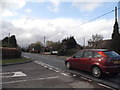
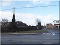
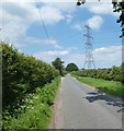
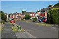
Photos of RG27 0DJ


Area Information
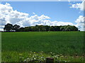
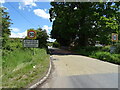
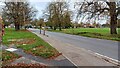
Living in RG27 0DJ defines a specific chapter for homebuyers seeking a small, contained residential cluster. This postcode covers precisely 7.6 hectares, creating a neighbourhood that feels intimate yet connected to the wider Basingstoke and Bloomsbury region. With a population of 1,828 residents, the area maintains a manageable scale where daily routines remain straightforward. The community sits within a practical reach of major local hubs, ensuring that life here balances quiet domesticity with accessible convenience. Residents enjoy a setting that avoids the sprawl of larger urban centres while retaining essential access to services. The density of 849 people per square kilometre indicates a compact environment where properties are situated close to one another, fostering a sense of local familiarity. This specific postcode offers a distinct alternative to larger towns, providing a focused living space for those who value a defined neighbourhood boundary. The area serves as a stable residential pocket, offering buyers a clear view of what daily life entails without unnecessary noise or congestion. For anyone researching homes in RG27 0DJ, the physical footprint of the estate creates a unique sense of place that stands apart from more diffuse suburban developments.
- Area Type
- Postcode
- Area Size
- 7.6 hectares
- Population
- 1828
- Population Density
- 849 people/km²
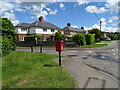
The property market in RG27 0DJ is defined by a overwhelming presence of owner-occupied housing. With a home ownership level of 76 per cent, the area functions primarily as an owner-occupied estate rather than a rental sector. This high rate suggests that the majority of houses in RG27 0DJ have been purchased by residents who intend to stay for the long term. The accommodation type is listed as houses, indicating an absence of flats or purpose-built apartment blocks in this specific postcode. This stock profile appeals to buyers seeking detached or terraced family homes with private gardens, rather than high-density residential units. The lack of rental pressure often correlates with more stable neighbourhood dynamics and potentially lower crime rates. Buyers looking at homes in RG27 0DJ should anticipate a market where sellers retain strong attachment to their properties. The 7.6-hectare size means the housing stock is limited, creating a competitive micro-market for any available properties. This concentration of similar housing types ensures a uniform aesthetic and a clear understanding of what property life entails in this locality.
House Prices in RG27 0DJ
Showing 3 properties
| Address | Type | Beds | Baths | Last Sale Price | Last Sale Date | |
|---|---|---|---|---|---|---|
| Stables At, Lilly Mill Farm, Mill Lane, Sherfield On Loddon, RG27 0DJ | Farm | - | - | - | - | |
| Lilly Mill Farm, Mill Lane, Sherfield On Loddon, RG27 0DJ | Detached | - | - | - | - | |
| Lilly Mill, Mill Lane, Sherfield On Loddon, RG27 0DJ | house | - | - | - | - |
Energy Efficiency in RG27 0DJ
Daily lifestyle in RG27 0DJ relies heavily on practical access to nearby amenities just beyond the immediate neighbourhood boundary. Shopping options include Tesco Basingstoke, M&S Chineham, and Lidl Chineham, offering comprehensive retail coverage for groceries and household essentials. This selection ensures that residents do not need to travel far for daily shopping needs. Five retail outlets within practical reach confirm that the area is well-served by modern supermarkets and department stores. For commuting and train access, five rail stations are located nearby, including Bramley Railway Station, Mortimer Railway Station, and Hook Railway Station. These transport nodes provide flexible connections to broader regional centers. The combination of major supermarkets and multiple railway stations creates a convenience that is rare for a small residential cluster. Residents of RG27 0DJ can manage their weekly shop and travel plans without significant expenditure on fuel or time. The presence of these specific named venues integrates the small-scale postcode into a larger network of local services, enhancing the overall quality of life for inhabitants.
Amenities
Schools
| Rank | School | Type | Entry gender | Ages |
|---|
Explore more schools in this area
Go to Schools tabDemographics
The community in RG27 0DJ reflects a mature and settled demographic profile. The median age stands at 47 years, confirming that adults between 30 and 64 years represent the most common age range within the cluster. This age distribution suggests an area populated by households in their mid-life stages rather than young families or retirees. Home ownership is the dominant housing tenure, with 76 per cent of residents owning their property outright or with a mortgage. This high percentage indicates a established neighbourhood where families have put down roots over time. The accommodation type is exclusively houses, reinforcing the traditional family-oriented character of the site. Predominantly White residents form the bulk of the population, contributing to a consistent community identity. These figures paint a picture of stability, where long-term residents have built secure futures in this 특정 locality. The data confirms a low-turnover environment typical of areas favoured by those seeking permanence. Buyers considering RG27 0DJ should expect a quiet, family-centric atmosphere rather than a transient rental market or a hub for young professionals. The specific demographic mix supports schools and local services that cater to children and working-age adults.
Household Size
Accommodation Type
Tenure
Ethnic Group
Religion
Household Composition
Age
Household Deprivation
NS-SEC
Explore more demographic insights in this area
Go to Demographics tabPlanning
Planning Constraints
- Flood RiskPremium
- Ramsar Wetland SitesPremium
- Area of Outstanding Natural BeautyPremium
- Protected Nature ReservePremium
- Protected WoodlandPremium