Area Overview for RG26 5XH
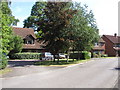
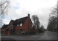
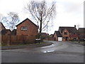
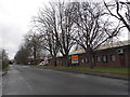
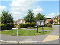
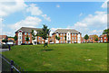
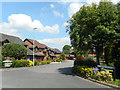
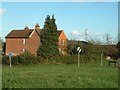
Photos of RG26 5XH


Area Information
RG26 5XH is a compact residential cluster defined by its modest size of 5.7 hectares. With a population of 1,828, this specific postcode covers a small but established community in England. The area offers a focused living environment where neighbouring streets form a close-knit residential cluster. Residents live in a setting that prioritises home stability, reflected in the high rate of permanent residence within these boundaries. The density stands at 849 people per square kilometre, creating a space that is suburban in character rather than urban. This postcode serves as a practical base for those seeking a home in a defined, manageable locality. You will find a neighbourhood where daily routines centre on local access and domestic peace. The postcode acts as a clear identifier for homes in this specific slice of the wider region. Living in this area means enjoying a settled atmosphere without the sprawl of larger towns.
- Area Type
- Postcode
- Area Size
- 5.7 hectares
- Population
- 1828
- Population Density
- 849 people/km²
The property market in RG26 5XH is characterised by a strong preference for houses rather than flats. Seventy-six per cent of residents own their homes, while the remaining quarter rent their properties. This high ownership figure suggests that the local housing stock consists largely of owner-occupied family homes. When searching for homes in this area, you will encounter a primarily residential landscape designed for permanent living. The accommodation type data confirms that houses dominate the estate, offering yard space and traditional layouts typical of the region. This tenure split often means that council tax bands and maintenance expectations align with owner-occupied standards. For buyers, this environment reduces the fluidity of frequent tenants and encourages long-term investment. The market here is less volatile than areas with high rental turnover. You will find a clear inventory of properties suited to families and retirees who value stability over speculation.
House Prices in RG26 5XH
Showing 24 properties
| Address | Type | Beds | Baths | Last Sale Price | Last Sale Date | |
|---|---|---|---|---|---|---|
| 17 St James Close, Bramley, RG26 5XH | Detached | 4 | 2 | £650,000 | Dec 2025 | |
| 2 St James Close, Bramley, RG26 5XH | Detached | 4 | 2 | £565,000 | Feb 2024 | |
| 10 St James Close, Bramley, RG26 5XH | Detached | 5 | 2 | £600,000 | Oct 2023 | |
| 22 St James Close, Bramley, RG26 5XH | Terraced | 3 | 1 | £340,000 | Feb 2023 | |
| 19 St James Close, Bramley, RG26 5XH | Detached | 3 | 2 | £471,000 | Nov 2022 | |
| 8 St James Close, Bramley, RG26 5XH | Detached | 4 | - | £495,000 | Jul 2022 | |
| 24 St James Close, Bramley, RG26 5XH | Semi-detached | 3 | 2 | £365,000 | Oct 2020 | |
| 25 St James Close, Bramley, RG26 5XH | Semi-detached | 3 | 2 | £363,000 | Nov 2019 | |
| 18 St James Close, Bramley, RG26 5XH | Detached | 6 | 3 | £495,000 | May 2019 | |
| 7 St James Close, Bramley, RG26 5XH | Detached | 4 | 2 | £475,000 | Nov 2018 |
Energy Efficiency in RG26 5XH
Residents of RG26 5XH enjoy practical access to four railway stations, including Bramley Railway Station, Mortimer Railway Station, and Basingstoke Railway Station. These transport links provide regular services for commuting to wider employment centres. Local retail options include Tesco Basingstoke, M and S Chineham SF, and Lidl Chineham for everyday shopping needs. You have straightforward access to major supermarkets and household goods stores within a short journey. These five notable retail venues ensure you do not need to travel far for groceries or clothing. The concentration of amenities around the postcode simplifies daily errands and errand running. Living in this area means balancing residential quiet with nearby commercial convenience. You can shop at Lidl or Tesco without a lengthy drive. This blend of transport and retail facilities defines the practical reality of life in RG26 5XH.
Amenities
Schools
| Rank | School | Type | Entry gender | Ages |
|---|
Explore more schools in this area
Go to Schools tabDemographics
The community in RG26 5XH reflects an established population with a median age of 47 years. Adults between 30 and 64 years old represent the most common age range, indicating a household dominated by families and working individuals. Home ownership stands at 76%, which signifies a stable residential market where most residents have purchased their properties. Houses form the predominant accommodation type, shaping the visual character of the streets within this postcode. The population is predominantly White, reflecting the traditional demographic makeup of the region. This profile suggests a mature neighbourhood where long-term residents often remain in the same homes throughout their working lives. A high home ownership rate usually correlates with lower transient populations and more invested community members. You are likely to meet neighbours who have lived in RG26 5XH for many years. This demographic stability creates a predictable environment for buyers looking for a permanent address.
Household Size
Accommodation Type
Tenure
Ethnic Group
Religion
Household Composition
Age
Household Deprivation
NS-SEC
Explore more demographic insights in this area
Go to Demographics tabPlanning
Planning Constraints
- Flood RiskPremium
- Ramsar Wetland SitesPremium
- Area of Outstanding Natural BeautyPremium
- Protected Nature ReservePremium
- Protected WoodlandPremium