Area Overview for RG22 4QE
Photos of RG22 4QE
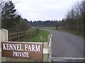
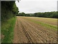
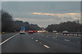
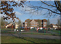
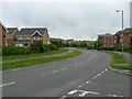
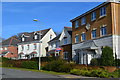
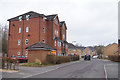
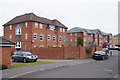
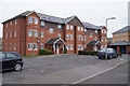
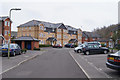
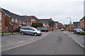
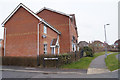
55 photos from this area
Area Information
Key information about the RG22 4QE including its size, population, and administrative classification.
- Area Type
- Postcode
- Area Size
- 2.3 hectares
- Population
- 1690
- Population Density
- 6016 people/km²
House Prices in RG22 4QE
57
Properties
£329,766
Average Sold Price
£169,995
Lowest Price
£600,000
Highest Price
Showing 57 properties
| Address | Type | Beds | Baths | Last Sale Price | Last Sale Date | |
|---|---|---|---|---|---|---|
| 19 Rycroft Meadow, Basingstoke, RG22 4QE | house | 3 | 3 | £386,500 | Jun 2025 | |
| 79 Rycroft Meadow, Basingstoke, RG22 4QE | house | 3 | 2 | £350,000 | Mar 2025 | |
| 3 Rycroft Meadow, Basingstoke, RG22 4QE | Detached | 4 | 3 | £600,000 | Feb 2025 | |
| 77 Rycroft Meadow, Basingstoke, RG22 4QE | Semi-detached | 3 | 2 | £380,000 | Dec 2024 | |
| 81 Rycroft Meadow, Basingstoke, RG22 4QE | Semi-detached | 3 | 2 | £410,000 | Aug 2024 | |
| 23 Rycroft Meadow, Basingstoke, RG22 4QE | Semi-detached | 3 | 2 | £405,000 | Dec 2023 | |
| 85 Rycroft Meadow, Basingstoke, RG22 4QE | Detached | 4 | 2 | £468,000 | Aug 2023 | |
| 105 Rycroft Meadow, Basingstoke, RG22 4QE | Terraced | 3 | 2 | £350,000 | Jul 2023 | |
| 75 Rycroft Meadow, Basingstoke, RG22 4QE | Semi-detached | 4 | 3 | £400,000 | Mar 2023 | |
| 89 Rycroft Meadow, Basingstoke, RG22 4QE | Semi-detached | 4 | 3 | £433,000 | Mar 2023 |
Page 1 of 6
Energy Efficiency in RG22 4QE
Amenities
Schools
| Rank | School | Type | Entry gender | Ages |
|---|
Explore more schools in this area
Go to Schools tabDemographics
Household Size
Family (3-5 people)
most common
Accommodation Type
Houses
most common
Tenure
67
majority
Ethnic Group
White
most common
Religion
N/A
most common
Household Composition
N/A
most common
Age
47
median
Adults (30-64 years)
most common
Household Deprivation
N/A
with no deprivation
NS-SEC
47
in Lower managerial occupations
Explore more demographic insights in this area
Go to Demographics tabPlanning
Planning Constraints
- Flood RiskPremium
- Ramsar Wetland SitesPremium
- Area of Outstanding Natural BeautyPremium
- Protected Nature ReservePremium
- Protected WoodlandPremium