Area Overview for RG22 4FE
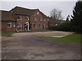
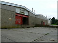
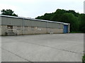
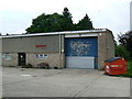
Photos of RG22 4FE

Area Information
Living in RG22 4FE means residing within a compact residential cluster spanning just 1.2 hectares. This specific postcode serves approximately 1,690 residents, creating a tightly knit community with a density of 144,282 people per square kilometre. The high population density reflects a neighbourhood where homes are in close proximity to one another, fostering a familiar and direct way of life. You will find that daily routines are structured around practical accessibility rather than extensive travel. The area functions as a distinct pocket within the wider RG22 postcode region, offering a residential focus without the sprawl of larger towns. Despite its small footprint, it provides a complete setup for those who value knowing their exact surroundings. The environment is defined by this concentrated residential nature, making it suitable for individuals seeking a defined and accessible local lifestyle.
- Area Type
- Postcode
- Area Size
- 1.2 hectares
- Population
- 1690
- Population Density
- 6016 people/km²
The property market in RG22 4FE is characterised primarily by owner-occupied housing. With 67% of residents owning their homes, this area functions as a low-rental sector where long-term stability reigns. Houses dominate the accommodation type, offering standalone living spaces rather than shared accommodations. This heavy reliance on ownership means the local market is driven by motivated sellers and established homeowners rather than frequent turnover typical of landlords. Prospective buyers looking at homes in RG22 4FE should expect a stock defined by conventional house designs suited to the local cluster. The small size of the area, covering only 1.2 hectares, limits the total volume of properties available compared to larger districts. Competition may exist among owner-occupiers looking to upsize or downsize, but the overall dynamic remains focused on retention.
House Prices in RG22 4FE
Showing 44 properties
| Address | Type | Beds | Baths | Last Sale Price | Last Sale Date | |
|---|---|---|---|---|---|---|
| 64 Oceana Crescent, Basingstoke, RG22 4FE | Terraced | 2 | 2 | £310,000 | Jun 2025 | |
| 52 Oceana Crescent, Basingstoke, RG22 4FE | Terraced | 2 | 2 | £327,500 | Mar 2025 | |
| 38 Oceana Crescent, Basingstoke, RG22 4FE | Terraced | 4 | 3 | £425,000 | Mar 2025 | |
| 88 Oceana Crescent, Basingstoke, RG22 4FE | Semi-detached | 4 | 3 | £375,000 | Jan 2025 | |
| 26 Oceana Crescent, Basingstoke, RG22 4FE | Detached | 4 | 2 | £535,000 | Sep 2024 | |
| 40 Oceana Crescent, Basingstoke, RG22 4FE | Terraced | 4 | 3 | £395,000 | Jun 2024 | |
| 42 Oceana Crescent, Basingstoke, RG22 4FE | Terraced | 4 | 4 | £450,000 | May 2024 | |
| 60 Oceana Crescent, Basingstoke, RG22 4FE | Terraced | 2 | 2 | £315,000 | Mar 2024 | |
| 74 Oceana Crescent, Basingstoke, RG22 4FE | Semi-detached | 4 | 2 | £411,000 | Jul 2022 | |
| 50 Oceana Crescent, Basingstoke, RG22 4FE | house | - | - | £295,000 | Apr 2022 |
Energy Efficiency in RG22 4FE
Residents of RG22 4FE benefit from a practical range of amenities within practical reach. Three retail options serve your weekly shopping needs, including The Southern Co-operative Co, Tesco Hounsome, and Lidl Basingstoke. These venues provide access to groceries, household essentials, and daily necessities without requiring a long journey. For rail travel, Basingstoke Railway Station, Overton Railway Station, and Micheldever Railway Station offer excellent connectivity to wider travel networks. You might also find yourself near Lasham Airport, providing unique access to private and regional aviation. This mix of retail and transport facilities ensures that daily life remains convenient and manageable. The proximity of these specific locations allows you to manage errands, social visits, and travel efficiently from your home. The lifestyle here is defined by this immediate access to essential services.
Amenities
Schools
| Rank | School | Type | Entry gender | Ages |
|---|
Explore more schools in this area
Go to Schools tabDemographics
The community in RG22 4FE reflects a settled population with a median age of 47 years. Most residents fall into the adult bracket between 30 and 64 years old, indicating a stable workforce and families established in the area. Home ownership stands at 67%, showing that two-thirds of households own their property outright or with a mortgage. This high level of ownership suggests a long-term commitment to the neighbourhood. Houses form the predominant accommodation type, meaning you will encounter traditional residential structures rather than high-rise flats or communal units. The predominant ethnic group is White, which mirrors the broad demographic trends found across many established suburbs. Deprivation data is not provided in the current records, so a specific analysis of local hardship indicators is unavailable. However, the age profile and ownership rates point toward a mature, stable demographic without significant transient populations.
Household Size
Accommodation Type
Tenure
Ethnic Group
Religion
Household Composition
Age
Household Deprivation
NS-SEC
Explore more demographic insights in this area
Go to Demographics tabPlanning
Planning Constraints
- Flood RiskPremium
- Ramsar Wetland SitesPremium
- Area of Outstanding Natural BeautyPremium
- Protected Nature ReservePremium
- Protected WoodlandPremium