Area Overview for RG21 5RY
Photos of RG21 5RY
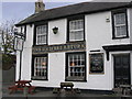


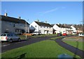
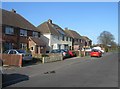
100 photos from this area
Area Information
Key information about the RG21 5RY including its size, population, and administrative classification.
- Area Type
- Postcode
- Area Size
- 7692 m²
- Population
- 1912
- Population Density
- 7107 people/km²
House Prices in RG21 5RY
19
Properties
£204,536
Average Sold Price
£49,500
Lowest Price
£325,000
Highest Price
Showing 19 properties
| Address | Type | Beds | Baths | Last Sale Price | Last Sale Date | |
|---|---|---|---|---|---|---|
| 28 Hailstone Road, Basingstoke, RG21 5RY | Semi-detached | 3 | - | £325,000 | Jul 2023 | |
| 14 Hailstone Road, Basingstoke, RG21 5RY | Terraced | 3 | 1 | £265,000 | Oct 2018 | |
| 18 Hailstone Road, Basingstoke, RG21 5RY | Terraced | 3 | 1 | £227,000 | Jun 2018 | |
| 26 Hailstone Road, Basingstoke, RG21 5RY | Semi-detached | 3 | 1 | £285,000 | Jul 2016 | |
| 22 Hailstone Road, Basingstoke, RG21 5RY | house | - | - | £280,000 | Feb 2016 | |
| 24 Hailstone Road, Basingstoke, RG21 5RY | Semi-detached | 3 | - | £245,000 | Jun 2015 | |
| 36 Hailstone Road, Basingstoke, RG21 5RY | Semi-detached | 3 | - | £273,000 | Oct 2014 | |
| 32 Hailstone Road, Basingstoke, RG21 5RY | Semi-detached | 3 | 2 | £214,000 | Mar 2014 | |
| 34 Hailstone Road, Basingstoke, RG21 5RY | house | - | - | £167,000 | Dec 2010 | |
| 2 Hailstone Road, Basingstoke, RG21 5RY | Semi-detached | 3 | - | £152,000 | Feb 2010 |
Page 1 of 2
Energy Efficiency in RG21 5RY
Amenities
Schools
| Rank | School | Type | Entry gender | Ages |
|---|
Explore more schools in this area
Go to Schools tabDemographics
Household Size
Family (3-5 people)
most common
Accommodation Type
Houses
most common
Tenure
36
majority
Ethnic Group
White
most common
Religion
N/A
most common
Household Composition
N/A
most common
Age
47
median
Adults (30-64 years)
most common
Household Deprivation
N/A
with no deprivation
NS-SEC
25
in Lower managerial occupations
Explore more demographic insights in this area
Go to Demographics tabPlanning
Planning Constraints
- Flood RiskPremium
- Ramsar Wetland SitesPremium
- Area of Outstanding Natural BeautyPremium
- Protected Nature ReservePremium
- Protected WoodlandPremium