Area Overview for RG21 4AA
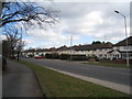
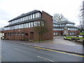
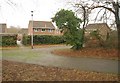
Photos of RG21 4AA


Area Information
Living in RG21 4AA offers a residential experience defined by its specific postcode cluster in England. This area covers a total land size of 4,267 square metres and serves a population of 1,587 people. The high population density results in a residential cluster where neighbours are naturally close together. This layout fosters a community where daily life moves at a steady pace, away from the sprawl of larger suburbs yet within reach of significant local amenities. The character of RG21 4AA is shaped entirely by its housing stock and the immediate needs of its 1,587 residents. You will find a neighbourhood where the built environment supports a settled demographic rather than a transient one. The area functions as a contained residential zone, distinct from surrounding commercial hubs yet well-integrated into the wider transport network. Prospective buyers looking at homes in RG21 4AA are entering a defined postcode sector where size and population create a specific living rhythm. The physical footprint is compact, which influences how residents access services and how much private space is available at any given address.
- Area Type
- Postcode
- Area Size
- 4267 m²
- Population
- 1587
- Population Density
- 4179 people/km²
The property market in RG21 4AA is characterised by a strong lean towards house ownership. With 71% of properties classified as owner-occupied, the area serves primarily as a location for individuals who have purchased their homes rather than tenants seeking leases. This ownership level implies that the housing stock consists largely of long-held residential assets. The predominant accommodation type in RG21 4AA is the house, which forms the core of the local housing inventory. This means buyers interested in finding homes in RG21 4AA are predominantly looking for detached, semi-detached, or terraced houses rather than apartments. The high proportion of owner-occupied homes suggests a slower turnover rate in the local real estate market. Sellers in this area often seek buyers who understand the value of the established house stock. When you examine houses in RG21 4AA, you are looking at properties that fit into a market where buyers typically commit to residences for the long term. This stability benefits those entering the market looking for a permanent base rather than a stopgap solution. The 28% rental proportion is relatively low compared to national averages, further emphasising the owner-led nature of this specific postcode cluster.
House Prices in RG21 4AA
Showing 5 properties
| Address | Type | Beds | Baths | Last Sale Price | Last Sale Date | |
|---|---|---|---|---|---|---|
| Eastgarth, London Road, Basingstoke, RG21 4AA | house | 3 | 1 | £435,000 | Jun 2025 | |
| Keswick, London Road, Basingstoke, RG21 4AA | house | - | - | £189,150 | Sep 2009 | |
| Rothesay, London Road, Basingstoke, RG21 4AA | Detached | - | - | £295,000 | May 2007 | |
| Wayford, London Road, Basingstoke, RG21 4AA | Detached | - | - | - | - | |
| Ludlow, London Road, Basingstoke, RG21 4AA | Detached | - | - | - | - |
Energy Efficiency in RG21 4AA
Daily life in RG21 4AA places key amenities within practical reach of your doorstep. Residents have five retail options nearby, with Iceland Chelsea, M&S Basingstoke, and Tesco Basingstoke serving as notable shopping destinations. These venues provide essential groceries, clothing, and daily necessities without requiring a long commute. For commuting, three railway stations offer rail links: Basingstoke Railway Station, Bramley Railway Station, and Hook Railway Station. These stations provide connected transport options that link the area to wider national networks. Additionally, one airport, Lasham Airport, sits nearby, offering regional air connectivity for residents requiring private or small commercial flights. This combination of rail and air access makes living in RG21 4AA accessible for both local and wider regional travel. You can access quality retail and transport links quickly, ensuring that convenience is a central feature of your routine..shopping trips and daily commutes are streamlined by the specific amenity choices found within this postcode radius.
Amenities
Schools
Families living in RG21 4AA have access to two named educational institutions in the immediate vicinity. The Costello School operates as an academy and holds a good overall Ofsted rating, indicating sound educational standards. Costello Technology College serves a primary education role for younger children in the local area. This mix provides a continuum of schooling options directly supported by the local infrastructure. You do not need to look far to find schools near RG21 4AA, as these two facilities form the principal educational provision for the neighbourhood. The presence of an academy with a good rating alongside a primary college suggests a commitment to secondary and secondary support for local pupils. When you consider schools for your children, the quality rating of The Costello School is a factual point of consideration for families relocating to RG21 4AA. The proximity of both institutions minimises travel time for students living in the immediate postcode area. This arrangement supports parents who prioritise convenience and established inspection ratings when selecting where to live.
| Rank | School | Type | Entry gender | Ages |
|---|
Explore more schools in this area
Go to Schools tabDemographics
The community in RG21 4AA is dominated by adults aged between 30 and 64 years. This age range represents the most common demographic, reflecting a population that has likely established careers and families. The median age of residents is 47 years, indicating an older demographic profile consistent with a settled neighbourhood. Home ownership stands at 71%, confirming that the majority of houses in RG21 4AA are owner-occupied rather than rental properties. This high rate suggests long-term residents who have chosen to purchase homes in the area. The predominant ethnic group is White, mirroring the broader statistical profile of many established English residential zones. Accommodation types within RG21 4AA consist primarily of houses, which aligns with the higher home ownership percentage. These homes provide separate living spaces that suit families and older adults equally. You will not find a mix of rented flats or student housing dominating the streets of this postcode. The 71% ownership figure means you can expect a stable environment where noise and turnover are naturally limited by the nature of property ownership.
Household Size
Accommodation Type
Tenure
Ethnic Group
Religion
Household Composition
Age
Household Deprivation
NS-SEC
Explore more demographic insights in this area
Go to Demographics tabPlanning
Planning Constraints
- Flood RiskPremium
- Ramsar Wetland SitesPremium
- Area of Outstanding Natural BeautyPremium
- Protected Nature ReservePremium
- Protected WoodlandPremium