Area Overview for RG20 8XD
Photos of RG20 8XD


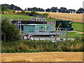
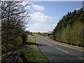
13 photos from this area
Area Information
Key information about the RG20 8XD including its size, population, and administrative classification.
- Area Type
- Postcode
- Area Size
- 63.2 hectares
- Population
- 1590
- Population Density
- 94 people/km²
House Prices in RG20 8XD
13
Properties
£671,750
Average Sold Price
£245,000
Lowest Price
£1,775,000
Highest Price
Showing 13 properties
| Address | Type | Beds | Baths | Last Sale Price | Last Sale Date | |
|---|---|---|---|---|---|---|
| Ashtree Cottage, Horsemoor, Chieveley, Newbury, RG20 8XD | Semi-detached | 3 | 1 | £417,500 | Jul 2023 | |
| Greenwood House, Horsemoor, Chieveley, Newbury, RG20 8XD | Detached | - | - | £900,000 | Aug 2022 | |
| The Limes, Horsemoor, Chieveley, Newbury, RG20 8XD | Retail | 2 | 1 | £500,000 | Mar 2022 | |
| Wood View, Horsemoor, Chieveley, Newbury, RG20 8XD | Semi-detached | 3 | - | £395,000 | Jan 2021 | |
| Horsemoor Cottage, Horsemoor, Chieveley, Newbury, RG20 8XD | Detached | 4 | 2 | £925,000 | Jul 2018 | |
| Horsemoor House, Horsemoor, Chieveley, Newbury, RG20 8XD | Detached | 4 | - | £1,775,000 | Aug 2013 | |
| Goldens, Horsemoor, Chieveley, Newbury, RG20 8XD | house | - | - | £735,000 | Aug 2013 | |
| Laurel Cottage, Horsemoor, Chieveley, Newbury, RG20 8XD | Detached | - | - | £245,000 | Dec 1999 | |
| Garden Cottage, Horsemoor, Chieveley, Newbury, RG20 8XD | Semi-detached | 2 | 1 | £400,000 | Nov 1998 | |
| Church Farm Barn, Horsemoor, Chieveley, Newbury, RG20 8XD | Detached | - | - | £425,000 | May 1998 |
Page 1 of 2
Energy Efficiency in RG20 8XD
Amenities
Schools
| Rank | School | Type | Entry gender | Ages |
|---|
Explore more schools in this area
Go to Schools tabDemographics
Household Size
Two person
most common
Accommodation Type
Houses
most common
Tenure
80
majority
Ethnic Group
White
most common
Religion
N/A
most common
Household Composition
N/A
most common
Age
47
median
Adults (30-64 years)
most common
Household Deprivation
N/A
with no deprivation
NS-SEC
43
in Lower managerial occupations
Explore more demographic insights in this area
Go to Demographics tabPlanning
Planning Constraints
- Flood RiskPremium
- Ramsar Wetland SitesPremium
- Area of Outstanding Natural BeautyPremium
- Protected Nature ReservePremium
- Protected WoodlandPremium