Area Overview for RG2 9LP
Photos of RG2 9LP
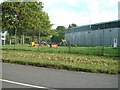
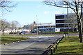
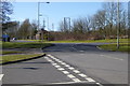
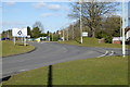
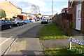
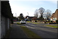
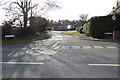
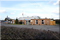
43 photos from this area
Area Information
Key information about the RG2 9LP including its size, population, and administrative classification.
- Area Type
- Postcode
- Area Size
- 2.6 hectares
- Population
- 1934
- Population Density
- 951 people/km²
House Prices in RG2 9LP
54
Properties
£230,510
Average Sold Price
£95,950
Lowest Price
£342,500
Highest Price
Showing 54 properties
| Address | Type | Beds | Baths | Last Sale Price | Last Sale Date | |
|---|---|---|---|---|---|---|
| 22 Hill Road, Arborfield, RG2 9LP | Terraced | 2 | 1 | £330,000 | May 2025 | |
| 23 Hill Road, Arborfield, RG2 9LP | Terraced | 2 | 1 | £342,500 | May 2025 | |
| 25 Hill Road, Arborfield, RG2 9LP | Terraced | 2 | 1 | £320,000 | Oct 2024 | |
| 35 Hill Road, Arborfield, RG2 9LP | Terraced | 2 | 1 | £285,000 | Oct 2024 | |
| 10 Hill Road, Arborfield, RG2 9LP | Terraced | 2 | 1 | £315,000 | Jan 2024 | |
| 47 Hill Road, Arborfield, RG2 9LP | Terraced | 2 | 1 | £342,500 | Nov 2022 | |
| 4 Hill Road, Arborfield, RG2 9LP | house | - | - | £300,000 | Sep 2022 | |
| 21 Hill Road, Arborfield, RG2 9LP | Terraced | 2 | 1 | £315,000 | Aug 2022 | |
| 38 Hill Road, Arborfield, RG2 9LP | house | - | - | £297,000 | Mar 2022 | |
| 52 Hill Road, Arborfield, RG2 9LP | Terraced | 2 | 1 | £310,000 | Feb 2022 |
Page 1 of 6
Energy Efficiency in RG2 9LP
Amenities
Schools
| Rank | School | Type | Entry gender | Ages |
|---|
Explore more schools in this area
Go to Schools tabDemographics
Household Size
Family (3-5 people)
most common
Accommodation Type
Houses
most common
Tenure
50
majority
Ethnic Group
White
most common
Religion
N/A
most common
Household Composition
N/A
most common
Age
47
median
Adults (30-64 years)
most common
Household Deprivation
N/A
with no deprivation
NS-SEC
48
in Lower managerial occupations
Explore more demographic insights in this area
Go to Demographics tabPlanning
Planning Constraints
- Flood RiskPremium
- Ramsar Wetland SitesPremium
- Area of Outstanding Natural BeautyPremium
- Protected Nature ReservePremium
- Protected WoodlandPremium