Area Overview for RG2 9SU
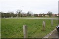
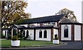
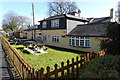
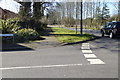
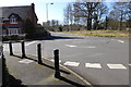
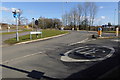
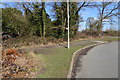
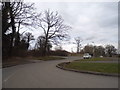
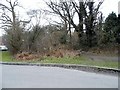
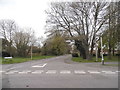
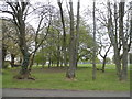
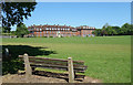
Photos of RG2 9SU
Area Information
RG2 9SU represents a specific residential cluster where 1,934 people currently reside. This postcode covers a relatively small area with a population density of 951 people per square kilometre, creating a moderately compact living environment. Residents here experience daily life within a defined neighbourhood that balances residential space with proximity to larger transport hubs. The location is situated in England, offering a typical British suburban setting where immediacy to services is high despite the compact layout. Living in RG2 9SU means being part of a community where every window has a view of a neighbour's garden due to the density figures. The area functions as a practical base for commuters and families who require quick access to Wokingham and surrounding towns. Daily routines involve short journeys to local Co-op branches or nearby train stations. The postcode serves as a distinct identifier for a home that values accessibility over expansive rural isolation. You will find that homes in this specific cluster offer convenient locations without sacrificing the relative peace of a residential zone. The compact nature of the area ensures that essential amenities are always within walking or cycling distance. This makes RG2 9SU a logical choice for those seeking a settled life close to main transport arteries.
- Area Type
- Postcode
- Area Size
- Not available
- Population
- 1934
- Population Density
- 951 people/km²
The housing stock in RG2 9SU is characterised by a strong preference for houses over other dwelling types. This architectural focus supports the demographic of adults aged 30 to 64 who require space and established layouts. Half of the residents own their homes, establishing a clear pattern of proprietorship that permeates the local property market. This 50% ownership rate indicates a balanced market where renting remains a viable option for the other half of the community. Buyers looking at this postcode will encounter a environment dominated by residential structures rather than flats or apartments. The cluster nature of the postcode means properties are close together, often as detached or semi-detached homes. There is no data on specific price ranges, but the accommodation type suggests a market geared towards families or professionals seeking rooms rather than studio living. Investing in a property here aligns you with a neighbourhood of previous owners who value stability. The mix of owner-occupiers and renters creates a fluid yet grounded market dynamic. Homes in RG2 9SU cater to those who need a traditional house layout amidst a high-density setting of 951 people per square kilometre.
House Prices in RG2 9SU
Showing 45 properties
| Address | Type | Beds | Baths | Last Sale Price | Last Sale Date | |
|---|---|---|---|---|---|---|
| 81 Lenham Drive, Arborfield Garrison, Arborfield, RG2 9SU | Semi-detached | - | - | - | - | |
| 35 Lenham Drive, Arborfield Garrison, Arborfield, RG2 9SU | Detached | - | - | - | - | |
| 89 Lenham Drive, Arborfield Garrison, Arborfield, RG2 9SU | Semi-detached | - | - | - | - | |
| 19 Lenham Drive, Arborfield Garrison, Arborfield, RG2 9SU | house | - | - | - | - | |
| 27 Lenham Drive, Arborfield Garrison, Arborfield, RG2 9SU | house | - | - | - | - | |
| 45 Lenham Drive, Arborfield Garrison, Arborfield, RG2 9SU | Detached | - | - | - | - | |
| 71 Lenham Drive, Arborfield Garrison, Arborfield, RG2 9SU | Detached | - | - | - | - | |
| 61 Lenham Drive, Arborfield Garrison, Arborfield, RG2 9SU | Semi-detached | - | - | - | - | |
| 41 Lenham Drive, Arborfield Garrison, Arborfield, RG2 9SU | Terraced | - | - | - | - | |
| 63 Lenham Drive, Arborfield Garrison, Arborfield, RG2 9SU | Semi-detached | - | - | - | - |
Energy Efficiency in RG2 9SU
Living in RG2 9SU offers immediate access to a range of retail and transport amenities. Five retail outlets serve the local population, including Co-op Arborfield, Co-op Finchampstead, and Co-op Former. These supermarkets provide daily necessities within practical reach for all residents. Commuters can step out and reach Wokingham Railway Station or Winnersh Railway Station quickly. Winnersh Triangle Railway Station offers additional connectivity for those travelling further afield. Air travel is supported by the proximity of Blackbushe Airport, which sits just one option away in terms of accessible airports. This mix of small-town retail and major transport hubs defines the lifestyle here. You will find that routine errands require minimal planning. The presence of multiple Co-op branches means grocery shopping is convenient and competitive. Retail options are sufficient for most weekly requirements without needing long drives. combining local shops with national rail connectivity creates a balanced daily life. Leisure pursuits often hinge on the ability to reach nearby towns easily. Homes in RG2 9SU are positioned to take advantage of these nearby facilities. The lifestyle is practical and efficient, avoiding isolation while maintaining residential comfort.
Amenities
Schools
Families living in RG2 9SU have access to Bohunt School Wokingham. This facility operates as an academy and holds a good Ofsted rating. The presence of a school rated good provides a reassuring standard for parents seeking education for their children. Bohunt School Wokingham serves as the primary educational institution referenced for this specific postcode area. The academy status means it receives funding directly from the government without local authority intervention, which often allows for greater flexibility in teaching methods. No other schools are listed in the immediate data for this cluster. This singular option suggests that residents may need to consider wider catchment areas for alternative schooling choices. However, the good rating of Bohunt School Wokingham indicates a positive learning environment. For families planning to settle in RG2 9SU, the proximity to this well-regarded academy is a significant factor. The school type supports a broad curriculum within an autonomous framework. Choosing a home near this location means prioritising access to a school that has met national quality standards.
| Rank | School | Type | Entry gender | Ages |
|---|
Explore more schools in this area
Go to Schools tabDemographics
The community in RG2 9SU is defined by a mature population profile with a median age of 47 years. Most inhabitants fall within the 30 to 64 years age range, indicating a neighbourhood dominated by adults rather than young families or retirees. House ownership stands at exactly 50%, dividing the resident population evenly between owners and renters. This high level of home ownership suggests stability and long-term commitment from many of the people living here. The predominant ethnic group is White, reflecting the broader demographic trends typical of this region in England. Accommodation types consist primarily of houses, aligning with the needs of the adult demographic who have likely moved away from student housing or starter flats. With a population of 1,934, the social fabric is tight-knit and familiar. You will notice a neighbourly atmosphere where residents know one another. The age profile means local shops see consistent customers throughout the week. Safety measures regarding flood risk are currently non-existent as the score is 0, indicating low risk coverage. Deprivation is not explicitly quantified in the available data, but the stable home ownership rate points to a settled group. Living here means engaging with a community that values permanence and has built a routine suited to working-age adults.
Household Size
Accommodation Type
Tenure
Ethnic Group
Religion
Household Composition
Age
Household Deprivation
NS-SEC
Explore more demographic insights in this area
Go to Demographics tabPlanning
Planning Constraints
- Flood RiskPremium
- Ramsar Wetland SitesPremium
- Area of Outstanding Natural BeautyPremium
- Protected Nature ReservePremium
- Protected WoodlandPremium