Area Overview for RG2 9HE
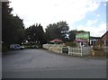
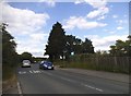
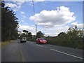
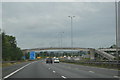
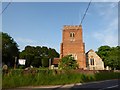
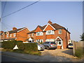
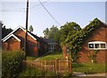
Photos of RG2 9HE
Area Information
RG2 9HE is a small residential cluster covering 1.1 hectares, home to a population of 1,716 people. This compact postcode offers a concentrated living environment where residents benefit from proximity to essential services. The area is situated within Berkshire, providing access to the wider South East region. Living in RG2 9HE means you are part of a defined neighbourhood characterised by its specific boundaries and strong local ties. The density is significant, with 150,172 people per square kilometre across the site, indicating a closely knit community layout. Daily life here revolves around quick access to nearby transport links and retail outlets. You will find that the area is designed for practical commuting and convenient access to Winchester and Reading. The postcodes surrounding this cluster connect you to established towns while maintaining a focus on immediate local interaction. This specific site represents a targeted location for those seeking a settled environment. It is not a sprawling suburb but a distinct pocket within the RG2 borough structure. Homebuyers visiting this area will notice the clear demarcation of the postcode from its surroundings. The location prioritises efficiency and connection to major infrastructure without the isolation of rural settings. You can expect a setting that balances residential quiet with accessibility to the broader economy.
- Area Type
- Postcode
- Area Size
- 1.1 hectares
- Population
- 1716
- Population Density
- 3770 people/km²
RG2 9HE represents a distinct segment of the South East property market where owner occupation dominates. With 81% of residents owning their homes, the area functions primarily as a market for established homeowners rather than first-time buyers or tenants. The accommodation type is exclusively houses, meaning you will not find any flats or maisonettes within this specific cluster. This uniformity in housing style contributes to a consistent streetscape and community feel. Prospective buyers expecting a mix of rental properties or上楼 flats will find this unlikely in this postcode. The high home ownership percentage indicates that houses here are typically purchased to remain in for the long term. This market behaviour stabilises property values and reduces turnover frequency compared to rental-heavy areas. Families looking for a house with garden space will find their needs met naturally by the available stock. The absence of flats suggests a design intent focused on standard suburban living rather than high-density urban living. When viewing properties in RG2 9HE, you should expect traditional house layouts typical of the region. This market composition makes the area attractive for move-up buyers or those seeking stability. The consistent housing type also facilitates easier comparisons when assessing neighbouring residences. Buyers driving through will see a uniform pitch of detached or semi-detached homes.
House Prices in RG2 9HE
Showing 23 properties
| Address | Type | Beds | Baths | Last Sale Price | Last Sale Date | |
|---|---|---|---|---|---|---|
| 6 Deardon Way, Shinfield, RG2 9HE | Detached | 4 | 2 | £620,000 | Jul 2025 | |
| 16 Deardon Way, Shinfield, RG2 9HE | Terraced | 3 | 3 | £352,500 | Dec 2024 | |
| 9 Deardon Way, Shinfield, RG2 9HE | Detached | 1 | 1 | £550,000 | Sep 2024 | |
| 19 Deardon Way, Shinfield, RG2 9HE | Detached | 3 | 2 | £495,000 | Apr 2023 | |
| 8 Deardon Way, Shinfield, RG2 9HE | house | - | - | £455,000 | Nov 2021 | |
| 22 Deardon Way, Shinfield, RG2 9HE | house | - | - | £345,000 | Mar 2021 | |
| 14 Deardon Way, Shinfield, RG2 9HE | Terraced | 3 | - | £345,000 | Jan 2021 | |
| 1 Deardon Way, Shinfield, RG2 9HE | Detached | 4 | 2 | £610,000 | Sep 2020 | |
| 17 Deardon Way, Shinfield, RG2 9HE | Detached | 4 | 2 | £520,000 | Aug 2018 | |
| 15 Deardon Way, Shinfield, RG2 9HE | Detached | 3 | 2 | £400,000 | May 2018 |
Energy Efficiency in RG2 9HE
Living in RG2 9HE places you within practical reach of key retail and transport hubs. For shopping needs, Lidl Beke, Asda Shinfield, and a Co-op Former are identified as the nearest major retailers. You have five retail options listed, providing variety in weekly grocery shopping and household essentials. Supermarkets are a short drive away, ensuring fresh produce and daily necessities are easily accessible without venturing into city centres. Transport connectivity is similarly robust, with five rail stations identified as neighbours. Earley Railway Station, Winnersh Triangle Railway Station, and Winnersh Railway Station form the core of your public transport network. These stations offer links to Winchester, Reading, and London, facilitating daily commuting. You can combine local retail trips with a train journey to the capital seamlessly. The presence of these specific stations means travel times are predictable and frequent services are likely available. Residents enjoy a lifestyle where weekend shopping and mid-week commuting are both streamlined. The combination of large supermarkets and train access defines the daily rhythm for households here. This practical convenience reduces the time spent travelling and increases time for home and family.
Amenities
Schools
The educational provision for families nearby RG2 9HE includes Alder Grove Church of England Primary School. This institution holds a Good rating from Ofsted, confirming its standard of education meets regulatory expectations for primary schooling. As a primary school, it caters to children ages typically between four and eleven years old. This single named facility suggests that secondary education options lie outside the immediate immediate vicinity of this small cluster. For parents considering homes near RG2 9HE, access to a well-rated primary school is a confirmed feature of the location. The mix of just one listed school indicates a reliance on local catchment areas or slightly more distant secondary provisions not listed in this dataset. You can rely on the primary education choice being maintained at a Good standard within walking or short driving distance. The school type focuses on foundational learning and early childhood development before students progress to secondary colleges. This educational anchor supports the family-oriented demographic of the area. It is advisable for families to verify catchment boundaries directly with the council before committing to a purchase. The presence of a Good rated school adds tangible value to properties in the locality.
| Rank | School | Type | Entry gender | Ages |
|---|
Explore more schools in this area
Go to Schools tabDemographics
The community in RG2 9HE is defined by a mature population profile. The median age is 47 years, reflecting a demographic dominated by adults between 30 and 64 years old. You will find that this area attracts families and professionals who have established careers. Eighty-one per cent of residents own their homes, suggesting a long-term resident base rather than a transient rental market. Almost all accommodation consists of houses, indicating a preference for detached or semi-detached living arrangements over flats. The predominant ethnic group is White, which aligns with the broader suburban makeup of this part of Berkshire. This statistical profile points to a stable neighbourhood where generations often remain in the same property. The high home ownership rate of 81% means you are likely to deal with owners who know their property well. There are very few young children or elderly demographics populating the core age bracket according to the data. The housing stock supports a lifestyle where people remain in one location for their entire adult lives. This consistency creates a predictable environment for those considering moving into this specific postcode. Buyers should note that the age skew means services may cater more to adults than families with very young infants. The housing type remains exclusively houses, which shapes the street patterns and garden availability.
Household Size
Accommodation Type
Tenure
Ethnic Group
Religion
Household Composition
Age
Household Deprivation
NS-SEC
Explore more demographic insights in this area
Go to Demographics tabPlanning
Planning Constraints
- Flood RiskPremium
- Ramsar Wetland SitesPremium
- Area of Outstanding Natural BeautyPremium
- Protected Nature ReservePremium
- Protected WoodlandPremium