Area Overview for RG2 9GD
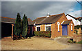
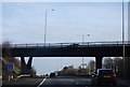
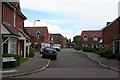
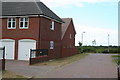
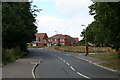
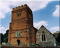
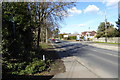
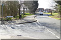
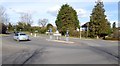
Photos of RG2 9GD
Area Information
RG2 9GD is a specific postcode area covering a small residential cluster that feels distinct from the surrounding sprawl. This location occupies just two hectares of land, creating a compact community where residents know their neighbours. The population stands at 1,993 people, meaning the area maintains a manageable scale without the chaos of larger urban zones. You will find that daily life here balances convenience with a sense of privacy, as the density reaches 480 people per square kilometre. This figure suggests a neighbourhood that is populated enough for walkability but sparse enough to retain a country feel. Living in RG2 9GD means accessing a defined space where homes are close enough for interaction yet separate enough for independence. The area sits within England, benefiting from established infrastructure while avoiding the congestion of major population hubs. Prospective buyers often appreciate how the small footprint allows for a clear understanding of local boundaries and council responsibilities. This postcode represents a snapshot of planned residential development rather than organic growth. You can move here knowing exactly what land you occupy and what lies immediately beyond your boundary lines. The character of RG2 9GD is defined by its size, offering a secluded feel within a functional network of roads and utilities.
- Area Type
- Postcode
- Area Size
- 2.0 hectares
- Population
- 1993
- Population Density
- 480 people/km²
RG2 9GD functions as a predominantly owner-occupied district rather than a rental market. The data confirms that 83 per cent of residents own their homes, which dictates the character of the property market. Houses account for the vast majority of accommodation types, meaning buyers looking for flats or apartments will not find them within this specific postcode. This presentation points to a mature housing stock where freehold properties dominate the streets. You will encounter fewer vacant properties than in areas with high rental yields, reducing the likelihood of speculative buying and selling. The small size of the area, at just two hectares, means that house prices per square metre may reflect a premium for space and exclusivity. Buyers interested in living in RG2 9GD should anticipate competition from other owners looking to expand their portfolios or downsize locally. The lack of rental listings suggests stability, yet it also means less flexibility for those trying to relocate quickly without a chain. When viewing homes in RG2 9GD, focus on the condition of gardens and outbuildings, as these are common features in house-based properties. The market here rewards those willing to engage directly with owners rather than relying on agency-led leasing options. This ownership culture often results in well-maintained exteriors and tidy communal spaces, benefiting those who value a neat environment.
House Prices in RG2 9GD
Showing 39 properties
| Address | Type | Beds | Baths | Last Sale Price | Last Sale Date | |
|---|---|---|---|---|---|---|
| 12 Firethorn, Shinfield, RG2 9GD | Detached | 5 | 3 | £1,000,000 | Sep 2025 | |
| 48 Firethorn, Shinfield, RG2 9GD | Detached | 4 | 3 | £610,000 | May 2025 | |
| 5 Firethorn, Shinfield, RG2 9GD | Semi-detached | 4 | 2 | £501,000 | Jan 2025 | |
| 38 Firethorn, Shinfield, RG2 9GD | Detached | 4 | 3 | £565,000 | Dec 2024 | |
| 36 Firethorn, Shinfield, RG2 9GD | Detached | 4 | 3 | £575,000 | Dec 2024 | |
| 23 Firethorn, Shinfield, RG2 9GD | Terraced | 3 | 2 | £490,000 | Jan 2023 | |
| 28 Firethorn, Shinfield, RG2 9GD | Retail | 3 | 2 | £455,000 | May 2022 | |
| 11 Firethorn, Shinfield, RG2 9GD | house | - | - | £540,000 | Jun 2021 | |
| 6 Firethorn, Shinfield, RG2 9GD | Detached | 5 | 3 | £800,000 | Jan 2020 | |
| 2 Firethorn, Shinfield, RG2 9GD | house | - | - | £825,000 | Aug 2019 |
Energy Efficiency in RG2 9GD
Your daily lifestyle in RG2 9GD benefits from a practical proximity to essential retail and rail hubs. Asda Shinfield, Lidl Beke, and the former Co-op location provide a range of groceries and household essentials within a short practical reach. You will find that five retail outlets operate nearby, allowing for one-stop shopping trips without requiring a long drive. Rail transport offers five stations close by, including Earley Railway Station, Winnersh Triangle Railway Station, and Winnersh Railway Station. These locations facilitate easy access to central London and other business districts via frequent commuter trains. Living in RG2 9GD means you do not need a car for all your shopping, as the nearest shops are walkable or easily reachable by car for larger hauls. The combination of supermarkets and rail stations creates a functional loop for your weekly trips. Dinner out or a weekend trip to a village market becomes manageable without significant travel time. Residents also appreciate that the retail options cater to everyday needs rather than high-end luxury shopping. This balance of convenience and local charm defines the lifestyle here, ensuring that routine tasks never consume your entire weekend.
Amenities
Schools
| Rank | School | Type | Entry gender | Ages |
|---|
Explore more schools in this area
Go to Schools tabDemographics
The community in RG2 9GD reflects a mature demographic profile, with a median age of 47 years. Adults between the ages of 30 and 64 years represent the most common age range, indicating a resident base that has likely stabilised their careers and families. You will find that 83 per cent of households own their homes, pointing to a settlement where long-term residents have stayed through market fluctuations. This high ownership level contrasts sharply with rental-heavy districts, creating a stable environment where neighbours often know each other after many years. Houses dominate the accommodation types found here, meaning you will not search for flats or shared living arrangements. The predominant ethnic group is White, which aligns with the broader statistical profile of many established suburbs in England. This demographic consistency contributes to a predictable social fabric where interactions between neighbours remain somewhat familiar and traditional. Understanding who lives in this area helps shape expectations for local schools, community groups, and social events. The age profile also suggests a quieter atmosphere during evenings compared to neighbourhoods filled with younger families or students. Homeowners here typically invest in the maintenance of their properties, raising the overall standard of the streetscape. When considering schools near RG2 9GD, families often find residents supportive of local educational initiatives due to the high home ownership barrier.
Household Size
Accommodation Type
Tenure
Ethnic Group
Religion
Household Composition
Age
Household Deprivation
NS-SEC
Explore more demographic insights in this area
Go to Demographics tabPlanning
Planning Constraints
- Flood RiskPremium
- Ramsar Wetland SitesPremium
- Area of Outstanding Natural BeautyPremium
- Protected Nature ReservePremium
- Protected WoodlandPremium