Area Overview for RG2 9FT
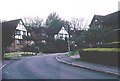
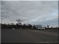
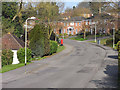
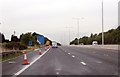
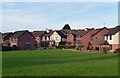
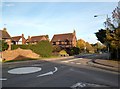
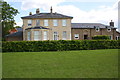
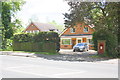
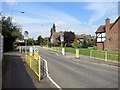
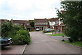
Photos of RG2 9FT


Area Information
Living in RG2 9FT offers a distinct residential experience within a defined postcode area covering 6706 square metres. This specific cluster accommodates a population of 2270 people, creating a high density environment typical of sought-after suburban zones in Reading. You will find a neighbourhood that balances proximity to local infrastructure with a focused, compact living arrangement. The area functions as a residential hub where daily life revolves around established transport links and essential services located just a short distance away. Residents here enjoy the advantages of a well-connected location without the sprawl of larger urban districts. The concentration of homes allows for a sense of community while maintaining privacy within individual properties. Accessibility is a key feature, with easy reach to major rail stations and retail outlets. This postcode represents a practical choice for those prioritising efficiency and access to metropolitan amenities. The character of RG2 9FT is defined by its role as a gateway to Reading. You can expect a stable environment where the pace of life allows for both convenience and comfort. Whether you are commuting to the city centre or visiting local parks, the layout supports an active lifestyle. The area serves as a reliable home base for families and professionals alike, offering a straightforward quality of life. Your daily routine will benefit from the strategic positioning of this residential zone, ensuring you are never far from what you need.
- Area Type
- Postcode
- Area Size
- 6706 m²
- Population
- 2270
- Population Density
- 2510 people/km²
The property market in RG2 9FT is characterised by a strong preference for ownership rather than renting. With 62% of residents owning their homes, this area functions more like an established community than a commuter rental hub. You are looking at a stock dominated by Houses, which suits the needs of families and retirees alike. The high rate of home ownership suggests that buyers have moved here to settle down, valising security and stability over the flexibility of the private rental sector. When considering homes in RG2 9FT, you will find properties designed for longevity and family living. The concentration of owner-occupiers drives competition from those looking for similar houses rather than new-build apartments or flexible leasehold options. This market dynamic often supports higher price retention, as existing owners tend to resist selling unless terms are highly favourable. The sheltered housing preference means that smaller flats or studio apartments rarely feature prominently in local inventory. For prospective buyers, this indicates a market where negotiation is often about fit rather than fundamental desirability. The dominance of Houses means you can expect larger footprints and potential for extension or renovation. Landscaping and outdoor space remain critical selling points in this context. The area appeals to those seeking a suburban experience within close proximity to Reading. You will find fewer transient occupants, leading to quieter streets and less noise disturbance. The stability of the ownership model creates a predictable environment for investments in home improvements.
House Prices in RG2 9FT
Showing 41 properties
| Address | Type | Beds | Baths | Last Sale Price | Last Sale Date | |
|---|---|---|---|---|---|---|
| 19 Perigee, Shinfield, RG2 9FT | Semi-detached | 5 | 2 | £425,000 | Mar 2025 | |
| 38 Perigee, Shinfield, RG2 9FT | Flat | - | - | £250,000 | Mar 2024 | |
| 22 Perigee, Shinfield, RG2 9FT | Flat | - | - | £234,000 | Sep 2023 | |
| 21 Perigee, Shinfield, RG2 9FT | Terraced | 4 | 2 | £415,000 | May 2023 | |
| 30 Perigee, Shinfield, RG2 9FT | Flat | 2 | 2 | £240,000 | Nov 2022 | |
| 24 Perigee, Shinfield, RG2 9FT | Flat | 2 | - | £245,000 | Jul 2022 | |
| 52 Perigee, Shinfield, RG2 9FT | Retail | 2 | 1 | £215,000 | Jul 2022 | |
| 5 Perigee, Shinfield, RG2 9FT | Terraced | 4 | 2 | £435,000 | Jun 2022 | |
| 20 Perigee, Shinfield, RG2 9FT | Flat | 2 | 2 | £237,500 | May 2022 | |
| 9 Perigee, Shinfield, RG2 9FT | house | 3 | 2 | £390,000 | Mar 2022 |
Energy Efficiency in RG2 9FT
Daily life in RG2 9FT is supported by a range of practical amenities within easy reach. Five retail outlets serve your shopping needs, including Co-op Whitley, M&S Lower Earley SF, and Tesco Reading. These venues cover everything from groceries to general household provisions. You can complete your weekly shopping without travelling far from your home, saving time and petrol. Transport links reinforce this convenience, with five nearby railway stations providing swift access to the city. Earley Railway Station, Winnersh Triangle Railway Station, and Reading Railway Station are all accessible from your doorstep. This network connects you to employment hubs and leisure destinations quickly. You might combine a morning walk with a stop at Co-op Whitley for fresh produce, then catch a train to Reading for an afternoon outing. The combination of retail and rail services creates a lifestyle focused on efficiency and independence. You do not need to rely solely on car travel for most errands. The presence of major retailers like M&S and Tesco ensures competitive pricing and product variety. Local convenience stores complement these larger chains for quick essentials. Your weekends might involve exploring Reading or attending events nearby, made easy by the rail connections. This blend of local and regional access defines a relaxed but active living pattern.
Amenities
Schools
OneSchool Global UK Reading Primary Campus stands as the nearest educational facility to RG2 9FT. This independent school offers an alternative to the state system, catering to families who prioritise private education options. The presence of an independent school near your home indicates demand for varied educational pathways within the local catchment. While the data does not list the Ofsted rating for this school, the inclusion of OneSchool Global UK Reading Primary Campus suggests a high-quality option available to residents in RG2 9FT. Independent schools often provide thorough education and distinct character compared to state-run alternatives. Families considering homes in RG2 9FT will benefit from immediate access to this type of learning environment for their children. The availability of this specific school means parents in the area have a clear choice for primary education. You do not need to commute long distances to secure an independent place for your child. The school serves as a key amenity, linking the residential zone directly to educational outcomes. This arrangement supports families wishing to raise their children locally without relying solely on public transport or school buses.
| Rank | School | Type | Entry gender | Ages |
|---|
Explore more schools in this area
Go to Schools tabDemographics
The community in RG2 9FT is defined by stable, established residents rather than a transient population. The median age stands at 47 years, placing the demographic profile firmly among Adults aged between 30 and 64. This age range indicates a neighbourhood populated by individuals who have put down roots and value long-term stability over rapid urban change. A significant proportion of the population falls into this working-age bracket, ensuring the area attracts buyers seeking mature, settled surroundings. Home ownership is the dominant housing arrangement, with 62% of residents owning their homes outright or via mortgage. This high rate of ownership reflects a desire for permanence and control over one's living environment. The remaining residents likely include long-term renters or individuals preferring flexible accommodation options. The predominant ethnic group in the area is White, contributing to a relatively homogenous community where longstanding social networks often define local interactions. Accommodation types are primarily Houses, aligning with the preferences of the older demographic and owner-occupiers. You will typically find detached or semi-detached properties rather than apartments or terraced flats, catering to families and couples with space requirements. This housing stock supports a lifestyle centred on outdoor areas and garden space. The combination of an older population and high home ownership rates creates a quiet, predictable atmosphere. There is little evidence of gentrification or rapid demographic shifts, meaning the social fabric remains consistent.
Household Size
Accommodation Type
Tenure
Ethnic Group
Religion
Household Composition
Age
Household Deprivation
NS-SEC
Explore more demographic insights in this area
Go to Demographics tabPlanning
Planning Constraints
- Flood RiskPremium
- Ramsar Wetland SitesPremium
- Area of Outstanding Natural BeautyPremium
- Protected Nature ReservePremium
- Protected WoodlandPremium