Area Overview for RG2 9DB
Photos of RG2 9DB

Area Information
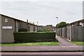
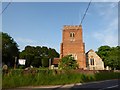
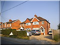
RG2 9DB is a compact residential postcode in England, covering just 5.9 hectares and home to 2010 residents. With a population density of 1043 people per square kilometre, it is a tightly knit area where daily life is shaped by its small-scale character. The community is predominantly composed of adults aged 30 to 64, with a median age of 47, suggesting a mature, stable population. Most residents own their homes, with 86% of properties in private ownership, and the area is largely made up of houses rather than flats. This creates a distinct residential feel, with a focus on family-oriented living. The area’s proximity to rail networks and local amenities adds to its practical appeal, while its low population density ensures a quieter, more intimate environment. For those seeking a balance between convenience and tranquillity, RG2 9DB offers a snapshot of suburban living with easy access to nearby towns and services.
- Area Type
- Postcode
- Area Size
- 5.9 hectares
- Population
- 2010
- Population Density
- 1043 people/km²
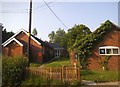
The property market in RG2 9DB is characterised by high home ownership, with 86% of residents owning their homes. This suggests a strong preference for private ownership over rental living, which is uncommon in many urban areas. The accommodation type is predominantly houses, which are typically larger and more spacious than flats, further reinforcing the area’s suburban appeal. As a small postcode covering just 5.9 hectares, the housing stock is limited, meaning buyers may need to consider nearby areas for more options. The high proportion of owner-occupied properties indicates a stable market with little turnover, which can be advantageous for long-term investors. However, the limited size of the area may also mean fewer choices for buyers seeking specific property types or features.
House Prices in RG2 9DB
Showing 3 properties
| Address | Type | Beds | Baths | Last Sale Price | Last Sale Date | |
|---|---|---|---|---|---|---|
| Nursery Cottage, Church Lane, Shinfield, RG2 9DB | Detached | 3 | 1 | - | - | |
| Gas Governor, Church Lane, Shinfield, RG2 9DB | Industrial | - | - | - | - | |
| Marketing Suite, Longcroft Gardens, Shinfield, RG2 9DB | Office | - | - | - | - |
Energy Efficiency in RG2 9DB
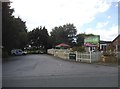
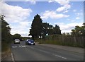
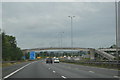
RG2 9DB offers a range of amenities within practical reach, including five retail outlets such as Lidl Beke, Asda Shinfield, and Co-op Whitley. These shops provide everyday essentials, making it convenient for residents to manage their household needs locally. The area’s proximity to multiple railway stations also enhances its connectivity, allowing easy access to broader networks for shopping, dining, or leisure activities. While specific parks or leisure facilities are not mentioned in the data, the presence of nearby retail and transport options suggests a lifestyle that balances practicality with accessibility. The compact nature of the area means amenities are concentrated, reducing the need for long commutes to access services.
Amenities
Schools
The schools near RG2 9DB include Ryeish Green School, a primary school, and Oakbank, an academy with an Ofsted rating of inadequate. The presence of a primary school is a key consideration for families with young children, offering a local option for early education. However, the academy’s inadequate rating raises concerns about the quality of secondary education in the area. This mix of school types means families may need to look beyond RG2 9DB for higher education options. The data does not indicate the presence of other schools, so parents should carefully evaluate the performance of these institutions when considering the area for relocation.
| Rank | School | Type | Entry gender | Ages |
|---|
Explore more schools in this area
Go to Schools tabDemographics
The population of RG2 9DB is predominantly adults aged 30 to 64, with a median age of 47. This suggests a community that is largely established, with fewer young families or elderly residents compared to other areas. Home ownership is high, with 86% of residents living in owner-occupied properties, indicating a stable housing market. The accommodation type is primarily houses, which aligns with the area’s suburban character. The predominant ethnic group is White, reflecting a homogenous demographic profile. While specific data on deprivation is not provided, the high home ownership rate and age distribution suggest a relatively affluent and settled community. The absence of detailed diversity statistics means the area’s cultural composition remains less defined, but the data highlights a focus on long-term residency and family-based living.
Household Size
Accommodation Type
Tenure
Ethnic Group
Religion
Household Composition
Age
Household Deprivation
NS-SEC
Explore more demographic insights in this area
Go to Demographics tabPlanning
Planning Constraints
- Flood RiskPremium
- Ramsar Wetland SitesPremium
- Area of Outstanding Natural BeautyPremium
- Protected Nature ReservePremium
- Protected WoodlandPremium