Area Overview for RG2 8QG
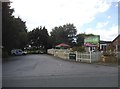
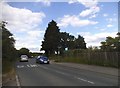
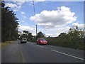
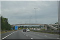
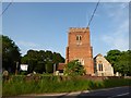
Photos of RG2 8QG
Area Information
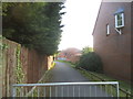
RG2 8QG is a small residential postcode area in England, covering just 3.7 hectares. Despite its compact size, it hosts a population of 2270 people, resulting in a remarkably high population density of 60,747 people per square kilometre. This suggests a tightly knit community, where homes are closely spaced. The area is characterised by its predominantly residential nature, with houses making up the majority of accommodation types. Daily life here is shaped by proximity to essential services and transport links. The median age of 47 indicates a mature population, with most residents falling within the 30-64 age range. This suggests a stable, established community, likely with strong local ties. The high broadband score of 100 ensures seamless digital connectivity, while nearby railway stations offer easy access to wider regional networks. For those considering living in RG2 8QG, the combination of density, accessibility, and established demographics creates a distinct urban residential experience.
- Area Type
- Postcode
- Area Size
- 3.7 hectares
- Population
- 2270
- Population Density
- 2510 people/km²
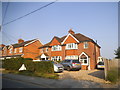
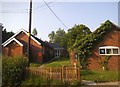
RG2 8QG is primarily an owner-occupied area, with 62% of homes owned by residents rather than rented. The accommodation type is predominantly houses, which suggests a focus on family-friendly or long-term residential properties. This contrasts with areas where flats or rental properties dominate. The small area size of 3.7 hectares implies a limited number of properties, potentially making the local housing market competitive. For buyers, this means a focus on individual homes rather than larger developments. The high population density indicates that properties are closely spaced, which could influence both property values and the character of the neighbourhood. Given the lack of planning constraints such as protected woodlands or Areas of Outstanding Natural Beauty, the area is likely more flexible for development or renovation. However, the limited size of the postcode means buyers should consider nearby areas for broader options.
House Prices in RG2 8QG
Showing 3 properties
| Address | Type | Beds | Baths | Last Sale Price | Last Sale Date | |
|---|---|---|---|---|---|---|
| 5 Longmore Road, Shinfield, RG2 8QG | house | - | - | £525,000 | Nov 2023 | |
| 3 Longmore Road, Shinfield, RG2 8QG | Detached | - | - | £360,000 | Oct 2004 | |
| Voyage Care, 1 Longmore Road, Shinfield, RG2 8QG | Retirement | - | - | £230,000 | Aug 1999 |
Energy Efficiency in RG2 8QG
The lifestyle in RG2 8QG is shaped by its proximity to retail and transport hubs. Nearby amenities include five retail outlets, such as Co-op Whitley, Lidl Beke, and Asda Shinfield, offering everyday shopping and convenience. These stores are within practical reach, supporting a self-sufficient local economy. The area’s rail network, with stations like Earley and Reading, connects residents to broader regional opportunities, including employment and leisure activities. While the data does not mention parks or leisure facilities, the high population density and retail presence suggest a compact, functional living environment. The absence of specific details on recreational spaces means buyers should consider whether nearby areas provide the desired balance of urban convenience and outdoor amenities. Overall, the area’s character is defined by accessibility and proximity to essential services.
Amenities
Schools
The nearest school to RG2 8QG is OneSchool Global UK Reading Primary Campus, an independent institution. This school type typically offers fee-paying education with a focus on international curricula. While no Ofsted rating is provided, the presence of an independent school suggests the area may attract families seeking alternative educational pathways. However, the absence of state-funded schools in the data means the educational landscape is limited to this single option. For families prioritising a range of school types, this could be a consideration. The school’s location within practical reach of residents highlights its accessibility, but the lack of additional schools in the data means the area’s educational offerings are not diversified. Buyers should assess whether this single school meets their needs or if proximity to other schools in nearby areas is required.
| Rank | School | Type | Entry gender | Ages |
|---|
Explore more schools in this area
Go to Schools tabDemographics
The population of RG2 8QG is predominantly adults aged 30-64, with a median age of 47. This reflects a mature, settled community, likely with long-term residents. Home ownership is high at 62%, indicating a strong presence of owner-occupied properties rather than rentals. The area is largely composed of houses, which aligns with the demographic profile of families and individuals seeking stable, long-term housing. The predominant ethnic group is White, which shapes the cultural and social fabric of the area. While no specific data on deprivation is provided, the high home ownership rate and stable age distribution suggest a community with relatively consistent access to resources and services. The absence of significant demographic diversity, however, means the social landscape is homogenous. This could be a consideration for those seeking a more varied community.
Household Size
Accommodation Type
Tenure
Ethnic Group
Religion
Household Composition
Age
Household Deprivation
NS-SEC
Explore more demographic insights in this area
Go to Demographics tabPlanning
Planning Constraints
- Flood RiskPremium
- Ramsar Wetland SitesPremium
- Area of Outstanding Natural BeautyPremium
- Protected Nature ReservePremium
- Protected WoodlandPremium