Area Overview for RG2 8UH
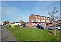
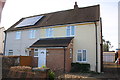
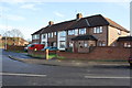
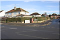
Photos of RG2 8UH
Area Information
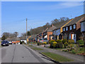
RG2 8UH is a compact residential postcode in England, covering just 1.2 hectares and home to 1,530 residents. Its high population density of 132,130 people per square kilometre reflects a tightly packed community, typical of urban or semi-urban settings. The area is characterised by a mix of housing types, though the data specifies that homes here are predominantly houses rather than flats or apartments. Daily life in RG2 8UH is shaped by its proximity to retail and transport hubs. Residents have easy access to Co-op Whitley, Lidl Whitley, and Aldi at Gateway Retail Park, ensuring convenience for shopping. Rail connectivity is strong, with multiple stations including Reading West and Earley within practical reach, making commuting straightforward. The area’s broadband score of 100 and mobile coverage of 85 indicate reliable digital infrastructure, supporting both remote work and everyday internet use. With a median age of 47 and a population skewed toward adults aged 30–64, the community likely balances family life with professional commitments. The low flood risk and absence of environmental constraints like protected woodlands or AONB designations suggest a practical, low-maintenance living environment.
- Area Type
- Postcode
- Area Size
- 1.2 hectares
- Population
- 1530
- Population Density
- 3673 people/km²
The property market in RG2 8UH is shaped by its small size and specific characteristics. With only 1.2 hectares of land and a population of 1,530, the area is highly compact, likely limiting the number of available homes. The data indicates that 36% of residents are homeowners, suggesting that the majority of properties are rented out. This dynamic may make the area more attractive to tenants than buyers, though the presence of houses rather than flats or apartments implies a focus on family-oriented housing. The low home ownership rate could reflect either a transient population or limited opportunities for purchase in a constrained market. For buyers, the immediate surroundings may offer more options, but within RG2 8UH itself, competition for properties is likely intense. The area’s proximity to rail stations and retail amenities may enhance its appeal, but its tiny footprint means that any investment here would require careful consideration of both location and long-term viability.
House Prices in RG2 8UH
Showing 41 properties
| Address | Type | Beds | Baths | Last Sale Price | Last Sale Date | |
|---|---|---|---|---|---|---|
| 33 Copenhagen Close, Reading, RG2 8UH | Terraced | 2 | 1 | £294,000 | Nov 2024 | |
| 12 Copenhagen Close, Reading, RG2 8UH | Terraced | 2 | 1 | £318,000 | Nov 2023 | |
| 7 Copenhagen Close, Reading, RG2 8UH | Terraced | 2 | 1 | £307,000 | Jun 2023 | |
| 2 Copenhagen Close, Reading, RG2 8UH | house | - | - | £266,950 | Sep 2021 | |
| 11 Copenhagen Close, Reading, RG2 8UH | Terraced | 2 | 1 | £229,950 | Nov 2020 | |
| 41 Copenhagen Close, Reading, RG2 8UH | Terraced | 2 | 1 | £262,500 | Aug 2020 | |
| 6 Copenhagen Close, Reading, RG2 8UH | house | 3 | - | £255,000 | Jul 2020 | |
| 38 Copenhagen Close, Reading, RG2 8UH | Terraced | 2 | 1 | £240,000 | Apr 2019 | |
| 4 Copenhagen Close, Reading, RG2 8UH | Terraced | 2 | 1 | £257,500 | Apr 2019 | |
| 42 Copenhagen Close, Reading, RG2 8UH | Terraced | 2 | 1 | £220,000 | May 2015 |
Energy Efficiency in RG2 8UH
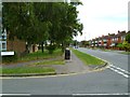
Residents of RG2 8UH benefit from a range of nearby amenities that support daily life. The retail sector is well-represented, with Co-op Whitley, Lidl Whitley, and Aldi at Gateway Retail Park providing essential shopping options within easy reach. These stores cater to both everyday needs and occasional purchases, reducing the necessity for longer trips. The area’s rail connections, including Earley and Reading West stations, offer direct links to major transport routes, enhancing mobility for work, leisure, and travel. While the data does not mention parks or leisure facilities, the proximity to rail hubs and retail centres suggests a lifestyle focused on convenience and connectivity. The compact nature of RG2 8UH means that amenities are tightly clustered, which can be both a boon and a limitation—residents enjoy easy access to services but may find the area’s size restrictive for those seeking more open spaces. The combination of retail and transport options makes daily life efficient, though it may not appeal to those prioritising larger green spaces or quieter surroundings.
Amenities
Schools
| Rank | School | Type | Entry gender | Ages |
|---|
Explore more schools in this area
Go to Schools tabDemographics
The demographic profile of RG2 8UH reveals a population with a median age of 47, indicating a mature community where adults aged 30–64 form the largest group. This suggests a mix of established families and professionals, with fewer young children or retirees compared to other areas. Home ownership here is relatively low at 36%, implying that a significant portion of the housing stock is rented out, possibly attracting younger or transient residents. The predominant ethnic group is White, though the data does not provide further breakdowns of diversity. The high population density—132,130 people per square kilometre—raises questions about living space per household, though the area’s small size means residents are likely to be closely connected. The lack of specific data on deprivation or income levels means it is unclear how this affects quality of life, but the low crime score of 79 (on a 100-point scale) suggests a generally safe environment. These factors combine to create a community that is stable but not without challenges, particularly in terms of housing availability and affordability.
Household Size
Accommodation Type
Tenure
Ethnic Group
Religion
Household Composition
Age
Household Deprivation
NS-SEC
Explore more demographic insights in this area
Go to Demographics tabPlanning
Planning Constraints
- Flood RiskPremium
- Ramsar Wetland SitesPremium
- Area of Outstanding Natural BeautyPremium
- Protected Nature ReservePremium
- Protected WoodlandPremium