Area Overview for RG2 8TH
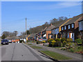
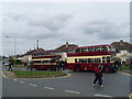
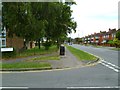
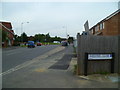
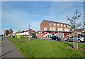
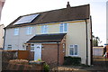
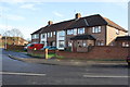
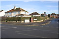
Photos of RG2 8TH
Area Information
RG2 8TH is a compact residential postcode area in England, covering just 1920 square metres and home to 1986 residents. Its high population density of 1034300 people per square kilometre reflects a tightly knit community, ideal for those seeking a closely connected neighbourhood. The area’s small size means it is likely a single cluster of homes, possibly centred around a local hub or road. With rail links to Earley, Reading West, and Reading stations, it offers convenient access to nearby towns, while nearby retail options like Co-op Whitley and Aldi Gateway Retail Park provide daily essentials. The area’s demographics suggest a mature population, with a median age of 47 and a majority of residents aged 30–64. This mix of age groups and the high home ownership rate of 62% indicate a stable, long-term community. Living here means a balance of residential tranquillity and practical connectivity, though the small footprint means every home is within close proximity to neighbours and amenities.
- Area Type
- Postcode
- Area Size
- 1920 m²
- Population
- 1986
- Population Density
- 2089 people/km²
The property market in RG2 8TH is characterised by a high home ownership rate of 62%, suggesting a mix of owner-occupied homes and a smaller proportion of rental properties. The accommodation type is predominantly houses, which is unusual for a small postcode area but may indicate a focus on family homes or larger residences. Given the area’s compact size and limited population, the housing stock is likely limited to a small number of properties, possibly clustered around a central location. This makes the market highly localised, with limited scope for expansion. Buyers should consider the area’s small footprint and the potential for properties to be in close proximity to each other. The market may appeal to those seeking a quiet, established home in a community with a stable demographic.
House Prices in RG2 8TH
Showing 8 properties
| Address | Type | Beds | Baths | Last Sale Price | Last Sale Date | |
|---|---|---|---|---|---|---|
| 2, Howard Villas, Whitley Wood Road, Reading, RG2 8TH | house | - | - | £66,250 | Jun 2021 | |
| 3, Howard Villas, Whitley Wood Road, Reading, RG2 8TH | house | - | - | £41,250 | Mar 2010 | |
| 6, Howard Villas, Whitley Wood Road, Reading, RG2 8TH | Terraced | 2 | 2 | - | - | |
| 4, Howard Villas, Whitley Wood Road, Reading, RG2 8TH | Terraced | 2 | - | - | - | |
| 8, Howard Villas, Whitley Wood Road, Reading, RG2 8TH | house | - | - | - | - | |
| 7, Howard Villas, Whitley Wood Road, Reading, RG2 8TH | house | - | - | - | - | |
| 1, Howard Villas, Whitley Wood Road, Reading, RG2 8TH | Semi-detached | 3 | 2 | - | - | |
| 5, Howard Villas, Whitley Wood Road, Reading, RG2 8TH | house | - | - | - | - |
Energy Efficiency in RG2 8TH
The lifestyle in RG2 8TH is shaped by its proximity to essential retail and transport hubs. Nearby shops include Co-op Whitley, Lidl Whitley, and Aldi Gateway Retail Park, offering a range of grocery and convenience options. These stores are likely within walking or short driving distance, making daily errands practical. The area’s rail links to Earley, Reading West, and Reading stations provide access to broader amenities, from cultural attractions to larger shopping centres. While the data does not mention parks or leisure facilities, the presence of multiple rail stations and retail options suggests a functional, community-focused lifestyle. The compact nature of the area means residents can access these amenities without long commutes, though the lack of detailed information on recreational spaces may require further local investigation.
Amenities
Schools
| Rank | School | Type | Entry gender | Ages |
|---|
Explore more schools in this area
Go to Schools tabDemographics
The population of RG2 8TH is predominantly adults aged 30–64, with a median age of 47. This suggests a community of established professionals, families, and retirees, reflecting a mature demographic profile. Home ownership is high at 62%, indicating a strong presence of long-term residents. The accommodation type is primarily houses, which aligns with the area’s likely suburban or semi-rural character. The predominant ethnic group is White, though no data is provided on other ethnicities or diversity metrics. The age range and home ownership figures imply a stable, low-turnover community where residents are likely to remain for extended periods. This demographic profile may influence local services and amenities, tailored to the needs of middle-aged and older adults.
Household Size
Accommodation Type
Tenure
Ethnic Group
Religion
Household Composition
Age
Household Deprivation
NS-SEC
Explore more demographic insights in this area
Go to Demographics tabPlanning
Planning Constraints
- Flood RiskPremium
- Ramsar Wetland SitesPremium
- Area of Outstanding Natural BeautyPremium
- Protected Nature ReservePremium
- Protected WoodlandPremium