Area Overview for RG2 8SY
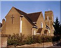
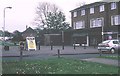
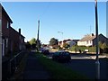
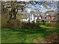
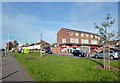
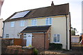
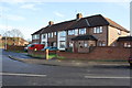
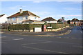
Photos of RG2 8SY
Area Information
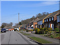
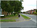
RG2 8SY is a small, densely populated residential area in England, covering just 1.8 hectares and home to 2,270 residents. Its compact size means it’s a tight-knit community, with homes clustered closely together. The area’s demographics suggest a mature population, with a median age of 47 and the majority of residents aged between 30 and 64. This suggests a stable, established neighbourhood where many residents may have lived for years. The high home ownership rate—62%—points to a community of long-term residents rather than a transient rental market. Living here offers proximity to essential services, with five retail outlets and multiple rail stations within practical reach. The area’s low crime risk and flood safety score make it an attractive option for families and professionals seeking a secure, well-connected environment. However, its small size means buyers should consider nearby areas for more housing options.
- Area Type
- Postcode
- Area Size
- 1.8 hectares
- Population
- 2270
- Population Density
- 2510 people/km²
RG2 8SY is predominantly an owner-occupied area, with 62% of residents owning their homes. The accommodation type is largely houses, which is uncommon in densely populated urban areas. This suggests a mix of older properties and family homes, likely built for long-term occupation rather than speculative investment. The small area size—just 1.8 hectares—means the housing stock is limited, so buyers may need to look beyond the postcode for more options. The high home ownership rate indicates a stable market with little turnover, which can be appealing for those seeking a secure investment. However, the lack of flats or newer developments may limit choices for first-time buyers or those seeking rental properties. The area’s compactness also means proximity to amenities is key, with rail links and retail outlets within walking distance for many residents.
House Prices in RG2 8SY
Showing 36 properties
| Address | Type | Beds | Baths | Last Sale Price | Last Sale Date | |
|---|---|---|---|---|---|---|
| 53 Woodside Way, Shinfield, RG2 8SY | Semi-detached | 4 | 1 | £462,000 | Sep 2025 | |
| 67 Woodside Way, Shinfield, RG2 8SY | Semi-detached | 2 | 1 | £325,000 | Apr 2024 | |
| 23 Woodside Way, Shinfield, RG2 8SY | Semi-detached | 4 | 1 | £370,000 | Nov 2023 | |
| 25 Woodside Way, Shinfield, RG2 8SY | Semi-detached | 3 | 1 | £406,000 | Jul 2022 | |
| 43 Woodside Way, Shinfield, RG2 8SY | house | 2 | - | £320,000 | Jun 2021 | |
| 45 Woodside Way, Shinfield, RG2 8SY | Semi-detached | 3 | 1 | £320,000 | Feb 2021 | |
| 55 Woodside Way, Shinfield, RG2 8SY | Semi-detached | 3 | 1 | £260,000 | Sep 2019 | |
| 3 Woodside Way, Reading, RG2 8SY | Semi-detached | - | - | £310,000 | Aug 2019 | |
| 1 Woodside Way, Reading, RG2 8SY | Semi-detached | 3 | - | £334,939 | May 2019 | |
| 69 Woodside Way, Shinfield, RG2 8SY | Semi-detached | 2 | 1 | £270,000 | May 2019 |
Energy Efficiency in RG2 8SY
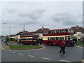
RG2 8SY offers a range of retail and transport options within walking distance. Local shops include Co-op Whitley, Lidl Whitley, and Aldi Unit 6 Gateway Retail Park, providing everyday essentials and grocery needs. The nearby rail stations—Earley, Reading, and Reading West—offer frequent services to surrounding towns and cities, making commuting straightforward. While the area lacks major parks or leisure facilities, its proximity to Reading’s broader amenities means residents can access cultural venues, restaurants, and green spaces in the city. The compact layout ensures convenience, with most amenities within practical reach. However, the absence of dedicated leisure or recreational spaces within the postcode itself may require residents to travel slightly further for activities like dining out or outdoor recreation.
Amenities
Schools
The nearest school to RG2 8SY is OneSchool Global UK Reading Primary Campus, an independent institution. This school offers a private education option, which may appeal to families seeking alternative schooling. However, the data does not list any state schools or secondary education facilities in the immediate vicinity, suggesting parents may need to look further afield for comprehensive schooling. The presence of an independent school indicates a community that values choice in education, though it also highlights the need for additional research into secondary school options. For families prioritising a single, high-quality primary school, OneSchool provides a dedicated option, but broader educational planning should consider nearby districts.
| Rank | School | Type | Entry gender | Ages |
|---|
Explore more schools in this area
Go to Schools tabDemographics
The population of RG2 8SY is 2,270, with a median age of 47, indicating a community skewed towards middle-aged and older adults. The most common age range is 30–64, suggesting a mix of working professionals and families. Home ownership is strong, with 62% of residents owning their homes, and the majority of properties are houses rather than flats. The predominant ethnic group is White, reflecting a homogenous demographic profile. This data implies a stable, low-turnover community where many residents may have lived for decades. The population density—128,857 people per square kilometre—highlights the area’s compact nature, which can create a sense of familiarity but may also limit expansion. For buyers, this profile suggests a neighbourhood with established social networks and a focus on long-term residency rather than short-term rental trends.
Household Size
Accommodation Type
Tenure
Ethnic Group
Religion
Household Composition
Age
Household Deprivation
NS-SEC
Explore more demographic insights in this area
Go to Demographics tabPlanning
Planning Constraints
- Flood RiskPremium
- Ramsar Wetland SitesPremium
- Area of Outstanding Natural BeautyPremium
- Protected Nature ReservePremium
- Protected WoodlandPremium