Area Overview for RG2 8EQ
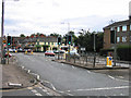
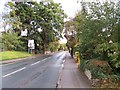
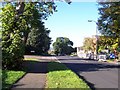
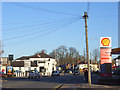
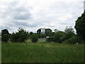
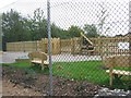
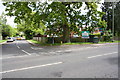
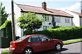
Photos of RG2 8EQ
Area Information
RG2 8EQ is a compact postcode area in England, covering just 6,225 square metres and home to 1,362 residents. Despite its small size, the area’s high population density of 218,797 people per square kilometre reflects a tightly knit community. This is a residential cluster where the pace of life is deliberate, with proximity to essential services and transport links. The area’s character is defined by its mix of housing stock and accessibility to nearby towns. Residents benefit from being close to retail hubs like Tesco Reading and rail stations such as Earley and Reading, which provide direct connections to major cities. The demographic profile suggests a mature population, with a median age of 47, and a strong presence of adults aged 30–64. Daily life here balances local convenience with the option to commute further afield, making it appealing to those seeking a quiet yet connected environment.
- Area Type
- Postcode
- Area Size
- 6225 m²
- Population
- 1362
- Population Density
- 3903 people/km²
The property market in RG2 8EQ is characterised by a 56% home ownership rate, indicating a mix of owner-occupied and rental properties. The area’s housing stock is primarily composed of houses, which may appeal to families seeking space and privacy. Given the small size of the postcode, the immediate surroundings are crucial for buyers, as the local supply of homes is limited. The high population density suggests that properties here are in demand, potentially supporting strong retention rates among existing owners. However, the relatively low home ownership percentage implies a notable rental market, which could affect property values and availability. Buyers should consider the broader regional context, as the area’s small footprint means proximity to nearby towns may be necessary for additional amenities or housing options.
House Prices in RG2 8EQ
Showing 18 properties
| Address | Type | Beds | Baths | Last Sale Price | Last Sale Date | |
|---|---|---|---|---|---|---|
| 18 Wyncote Close, Shinfield, RG2 8EQ | Semi-detached | - | - | £165,000 | Aug 2008 | |
| 12 Wyncote Close, Shinfield, RG2 8EQ | Semi-detached | - | - | £174,000 | Nov 2004 | |
| 11 Wyncote Close, Shinfield, RG2 8EQ | Semi-detached | 2 | 1 | £117,000 | Jul 2004 | |
| 9 Wyncote Close, Shinfield, RG2 8EQ | Semi-detached | - | - | £130,000 | Apr 2002 | |
| 19 Wyncote Close, Shinfield, RG2 8EQ | Semi-detached | - | - | £115,950 | Nov 2000 | |
| 4 Wyncote Close, Shinfield, RG2 8EQ | house | - | - | - | - | |
| 14 Wyncote Close, Shinfield, RG2 8EQ | house | - | - | - | - | |
| 1 Wyncote Close, Shinfield, RG2 8EQ | house | - | - | - | - | |
| 3 Wyncote Close, Shinfield, RG2 8EQ | house | - | - | - | - | |
| 6 Wyncote Close, Shinfield, RG2 8EQ | house | - | - | - | - |
Energy Efficiency in RG2 8EQ
Living in RG2 8EQ offers access to a range of practical amenities within reach. The area is served by five retail outlets, including Tesco Reading and M&S Lower Earley, providing everyday shopping convenience. Nearby rail stations, such as Earley and Winnersh Triangle, ensure easy access to urban centres and regional transport networks. While the data does not specify parks or leisure facilities, the proximity to major towns suggests that recreational options are available in nearby areas. The combination of retail, rail, and local services creates a lifestyle that balances self-sufficiency with the ability to engage with broader opportunities. This makes RG2 8EQ suitable for those prioritising accessibility without sacrificing a sense of community.
Amenities
Schools
The nearest school to RG2 8EQ is Crosfields School, an independent institution. While no Ofsted rating is provided, the presence of an independent school suggests a focus on private education for families in the area. The absence of state schools in the immediate vicinity means parents may need to look further afield for public education options. This dynamic could influence the appeal of the area for families prioritising specific educational pathways. The single school listed highlights a limited diversity in educational provision, which may require careful planning for those seeking a range of school types.
| Rank | School | Type | Entry gender | Ages |
|---|
Explore more schools in this area
Go to Schools tabDemographics
The population of RG2 8EQ is predominantly middle-aged, with a median age of 47 and the majority of residents falling within the 30–64 age range. This suggests a community of established professionals and families, with a lower proportion of younger or older demographics. Home ownership rates stand at 56%, indicating a stable housing market with a significant portion of residents owning their properties. The predominant accommodation type is houses, which aligns with the area’s residential character. The predominant ethnic group is White, reflecting a homogenous demographic profile. While no specific data on deprivation is provided, the high home ownership and age distribution suggest a relatively stable quality of life. The absence of detailed diversity metrics means the community’s social composition remains largely defined by these parameters.
Household Size
Accommodation Type
Tenure
Ethnic Group
Religion
Household Composition
Age
Household Deprivation
NS-SEC
Explore more demographic insights in this area
Go to Demographics tabPlanning
Planning Constraints
- Flood RiskPremium
- Ramsar Wetland SitesPremium
- Area of Outstanding Natural BeautyPremium
- Protected Nature ReservePremium
- Protected WoodlandPremium