Area Overview for RG2 8EE
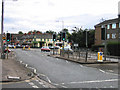
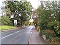
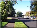
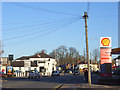
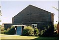
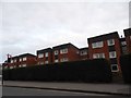
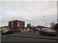
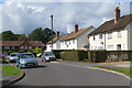
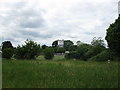
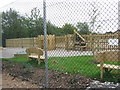
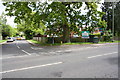
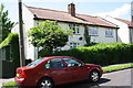
Photos of RG2 8EE
Area Information
RG2 8EE is a compact residential postcode in England, covering just 6,279 square metres and home to 1,362 residents. Despite its small size, it has a high population density of 216,917 people per square kilometre, reflecting a tightly knit community. The area is characterised by a mix of housing types, though the data highlights that houses are the predominant accommodation. Living here means being part of a mature demographic, with a median age of 47 and the majority of residents aged between 30 and 64. The proximity to key amenities, including retail hubs like Tesco Reading and rail stations such as Earley and Reading, ensures convenience for daily life. The area’s digital connectivity is exceptional, with a broadband score of 100 and a mobile coverage score of 82, supporting both work and leisure. While crime risk is rated as medium, the absence of environmental constraints like flood zones or protected areas makes it a practical choice for buyers seeking a balance between accessibility and safety.
- Area Type
- Postcode
- Area Size
- 6279 m²
- Population
- 1362
- Population Density
- 3903 people/km²
The property market in RG2 8EE is defined by a 56% home ownership rate, indicating that nearly half of the housing stock is rented. This suggests a mix of owner-occupied and rental properties, though the data specifies that houses are the primary accommodation type. Given the area’s small size and high population density, the housing stock is likely limited, making it a niche market for buyers. The prevalence of houses may appeal to families or those seeking larger living spaces, though the compact nature of the postcode means proximity to amenities is a key selling point. Buyers should consider the area’s immediate surroundings for additional options, as the local market may not offer extensive variety. The combination of houses and moderate home ownership suggests a balance between stability and flexibility for residents.
House Prices in RG2 8EE
Showing 14 properties
| Address | Type | Beds | Baths | Last Sale Price | Last Sale Date | |
|---|---|---|---|---|---|---|
| 1 St Barnabas Road, Shinfield, RG2 8EE | Semi-detached | 1 | 1 | £455,000 | Apr 2022 | |
| 9 St Barnabas Road, Shinfield, RG2 8EE | house | - | - | £361,000 | Nov 2020 | |
| 27 St Barnabas Road, Shinfield, RG2 8EE | Semi-detached | 3 | 1 | £195,000 | Jul 2010 | |
| 29 St Barnabas Road, Shinfield, RG2 8EE | Semi-detached | - | - | £235,000 | Sep 2006 | |
| 23 St Barnabas Road, Shinfield, RG2 8EE | Semi-detached | - | - | £123,500 | May 2001 | |
| 17 St Barnabas Road, Shinfield, RG2 8EE | Semi-detached | - | - | £80,000 | Jun 2000 | |
| 11 St Barnabas Road, Shinfield, RG2 8EE | house | 1 | 1 | - | - | |
| 19 St Barnabas Road, Shinfield, RG2 8EE | house | - | - | - | - | |
| 15 St Barnabas Road, Shinfield, RG2 8EE | house | - | - | - | - | |
| 31 St Barnabas Road, Shinfield, RG2 8EE | Semi-detached | 1 | 1 | - | - |
Energy Efficiency in RG2 8EE
Daily life in RG2 8EE is shaped by its proximity to retail and transport hubs. The five notable retail locations include Tesco Reading and Iceland Lower, providing essential shopping options for groceries and household needs. For dining and leisure, the data does not specify restaurants or parks, but the rail stations offer access to broader cultural and recreational opportunities in nearby towns. The presence of multiple rail stations, including Reading and Earley, ensures easy travel for work, shopping, or socialising. While the area’s small size limits local amenities, its connectivity to larger centres compensates, making it practical for those who value convenience without sacrificing accessibility. The high broadband score also supports a lifestyle that balances home-based activities with external pursuits.
Amenities
Schools
The nearest school to RG2 8EE is Crosfields School, an independent institution. While no Ofsted rating is provided, independent schools often cater to specific educational preferences, potentially offering tailored curricula or smaller class sizes. Families seeking independent education may find this a key advantage, though the absence of state schools in the data means the area’s school options are limited to this single institution. Parents should consider whether Crosfields aligns with their child’s needs, including academic focus, extracurriculars, or religious affiliation. The lack of additional schools nearby may influence decisions about proximity to other educational facilities or commuting.
| Rank | School | Type | Entry gender | Ages |
|---|
Explore more schools in this area
Go to Schools tabDemographics
The community in RG2 8EE is predominantly composed of adults aged 30 to 64, with a median age of 47. This suggests a stable, mature population, likely with established careers and families. Home ownership is at 56%, indicating a mix of owner-occupied properties and rental units. The area’s accommodation is largely houses, which may appeal to those seeking more space or privacy. The predominant ethnic group is White, reflecting a homogenous demographic profile. With a population density over 200,000 per square kilometre, the area is densely populated, which can influence local dynamics and amenities. While no specific deprivation data is provided, the high home ownership rate and access to rail and retail suggest a community that is relatively self-sufficient, though the medium crime risk score of 56 implies standard security measures are advisable.
Household Size
Accommodation Type
Tenure
Ethnic Group
Religion
Household Composition
Age
Household Deprivation
NS-SEC
Explore more demographic insights in this area
Go to Demographics tabPlanning
Planning Constraints
- Flood RiskPremium
- Ramsar Wetland SitesPremium
- Area of Outstanding Natural BeautyPremium
- Protected Nature ReservePremium
- Protected WoodlandPremium