Area Overview for RG2 7DN
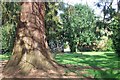
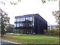
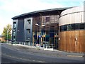
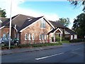
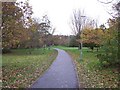
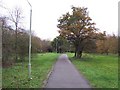
Photos of RG2 7DN


Area Information
RG2 7DN is a compact, densely populated postcode area in England, spanning just 2.5 hectares. With 1,708 residents, it is a tightly knit residential cluster where proximity to essential services and transport links defines daily life. The area’s high population density—68,240 people per square kilometre—reflects its role as a well-served, urbanised space. Despite its small size, RG2 7DN offers practical access to retail, rail, and educational facilities, making it appealing for those prioritising convenience. The community is characterised by a mature demographic, with a median age of 47 and a majority of residents aged 30–64. This suggests a mix of established professionals and families, contributing to a stable, low-maintenance lifestyle. The area’s proximity to Reading’s infrastructure, combined with its own local amenities, positions it as a practical choice for commuters and those seeking a balance between urban and suburban living.
- Area Type
- Postcode
- Area Size
- 2.5 hectares
- Population
- 1708
- Population Density
- 2841 people/km²
RG2 7DN is a predominantly owner-occupied area, with 64% of residents owning their homes. The housing stock is largely composed of houses, which suggests a focus on family-friendly, standalone properties. Given the area’s small size and high population density, the property market is likely limited to the immediate postcode and surrounding zones. This makes it a niche market, where availability may be constrained by the area’s compact footprint. Buyers should consider that the housing stock is not diverse, with no mention of flats or other property types. The high home ownership rate indicates a stable market, but the small area means competition for properties could be fierce. For those seeking a house in a convenient, well-connected location, RG2 7DN offers practical access to rail and retail, though expansion options are limited.
House Prices in RG2 7DN
Showing 1 properties
| Address | Type | Beds | Baths | Last Sale Price | Last Sale Date | |
|---|---|---|---|---|---|---|
| Leighton Park School, East Lodge, Pepper Lane, Reading, RG2 7DN | Detached | - | - | - | - |
Energy Efficiency in RG2 7DN
RG2 7DN offers a range of retail and transport amenities within practical reach. The area is served by five retail outlets, including Co-op Whiteknights, Tesco Reading, and M&S Weldale BP, ensuring residents have access to everyday shopping needs. Rail connectivity is equally strong, with five stations nearby, including Earley Railway Station and Reading West Railway Station, facilitating easy travel to nearby cities and towns. While the data does not mention parks or leisure facilities, the proximity to Reading suggests access to larger recreational spaces. The compact nature of the area means amenities are closely clustered, contributing to a convenient, walkable lifestyle. For those who value accessibility over expansive green spaces, RG2 7DN provides a practical, urbanised environment with minimal need for long commutes.
Amenities
Schools
The nearest school to RG2 7DN is Leighton Park School, an independent institution. This school type caters to families seeking private education, though no Ofsted rating is provided in the data. The absence of state schools in the immediate area means families must look beyond RG2 7DN for public education options. The presence of a single independent school suggests the area may attract households prioritising private schooling, but it also means the school mix is limited. Parents should investigate further to determine whether Leighton Park School meets their specific needs, particularly in terms of curriculum, facilities, and admissions policies. For those requiring state schools, nearby areas or broader commuting zones may be necessary.
| Rank | School | Type | Entry gender | Ages |
|---|
Explore more schools in this area
Go to Schools tabDemographics
The population of RG2 7DN is predominantly composed of adults aged 30–64, with a median age of 47. This indicates a mature, settled community, likely with a strong presence of professionals and families. Home ownership is high, at 64%, suggesting a stable housing market and long-term residency. The area’s accommodation is primarily houses, which aligns with the demographics of older, family-oriented residents. The predominant ethnic group is White, reflecting a homogenous community. The high population density—68,240 people per square kilometre—means the area is intensely populated, yet its compact size ensures services and amenities are within walking or short driving distance. This density does not necessarily equate to overcrowding, but it does mean the area is well-suited to those who prioritise proximity to urban centres over expansive living spaces.
Household Size
Accommodation Type
Tenure
Ethnic Group
Religion
Household Composition
Age
Household Deprivation
NS-SEC
Explore more demographic insights in this area
Go to Demographics tabPlanning
Planning Constraints
- Flood RiskPremium
- Ramsar Wetland SitesPremium
- Area of Outstanding Natural BeautyPremium
- Protected Nature ReservePremium
- Protected WoodlandPremium