Area Overview for RG2 7DE
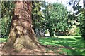
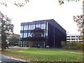
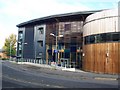
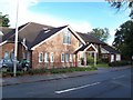
Photos of RG2 7DE


Area Information
Living in RG2 7DE offers a compact, densely populated residential experience within a small cluster of homes. The area covers just 2.0 hectares, yet it accommodates 3,551 residents, resulting in a high population density of 174,787 people per square kilometre. This suggests a tightly knit community with limited space for expansion. The area is primarily inhabited by young adults, with the majority aged 15–29, creating a dynamic, youthful atmosphere. Proximity to retail hubs like Co-op Whiteknights and major rail stations such as Reading Railway Station ensures daily convenience. While the area lacks large-scale amenities, its strategic location near transport links and essential services makes it practical for commuters and those prioritising accessibility. The absence of environmental constraints or flood risks adds to its appeal, though the small size means residents must navigate shared spaces and limited local infrastructure. For those seeking a compact, well-connected environment with a focus on practicality, RG2 7DE presents a distinct option in the Reading region.
- Area Type
- Postcode
- Area Size
- 2.0 hectares
- Population
- 3551
- Population Density
- 5407 people/km²
The property market in RG2 7DE is defined by a 52% home ownership rate, with houses forming the majority of accommodation types. This suggests a mix of owner-occupied homes and rental properties, though the exact proportion of rentals is not specified. The small area size of 2.0 hectares implies a limited housing stock, which could impact availability and competition for properties. Given the high population density, homes in RG2 7DE are likely to be compact, prioritising space efficiency over expansive layouts. For buyers, this means a focus on practical, functional housing rather than luxury or large-scale developments. The proximity to rail stations and retail centres may enhance property desirability, though the area’s small footprint means buyers should consider the potential for limited growth or redevelopment. Those seeking a house in this area may find it suited to short-term needs, with prices potentially reflecting the balance between demand and constrained supply.
House Prices in RG2 7DE
Showing 2 properties
| Address | Type | Beds | Baths | Last Sale Price | Last Sale Date | |
|---|---|---|---|---|---|---|
| Leighton Park School, North Lodge Leighton Park School, Shinfield Road, Reading, RG2 7DE | Flat | - | 1 | - | - | |
| Leighton Park School, Grove House, Shinfield Road, Reading, RG2 7DE | commercial | - | - | - | - |
Energy Efficiency in RG2 7DE
Residents of RG2 7DE have access to essential retail and transport hubs within practical reach. The area’s proximity to five notable retail outlets, including Co-op Whiteknights and M&S Weldale BP, ensures daily errands can be completed efficiently. Nearby rail stations such as Reading and Reading West Railway Station provide direct links to the city centre and beyond, facilitating both commuting and leisure travel. While the data does not specify parks or leisure facilities, the area’s compact design suggests a focus on functional living rather than expansive recreational spaces. The presence of multiple retail and transport options contributes to a convenient lifestyle, particularly for those prioritising accessibility over sprawling amenities. For residents, this means a balance of practicality and connectivity, with the immediate surroundings offering the essentials for daily life.
Amenities
Schools
| Rank | School | Type | Entry gender | Ages |
|---|
Explore more schools in this area
Go to Schools tabDemographics
RG2 7DE is characterised by a young population, with a median age of 22 and the majority of residents falling within the 15–29 age range. This demographic skews heavily towards students and early-career professionals, shaping a community focused on affordability and mobility. Home ownership in the area stands at 52%, indicating a balance between owner-occupied properties and rental units. The predominant accommodation type is houses, which, combined with the high population density, suggests a mix of family homes and smaller dwellings. The predominant ethnic group is White, reflecting the broader demographic trends of the region. While specific data on deprivation is not provided, the high proportion of young adults may correlate with lower household incomes and a reliance on part-time or student earnings. This profile positions RG2 7DE as a transitional area for those establishing their careers or pursuing education, with housing and lifestyle choices tailored to short-term needs.
Household Size
Accommodation Type
Tenure
Ethnic Group
Religion
Household Composition
Age
Household Deprivation
NS-SEC
Explore more demographic insights in this area
Go to Demographics tabPlanning
Planning Constraints
- Flood RiskPremium
- Ramsar Wetland SitesPremium
- Area of Outstanding Natural BeautyPremium
- Protected Nature ReservePremium
- Protected WoodlandPremium