Area Overview for RG2 7AG
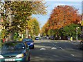
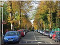
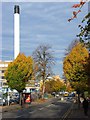
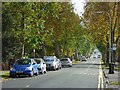
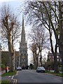
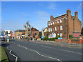
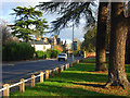
Photos of RG2 7AG

Area Information
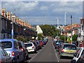
RG2 7AG is a compact residential postcode in England, covering 9,569 square metres and home to 1,877 residents. Its high population density of 196,150 people per square kilometre reflects a tightly knit community. This area is defined by its proximity to essential services and transport links, making it practical for daily life. Residents benefit from nearby schools, retail hubs, and railway stations, creating a functional environment for families and commuters. The area’s small size means amenities are within easy reach, though its density may feel busy for those preferring quieter settings. With a median age of 47, the population skews toward adults aged 30–64, suggesting a mix of established residents and families. While the area lacks natural or protected landscapes, its strategic location near Reading ensures access to broader urban amenities. For buyers, RG2 7AG offers a blend of convenience and affordability, though its limited space means properties are likely to be smaller or part of a shared housing stock.
- Area Type
- Postcode
- Area Size
- 9569 m²
- Population
- 1877
- Population Density
- 7129 people/km²
RG2 7AG’s property market is characterised by a 35% home ownership rate, with houses being the primary accommodation type. This suggests a mix of owner-occupied properties and rental units, though the exact proportion of rentals is not specified. Given the area’s small size and high population density, properties are likely to be compact, catering to families or individuals prioritising proximity to amenities. The dominance of houses over flats may appeal to buyers seeking more space, though the limited land area could restrict development. For investors, the rental market may be viable, particularly for those targeting long-term tenants. However, the low home ownership rate implies competition for available properties, potentially driving up prices. Buyers should consider the area’s practicality for daily life, with nearby schools and transport, but also its constraints in terms of space and privacy.
House Prices in RG2 7AG
Showing 20 properties
| Address | Type | Beds | Baths | Last Sale Price | Last Sale Date | |
|---|---|---|---|---|---|---|
| 7 Glebe Road, Reading, RG2 7AG | Bungalow | 3 | 2 | £600,000 | Mar 2025 | |
| 8 Glebe Road, Reading, RG2 7AG | Semi-detached | 5 | 2 | £815,000 | Jul 2024 | |
| 14 Glebe Road, Reading, RG2 7AG | Detached | 5 | 2 | £1,010,000 | May 2021 | |
| 9 Glebe Road, Reading, RG2 7AG | Detached | 4 | - | £500,000 | Sep 2016 | |
| 1 Glebe Road, Reading, RG2 7AG | Detached | 4 | 2 | £527,500 | Oct 2011 | |
| 6 Glebe Road, Reading, RG2 7AG | Semi-detached | - | - | £499,950 | Dec 2009 | |
| 12 Glebe Road, Reading, RG2 7AG | Semi-detached | 5 | 2 | £420,000 | Oct 2006 | |
| 2 Glebe Road, Reading, RG2 7AG | Flat | 3 | 2 | £285,000 | Mar 2003 | |
| 5 Glebe Road, Reading, RG2 7AG | Detached | - | - | £209,950 | Dec 1999 | |
| 3 Glebe Road, Reading, RG2 7AG | Detached | - | - | - | - |
Energy Efficiency in RG2 7AG
Living in RG2 7AG offers access to a range of amenities within walking or short driving distance. Retail options include major supermarkets such as Tesco Reading and Makro Reading, alongside M&S Royal Berkshire Hosp SF, providing convenience for grocery shopping and daily essentials. The area’s rail stations connect residents to Reading’s urban centres, facilitating access to cultural, leisure, and professional opportunities. While specific parks or leisure facilities are not listed, the proximity to Reading suggests nearby green spaces and recreational areas. The compact nature of RG2 7AG means amenities are tightly clustered, reducing travel time for errands or social activities. However, the absence of detailed data on local parks or dining options means buyers should investigate further for a full picture of lifestyle offerings.
Amenities
Schools
Residents of RG2 7AG have access to a range of educational institutions, including George Palmer Junior School and George Palmer Infant and Nursery School, both primary schools. For independent early education, Christchurch Gardens Kindergarten offers childcare and nursery services. The Avenue Special School provides support for students with specific needs. This diversity of school types ensures families can choose between state-run, independent, and specialist provisions. The presence of both primary and special schools suggests a well-rounded educational infrastructure, though no data is available on Ofsted ratings or academic performance. For parents, the proximity of these schools reduces commuting times, enhancing convenience. However, the absence of secondary schools in the immediate area may require families to consider nearby districts for high school options.
| Rank | School | Type | Entry gender | Ages |
|---|
Explore more schools in this area
Go to Schools tabDemographics
The population of RG2 7AG is predominantly adults aged 30–64, with a median age of 47. This indicates a community of mostly middle-aged individuals, likely balancing career and family responsibilities. Home ownership is relatively low at 35%, suggesting a higher proportion of renters, possibly including younger professionals or those prioritising flexibility. The area’s accommodation is largely composed of houses, though the exact mix of flats or other types is unspecified. The predominant ethnic group is White, with no data provided on other demographics. This homogeneity may influence the community’s social dynamics, though it’s unclear how this affects cohesion. The lack of specific data on deprivation means it’s difficult to assess broader quality-of-life factors, but the age profile suggests a stable, working-age population. For prospective buyers, the demographic profile indicates a market skewed toward owner-occupiers seeking long-term stability, though the lower home ownership rate may reflect rental demand.
Household Size
Accommodation Type
Tenure
Ethnic Group
Religion
Household Composition
Age
Household Deprivation
NS-SEC
Explore more demographic insights in this area
Go to Demographics tabPlanning
Planning Constraints
- Flood RiskPremium
- Ramsar Wetland SitesPremium
- Area of Outstanding Natural BeautyPremium
- Protected Nature ReservePremium
- Protected WoodlandPremium