Area Overview for RG2 7AB
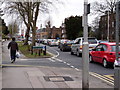
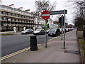
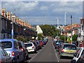
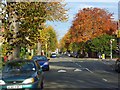
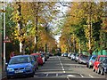
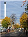
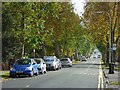
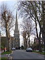
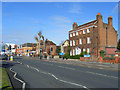
Photos of RG2 7AB


Area Information
RG2 7AB is a small, densely populated postcode area in England, covering just 615 square metres and home to 1877 residents. Its compact size means it is a tightly knit residential cluster, with a high population density of over 3 million people per square kilometre. This area is characterised by a mature community, with a median age of 47 and a strong presence of adults aged 30–64. Daily life here is shaped by proximity to essential services, including multiple retail outlets and railway stations, which provide easy access to the wider region. The area’s housing stock is predominantly composed of family homes, reflecting its appeal to settled households. While the population is largely White, the community’s diversity is not explicitly detailed in the data. Residents benefit from excellent broadband connectivity, scoring 99 out of 100, ensuring seamless digital access for work or leisure. However, the area’s compact nature means it is best suited for those prioritising convenience over expansive living spaces.
- Area Type
- Postcode
- Area Size
- 615 m²
- Population
- 1877
- Population Density
- 7129 people/km²
The property market in RG2 7AB is defined by a 35% home ownership rate, indicating that a significant portion of the housing stock is rented. This suggests a rental market with a mix of owner-occupied properties, though the area’s small size limits the availability of larger homes. The accommodation type is predominantly houses, which may appeal to families seeking space but could also mean limited options for buyers. Given the area’s compact nature, property values are likely influenced by proximity to nearby amenities such as retail hubs and railway stations. Buyers should consider that the small footprint of RG2 7AB means competition for properties may be fierce, particularly for those prioritising larger homes. The presence of family-oriented housing also implies a focus on long-term residency rather than short-term investment.
House Prices in RG2 7AB
No properties found in this postcode.
Energy Efficiency in RG2 7AB
Daily life in RG2 7AB is enriched by nearby amenities, including five retail outlets such as Tesco Reading and Makro Reading, offering a range of shopping and dining options. The area’s railway stations provide seamless access to the wider region, making it easy to explore beyond the postcode. While the data does not specify parks or leisure facilities, the compact layout ensures residents can reach essential services quickly. The presence of multiple schools and retail options suggests a community-oriented environment, where convenience is prioritised. For those who enjoy a mix of urban and suburban living, RG2 7AB’s proximity to both retail and transport hubs creates a balanced lifestyle. The area’s small size means amenities are closely clustered, enhancing accessibility for all residents.
Amenities
Schools
Residents of RG2 7AB have access to a range of educational institutions, including George Palmer Junior School and George Palmer Infant and Nursery School, both of which cater to primary education. For independent early years education, Christchurch Gardens Kindergarten is available, while The Avenue Special School provides support for students with specific needs. This mix of school types ensures families have options for both mainstream and specialist education. The presence of multiple primary schools suggests a focus on early education, though secondary schools are not listed in the data. Families with children will benefit from the proximity of these institutions, though the absence of secondary schools may necessitate commuting to nearby areas. The variety of school types reflects the area’s commitment to accommodating diverse educational requirements.
| Rank | School | Type | Entry gender | Ages |
|---|
Explore more schools in this area
Go to Schools tabDemographics
The population of RG2 7AB is predominantly adults aged 30–64, with a median age of 47, indicating a mature, stable community. Home ownership rates stand at 35%, suggesting a mix of owner-occupied and rented properties. The area’s accommodation is primarily houses, which aligns with the presence of family-oriented households. The predominant ethnic group is White, though specific data on diversity or deprivation is not provided. This demographic profile implies a community focused on long-term residency rather than transient populations. The high population density—over 3 million people per square kilometre—suggests a compact, efficient layout, though it may impact the availability of larger properties. For families seeking a settled environment with access to local amenities, RG2 7AB’s demographic makeup offers a balance of stability and proximity to services.
Household Size
Accommodation Type
Tenure
Ethnic Group
Religion
Household Composition
Age
Household Deprivation
NS-SEC
Explore more demographic insights in this area
Go to Demographics tabPlanning
Planning Constraints
- Flood RiskPremium
- Ramsar Wetland SitesPremium
- Area of Outstanding Natural BeautyPremium
- Protected Nature ReservePremium
- Protected WoodlandPremium