Area Overview for RG2 6DN
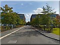
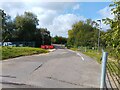
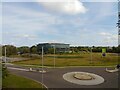
Photos of RG2 6DN

Area Information
RG2 6DN is a compact residential postcode in England, covering just 8.4 hectares and home to 1846 residents. Its small size means the area is tightly knit, with a population density of 252 people per square kilometre. The community here skews older, with a median age of 47 and most residents falling within the 30-64 age range. This suggests a stable, established population, likely with strong ties to local amenities and services. The area is predominantly owner-occupied, with 77% of homes owned by residents, and the housing stock is largely made up of traditional houses rather than flats or apartments. While the area is small, it is well-connected to nearby towns via rail, with stations such as Reading and Theale within reach. However, the high flood risk score of 87.35 raises a critical concern for prospective buyers, requiring careful consideration of property location and flood defences. Despite this, the area’s low crime rate—scoring 71 out of 100—offers reassurance about safety. Living in RG2 6DN means balancing proximity to urban conveniences with the need to address environmental risks.
- Area Type
- Postcode
- Area Size
- 8.4 hectares
- Population
- 1846
- Population Density
- 252 people/km²
The property market in RG2 6DN is characterised by a high rate of home ownership—77% of homes are owner-occupied—suggesting a stable and mature housing stock. The area is dominated by houses rather than flats or apartments, which is typical for smaller, rural postcode areas. This makes RG2 6DN an appealing choice for buyers seeking traditional family homes, though the small size of the area—just 8.4 hectares—means the housing stock is limited. Prospective buyers should consider nearby towns for a broader range of property options. The high home ownership rate also indicates a lower rental market presence, which may mean fewer short-term rental opportunities. For those prioritising long-term investment, the area’s stability and established character could be advantageous. However, the flood risk assessment—rated critical with a score of 87.35—adds a layer of complexity, requiring careful evaluation of property locations and flood mitigation measures.
House Prices in RG2 6DN
Showing 1 properties
| Address | Type | Beds | Baths | Last Sale Price | Last Sale Date | |
|---|---|---|---|---|---|---|
| Reading Green Park Railway Station, Flagstaff Road, Reading, RG2 6DN | commercial | - | - | - | - |
Energy Efficiency in RG2 6DN
Living in RG2 6DN offers access to a range of retail and transport amenities within practical reach. The area is served by five retail outlets, including major names like Tesco Reading, Costco Reading, and Aldi Unit 6 Gateway Retail Park. These provide residents with convenient access to groceries, household goods, and other essentials. For transport, five railway stations are nearby, including Reading West and Theale, offering connections to larger urban centres and regional routes. While the area itself is small, the proximity to these amenities suggests a lifestyle that balances local convenience with broader connectivity. The retail options cater to everyday needs, while the rail network supports commuting or leisure travel. The character of the area is defined by its compactness and reliance on nearby hubs for more extensive services, making it suitable for those who value accessibility without the density of a larger town.
Amenities
Schools
The nearest school to RG2 6DN is Grazeley Parochial Church of England Aided Primary School, a primary school with an Ofsted rating of satisfactory. This provides families with a local option for early education, though the data does not mention secondary schools in the immediate area. The presence of a primary school suggests the area is suitable for families with young children, but those requiring secondary education may need to look further afield. The school’s rating indicates it meets basic standards, though it is not outstanding. For buyers prioritising schools, this single primary option may be a consideration, especially if secondary schooling is a key factor in their decision. The absence of additional schools in the data means the educational landscape here is limited to primary provision, which could influence choices about proximity to larger towns with more comprehensive school networks.
| Rank | School | Type | Entry gender | Ages |
|---|
Explore more schools in this area
Go to Schools tabDemographics
The population of RG2 6DN is predominantly middle-aged, with a median age of 47 and the majority of residents aged between 30 and 64. This reflects a community of established individuals, likely with long-term ties to the area. Home ownership is high, at 77%, indicating a stable housing market where most residents are long-term property owners. The accommodation type is primarily houses, which is typical for smaller rural or semi-rural postcode areas. The predominant ethnic group is White, which aligns with broader demographic trends in the region. While no specific data on deprivation or diversity is provided, the high home ownership rate and age profile suggest a relatively affluent, settled population. The absence of detailed diversity statistics means the community’s composition remains largely unexplored in the data. For buyers, this demographic profile implies a neighbourhood with low turnover and a focus on long-term residency, which can be both a strength and a consideration for those seeking a more dynamic or diverse environment.
Household Size
Accommodation Type
Tenure
Ethnic Group
Religion
Household Composition
Age
Household Deprivation
NS-SEC
Explore more demographic insights in this area
Go to Demographics tabPlanning
Planning Constraints
- Flood RiskPremium
- Ramsar Wetland SitesPremium
- Area of Outstanding Natural BeautyPremium
- Protected Nature ReservePremium
- Protected WoodlandPremium